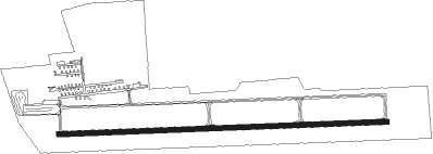
Huntington - Huntington Muni
Airport details
| Country | United States of America |
| State | Indiana |
| Region | K5 |
| Airspace | Chicago Ctr |
| Municipality | Huntington County |
| Elevation | 805ft (245m) |
| Timezone | GMT -5 |
| Coordinates | 40.85292, -85.45705 |
| Magnetic var | |
| Type | land |
| Available since | X-Plane v10.40 |
| ICAO code | KHHG |
| IATA code | n/a |
| FAA code | HHG |
Communication
| Huntington Muni CTAF/UNICOM | 122.800 |
| Huntington Muni AWOS | 126.575 |
| Huntington Muni FORT WAYNE Approach/Departure | 127.200 |
Runway info
| Runway 9 / 27 | ||
| length | 1520m (4987ft) | |
| bearing | 92° / 272° | |
| width | 23m (75ft) | |
| surface | asphalt | |
Nearby beacons
| code | identifier | dist | bearing | frequency |
|---|---|---|---|---|
| FWA | FORT WAYNE VORTAC | 14.3 | 65° | 117.80 |
| OLK | WEBSTER LAKE VOR | 23.7 | 354° | 110.40 |
| MZZ | MARION VOR/DME | 23.8 | 212° | 108.60 |
| OKK | KOKOMO VORTAC | 33.6 | 242° | 113.50 |
| GUS | GRISSOM (PERU) VORTAC | 33.9 | 253° | 108.45 |
| GW | SHENK (AUBURN) NDB | 35.8 | 48° | 227 |
| MIE | MUNCIE VOR/DME | 37 | 174° | 114.40 |
| JN | BALLL (MUNCIE) NDB | 40.8 | 169° | 365 |
| MI | BALLL (MUNCIE) NDB | 40.8 | 169° | 365 |
| AI | VIDEO (ANDERSON) NDB | 47.1 | 184° | 394 |
| AWW | WINCHESTER NDB | 47.8 | 142° | 212 |
| GSH | GOSHEN VORTAC | 47.9 | 320° | 113.70 |
| IRS | STURGIS NDB | 57.6 | 1° | 382 |
| UWL | NEW CASTLE NDB | 58.7 | 172° | 385 |
| UMP | METROPOLITAN (INDIANAPOLIS) NDB | 61.2 | 213° | 338 |
| SB | MISHA (SOUTH BEND) NDB | 61.6 | 318° | 341 |
| GIJ | GIPPER (NILES) VORTAC | 67.3 | 317° | 115.40 |
Instrument approach procedures
| runway | airway (heading) | route (dist, bearing) |
|---|---|---|
| RW09 | TELEY (147°) | TELEY IDXOH (7mi, 232°) 3000ft EHAQY (5mi, 183°) 3000ft |
| RNAV | EHAQY 3000ft AWOYI (5mi, 92°) 2300ft RUKME (2mi, 92°) 1660ft KHHG (3mi, 92°) 845ft (5199mi, 116°) 1700ft IDXOH (5209mi, 296°) 2600ft IDXOH (turn) | |
| RW27 | AJAYS (330°) | AJAYS OJHED (11mi, 17°) 3000ft MIHWI (5mi, 3°) 3000ft |
| RNAV | MIHWI 3000ft OQAKY (5mi, 272°) 2300ft KHHG (5mi, 272°) 849ft (5199mi, 116°) 1700ft IDXOH (5209mi, 296°) 2600ft IDXOH (turn) |
Disclaimer
The information on this website is not for real aviation. Use this data with the X-Plane flight simulator only! Data taken with kind consent from X-Plane 12 source code and data files. Content is subject to change without notice.
