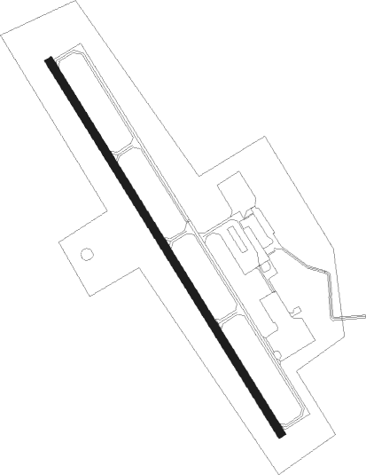
Hutchinson - Hutchinson Muni Butler Fld
Airport details
| Country | United States of America |
| State | Minnesota |
| Region | K3 |
| Airspace | Minneapolis Ctr |
| Municipality | Hutchinson |
| Elevation | 1060ft (323m) |
| Timezone | GMT -6 |
| Coordinates | 44.85989, -94.38250 |
| Magnetic var | |
| Type | land |
| Available since | X-Plane v10.40 |
| ICAO code | KHCD |
| IATA code | n/a |
| FAA code | HCD |
Communication
| Hutchinson Muni Butler Fld AWOS 3 | 118.525 |
| Hutchinson Muni Butler Fld CTAF/UNICOM | 122.800 |
Nearby Points of Interest:
Merton S. Goodnow House
-Universal Laboratories Building
-Brightwood Beach Cottage
-Litchfield Opera House
-Cokato Temperance Hall
-Howard Lake City Hall
-Norwood Methodist Episcopal Church
-Gibbon Village Hall
-Young America City Hall
-Waverly Village Hall
-Johann Schimmelpfennig Farmstead
-Dr. E.P. Hawkins Clinic, Hospital, and House
-Marysville Swedesburg Lutheran Church
-Renville County Courthouse and Jail
-Heins Block
-the thayer
-District No. 48 School
-Delano Village Hall
-Zoar Moravian Church
-Andrew Peterson Farmstead
-Fort Ridgely State Park CCC/Rustic Style Historic Resources
-Fort Ridgely
Nearby beacons
| code | identifier | dist | bearing | frequency |
|---|---|---|---|---|
| DWN | DARWIN VORTAC | 13.9 | 343° | 109 |
| BDH | WILLMAR VOR/DME | 35.2 | 289° | 113.70 |
| RWF | REDWOOD FALLS VOR/DME | 39.6 | 242° | 113.30 |
| FCM | FLYING CLOUD (MINNEAPOLIS VOR/DME | 40 | 92° | 117.70 |
| ST | HUSSK (ST CLOUD) NDB | 41.1 | 34° | 342 |
| MKT | MANKATO VOR/DME | 43.3 | 144° | 110.80 |
| STC | SAINT CLOUD VOR/DME | 43.6 | 25° | 112.10 |
| PNM | PRINCETON NDB | 53.5 | 48° | 368 |
Instrument approach procedures
| runway | airway (heading) | route (dist, bearing) |
|---|---|---|
| RW15 | FITAS (105°) | FITAS PUBBI (28mi, 92°) 3100ft |
| RW15 | PIKAW (250°) | PIKAW HUKOX (30mi, 267°) 3100ft PUBBI (7mi, 250°) 3100ft |
| RW15 | PUBBI (144°) | PUBBI 3100ft |
| RNAV | PUBBI 3100ft IZKOP (7mi, 144°) 2700ft KIYEB (3mi, 144°) 1640ft KHCD (2mi, 144°) 1095ft (5592mi, 115°) 1305ft WOBGI (5587mi, 295°) 3000ft WOBGI (turn) | |
| RW33 | BEEGR (342°) | BEEGR WOBGI (8mi, 12°) 3000ft |
| RW33 | WOBGI (324°) | WOBGI 3000ft |
| RW33 | WULEP (289°) | WULEP WOBGI (27mi, 277°) 3000ft |
| RNAV | WOBGI 3000ft NOYRI (7mi, 324°) 2700ft CUNGI (3mi, 324°) 1600ft KHCD (2mi, 324°) 1102ft (5592mi, 115°) 1312ft PUBBI (5597mi, 295°) 3100ft PUBBI (turn) |
Disclaimer
The information on this website is not for real aviation. Use this data with the X-Plane flight simulator only! Data taken with kind consent from X-Plane 12 source code and data files. Content is subject to change without notice.