Glencoe - Glencoe Muni
Airport details
| Country | United States of America |
| State | Minnesota |
| Region | K3 |
| Airspace | Minneapolis Ctr |
| Municipality | McLeod County |
| Elevation | 992ft (302m) |
| Timezone | GMT -6 |
| Coordinates | 44.75600, -94.08147 |
| Magnetic var | |
| Type | land |
| Available since | X-Plane v10.40 |
| ICAO code | KGYL |
| IATA code | n/a |
| FAA code | GYL |
Communication
| Glencoe Muni CTAF/UNICOM | 119.625 |
| Glencoe Muni CTAF/UNICOM | 122.800 |
| Glencoe Muni MINNEAPOLIS Approach/Departure | 125.000 |
Nearby Points of Interest:
Norwood Methodist Episcopal Church
-Young America City Hall
-Johann Schimmelpfennig Farmstead
-Merton S. Goodnow House
-Zoar Moravian Church
-Hooper–Bowler–Hillstrom House
-Andrew Peterson Farmstead
-Abraham Bisson House
-Howard Lake City Hall
-Laketown Moravian Brethren's Church
-Dr. William W. Mayo House
-Waverly Village Hall
-Carver Historic District
-Dr. E.P. Hawkins Clinic, Hospital, and House
-Little Rapids Fur Post Historical Marker
-Mudbaden Sulphur Springs Company
-Jordan Brewery Ruins
-Foss and Wells House
-German Evangelical Salem Church
-Walnut Street Historic District
-Delano Village Hall
-District No. 48 School
-Universal Laboratories Building
-Marysville Swedesburg Lutheran Church
-Strunk–Nyssen House
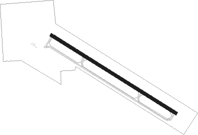
Runway info
| Runway 13 / 31 | ||
| length | 1006m (3301ft) | |
| bearing | 118° / 298° | |
| width | 23m (75ft) | |
| surface | asphalt | |
Nearby beacons
| code | identifier | dist | bearing | frequency |
|---|---|---|---|---|
| DWN | DARWIN VORTAC | 25.4 | 312° | 109 |
| FCM | FLYING CLOUD (MINNEAPOLIS VOR/DME | 27.5 | 84° | 117.70 |
| MKT | MANKATO VOR/DME | 33 | 162° | 110.80 |
| MSP | MINNEAPOLIS VOR/DME | 36.9 | 81° | 115.30 |
| GEP | GOPHER (MINNEAPOLIS) VORTAC | 38.1 | 61° | 117.30 |
| FGT | FARMINGTON VORTAC | 39.1 | 98° | 115.70 |
| ST | HUSSK (ST CLOUD) NDB | 43.6 | 9° | 342 |
| FOW | HALFWAY (MORRISTOWN) VOR/DME | 45 | 128° | 111.20 |
| STC | SAINT CLOUD VOR/DME | 47.6 | 2° | 112.10 |
| PNM | PRINCETON NDB | 52.5 | 30° | 368 |
| OW | TONNA (OWATONNA) NDB | 57 | 126° | 379 |
Departure and arrival routes
| Transition altitude | 18000ft |
| Transition level | 18000ft |
| STAR starting points | distance | inbound heading | |
|---|---|---|---|
| ALL | |||
| AGUDE5 | 75.2 | 258° | |
Instrument approach procedures
| runway | airway (heading) | route (dist, bearing) |
|---|---|---|
| RW13 | DWN (132°) | DWN AKIRE (15mi, 144°) 3000ft |
| RW13 | HAJIS (84°) | HAJIS AKIRE (13mi, 54°) 3000ft |
| RW13 | MAYER (213°) | MAYER AKIRE (14mi, 261°) 3000ft AKIRE (turn) 3000ft |
| RNAV | AKIRE 3000ft BOUGH (6mi, 118°) 2600ft ERUDE (3mi, 118°) 1600ft KGYL (2mi, 118°) 1032ft (5579mi, 115°) 1246ft OYITE (5570mi, 295°) 3000ft OYITE (turn) | |
| RW31 | BEEGR (43°) | BEEGR JUSOR (14mi, 87°) 3000ft OYITE (6mi, 46°) 3000ft |
| RW31 | DWN (132°) | DWN OYITE (36mi, 127°) 3000ft OYITE (turn) 3000ft |
| RW31 | LYDIA (284°) | LYDIA OYITE (17mi, 275°) 3000ft |
| RW31 | ZANNA (318°) | ZANNA OYITE (15mi, 336°) 3000ft |
| RNAV | OYITE 3000ft TUPUY (6mi, 298°) 2600ft WELIK (3mi, 298°) 1560ft KGYL (2mi, 298°) 1031ft (5579mi, 115°) 1242ft AKIRE (5588mi, 295°) 3000ft AKIRE (turn) |
Holding patterns
| STAR name | hold at | type | turn | heading* | altitude | leg | speed limit |
|---|---|---|---|---|---|---|---|
| AGUDE5 | BEERI | VHF | right | 127 (307)° | 1.0min timed | ICAO rules | |
| *) magnetic outbound (inbound) holding course | |||||||
Disclaimer
The information on this website is not for real aviation. Use this data with the X-Plane flight simulator only! Data taken with kind consent from X-Plane 12 source code and data files. Content is subject to change without notice.