Greensboro - Piedmont Triad Intl
Airport details
| Country | United States of America |
| State | North Carolina |
| Region | K7 |
| Airspace | Atlanta Ctr |
| Municipality | Guilford County |
| Elevation | 921ft (281m) |
| Timezone | GMT -5 |
| Coordinates | 36.10133, -79.94112 |
| Magnetic var | |
| Type | land |
| Available since | X-Plane v10.40 |
| ICAO code | KGSO |
| IATA code | GSO |
| FAA code | GSO |
Communication
| Piedmont Triad Intl ATIS | 128.550 |
| Piedmont Triad Intl UNICOM | 122.950 |
| Piedmont Triad Intl Clearance DEL | 121.750 |
| Piedmont Triad Intl Ground Control | 121.900 |
| Piedmont Triad Intl Tower | 119.100 |
| Piedmont Triad Intl Approach | 126.600 |
| Piedmont Triad Intl Approach | 124.350 |
| Piedmont Triad Intl Departure | 124.350 |
| Piedmont Triad Intl Departure | 126.600 |
Approach frequencies
| ILS-cat-III | RW05L | 109.55 | 18.00mi |
| ILS-cat-II | RW05R | 111.9 | 18.00mi |
| ILS-cat-II | RW23L | 109.3 | 18.00mi |
| ILS-cat-I | RW32 | 111.15 | 18.00mi |
| ILS-cat-I | RW23R | 109.55 | 18.00mi |
| 3° GS | RW05R | 111.9 | 18.00mi |
| 3° GS | RW05L | 109.55 | 18.00mi |
| 3° GS | RW23R | 109.55 | 18.00mi |
| 3° GS | RW23L | 109.3 | 18.00mi |
| 3° GS | RW32 | 111.15 | 18.00mi |
Nearby Points of Interest:
Kimrey-Haworth House
-Hoskins House Historic District
-Mock, Judson, Voehringer Company Hosiery Mill
-Former Pomona High School
-Wilbur and Martha Carter House
-First Baptist Church
-Richard Mendenhall Plantation Buildings
-South Main Street Historic District
-Isaac Harrison McKaughan House
-James H. and Anne B. Willis House
-Bumpas-Troy House
-Harden Thomas Martin House
-Charles H. Ireland House
-Charles D. McIver School
-Wafco Mills
-Dr. David P. Weir House
-Green Hill Cemetery Gatekeeper's House
-Oakdale Cotton Mill Village
-Michael Sherwood House
-Latham-Baker House
-Hillside
-John Marion Galloway House
-Guilford County Courthouse
-L. Richardson Preyer Federal Building
-Central Fire Station
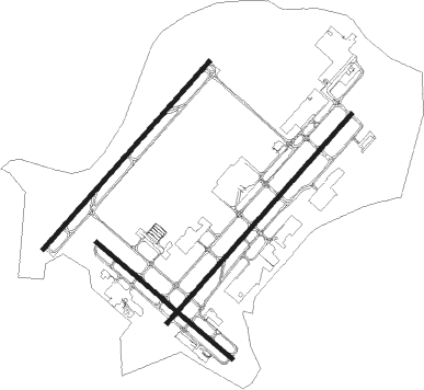
Runway info
Runway 5R / 23L  | ||
| length | 3053m (10016ft) | |
| bearing | 52° / 232° | |
| width | 46m (151ft) | |
| surface | asphalt | |
| blast zone | 58m (190ft) / 60m (197ft) | |
| Runway 14 / 32 | ||
| length | 1952m (6404ft) | |
| bearing | 129° / 309° | |
| width | 46m (151ft) | |
| surface | asphalt | |
| blast zone | 0m (0ft) / 58m (190ft) | |
| Runway 5L / 23R | ||
| length | 2744m (9003ft) | |
| bearing | 52° / 232° | |
| width | 46m (151ft) | |
| surface | asphalt | |
| blast zone | 122m (400ft) / 123m (404ft) | |
Nearby beacons
| code | identifier | dist | bearing | frequency |
|---|---|---|---|---|
| GSO | GREENSBORO VORTAC | 3.7 | 212° | 116.20 |
| IN | REENO (WINSTON SALEM) NDB | 11.1 | 262° | 317 |
| HB | ALAMM NDB | 18.8 | 109° | 361 |
| SIF | SLAMMER (REIDSVILLE) NDB | 18.9 | 32° | 423 |
| LIB | LIBERTY VORTAC | 23.6 | 131° | 113 |
| UV | BALES (MARTINSVILLE) NDB | 29.3 | 3° | 396 |
| RU | ROVDY (SALISBURY) NDB | 34.6 | 236° | 275 |
| VU | ALLER (ALBEMARLE) NDB | 37.4 | 193° | 346 |
| DAN | DANVILLE VOR | 40.5 | 52° | 113.10 |
| HUR | PERSON (ROXBORO) NDB | 43.1 | 81° | 220 |
| SDZ | SANDHILLS (SOUTHERN PINES VORTAC | 55.9 | 158° | 111.80 |
| SBV | SOUTH BOSTON VORTAC | 56.5 | 58° | 110.40 |
| PSK | PULASKI (DUBLIN) VORTAC | 69.9 | 322° | 116.80 |
| POB | POPE (FAYETTEVILLE) NDB | 71.2 | 132° | 338 |
| POB | POPE (FAYETTEVILLE) TACAN | 71.8 | 135° | 113.80 |
Departure and arrival routes
| Transition altitude | 18000ft |
| Transition level | 18000ft |
| SID end points | distance | outbound heading | |
|---|---|---|---|
| RW05 (ALL) | |||
| QUAK7 | 57mi | 58° | |
| RW05L | |||
| TRI9 | 50mi | 286° | |
| TRSHA1 | 48mi | 312° | |
| RW05R | |||
| TRI9 | 50mi | 286° | |
| TRSHA1 | 48mi | 312° | |
| RW14 | |||
| QUAK7 | 57mi | 58° | |
| TRI9 | 50mi | 286° | |
| TRSHA1 | 48mi | 312° | |
| RW23 (ALL) | |||
| QUAK7 | 57mi | 58° | |
| TRSHA1 | 48mi | 312° | |
| RW23L | |||
| TRI9 | 50mi | 286° | |
| RW23R | |||
| TRI9 | 50mi | 286° | |
| RW32 | |||
| QUAK7 | 57mi | 58° | |
| TRI9 | 50mi | 286° | |
| TRSHA1 | 48mi | 312° | |
| STAR starting points | distance | inbound heading | |
|---|---|---|---|
| ALL | |||
| BROOK4 | 52.1 | 94° | |
| HENBY3 | 37.3 | 172° | |
| BLOCC2 | 36.9 | 329° | |
| RW05L | |||
| TRAKS3 | 19.5 | 89° | |
| RW05R | |||
| TRAKS3 | 19.5 | 89° | |
| RW14 | |||
| TRAKS3 | 19.5 | 89° | |
| RW23 (ALL) | |||
| TRAKS3 | 19.5 | 89° | |
| RW32 | |||
| TRAKS3 | 19.5 | 89° | |
Instrument approach procedures
| runway | airway (heading) | route (dist, bearing) |
|---|---|---|
| RW05L | JEVEN (54°) | JEVEN 2900ft |
| RW05L | NUMUE (30°) | NUMUE 2900ft JEVEN (5mi, 310°) 2900ft |
| RW05L | WAKIM (75°) | WAKIM 2900ft JEVEN (5mi, 130°) 2900ft |
| RNAV | JEVEN 2900ft CIVES (6mi, 52°) 2500ft CONLO (3mi, 52°) 1600ft KGSO (3mi, 62°) 971ft TUPUE (13mi, 50°) 2800ft TUPUE (turn) | |
| RW05R | COSIS (50°) | COSIS 3000ft |
| RW05R | CUPET (71°) | CUPET 3000ft COSIS (5mi, 130°) 3000ft |
| RW05R | FINIR (27°) | FINIR 3000ft COSIS (5mi, 310°) 3000ft |
| RNAV | COSIS 3000ft FONIT (6mi, 52°) 2800ft KGSO (6mi, 49°) 953ft JELEB (13mi, 53°) 3200ft JELEB (turn) | |
| RW14 | COKIM (152°) | COKIM 3200ft FAMOV (5mi, 231°) 3200ft |
| RW14 | FAMOV (127°) | FAMOV 3200ft |
| RW14 | HERIP (107°) | HERIP 3200ft FAMOV (5mi, 51°) 3200ft |
| RNAV | FAMOV 3200ft GUKPE (6mi, 129°) 2700ft ZOLPO (4mi, 129°) 1520ft KGSO (2mi, 117°) 984ft IRKUW (12mi, 131°) 3700ft IRKUW (turn) | |
| RW23L | GICES (252°) | GICES 3200ft JELEB (5mi, 310°) 3200ft |
| RW23L | JELEB (233°) | JELEB 3200ft |
| RW23L | JUTSO (212°) | JUTSO 3200ft JELEB (5mi, 130°) 3200ft |
| RNAV | JELEB 3200ft NERLE (6mi, 232°) 2900ft KGSO (7mi, 234°) 938ft COSIS (12mi, 230°) 3000ft COSIS (turn) | |
| RW23R | COLKI (250°) | COLKI 3100ft TUPUE (5mi, 310°) 2800ft |
| RW23R | HEROR (207°) | HEROR 3100ft TUPUE (5mi, 130°) 2800ft |
| RW23R | TUPUE (230°) | TUPUE 2800ft |
| RNAV | TUPUE 2800ft HEVED (6mi, 232°) 2800ft KGSO (7mi, 228°) 910ft JEVEN (12mi, 234°) 2500ft JEVEN (turn) | |
| RW32 | IRKUW (311°) | IRKUW 3700ft |
| RW32 | PUXEE (281°) | PUXEE 3700ft IRKUW (8mi, 231°) 3700ft |
| RW32 | ZIGDI (347°) | ZIGDI 3700ft IRKUW (8mi, 51°) 3700ft |
| RNAV | IRKUW 3700ft OKZIF (6mi, 309°) 2700ft KGSO (6mi, 314°) 952ft (4918mi, 114°) 1100ft FAMOV (4927mi, 294°) 3700ft FAMOV (turn) |
Holding patterns
| STAR name | hold at | type | turn | heading* | altitude | leg | speed limit |
|---|---|---|---|---|---|---|---|
| BLOCC2 | BLOCC | VHF | right | 180 (0)° | DME 5.0mi | ICAO rules | |
| BROOK4 | BROOK | VHF | left | 282 (102)° | DME 4.0mi | ICAO rules | |
| BROOK4 | TRAKS | VHF | left | 282 (102)° | 1.0min timed | ICAO rules | |
| HENBY3 | HENBY | VHF | left | 1 (181)° | DME 11.0mi | ICAO rules | |
| *) magnetic outbound (inbound) holding course | |||||||
Disclaimer
The information on this website is not for real aviation. Use this data with the X-Plane flight simulator only! Data taken with kind consent from X-Plane 12 source code and data files. Content is subject to change without notice.