Greenville
Airport details
| Country | United States of America |
| State | Illinois |
| Region | K5 |
| Airspace | Kansas City Ctr |
| Municipality | Bond County |
| Elevation | 541ft (165m) |
| Timezone | GMT -6 |
| Coordinates | 38.83622, -89.37889 |
| Magnetic var | |
| Type | land |
| Available since | X-Plane v10.40 |
| ICAO code | KGRE |
| IATA code | GRE |
| FAA code | GRE |
Communication
| Greenville CTAF/UNICOM | 123.050 |
Nearby Points of Interest:
Greenville Public Library
-General Dean Suspension Bridge
-First Presbyterian Church
-Little Brick House
-James C. Twiss House
-Marine Chapter House
-George Blackman House
-Hayward-Hill House
-Freeman-Brewer-Sawyer House
-Montgomery County Courthouse
-U.S. Route 66
-Centralia Commercial Historic District
-Centralia Elks Lodge
-Sentinel Building
-Floyd and Glenora Dycus House
-Emerald Mound and Village Site
-Manske-Niemann Farm
-William Jennings Bryan Boyhood Home
-Badollet House
-Charles and Naomi Bachmann House
-Brown Shoe Company Factory
-Samuel Moody Grubbs House
-Litchfield Elks Lodge No. 654
-Litchfield Public Library
-William W. Jarvis House
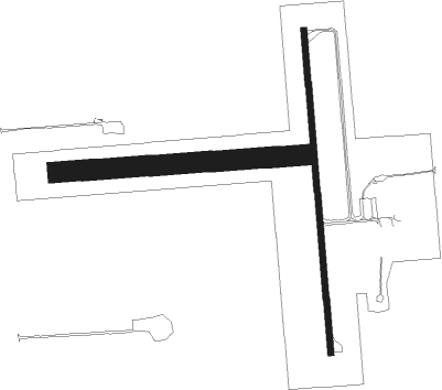
Runway info
Runway 18 / 36  | ||
| length | 1223m (4012ft) | |
| bearing | 180° / 360° | |
| width | 23m (75ft) | |
| surface | asphalt | |
| Runway 09 / 27 | ||
| length | 930m (3051ft) | |
| bearing | 90° / 270° | |
| width | 76m (250ft) | |
| surface | grass | |
Nearby beacons
| code | identifier | dist | bearing | frequency |
|---|---|---|---|---|
| GRE | GREENVILLE NDB | 0.3 | 107° | 233 |
| VLA | VANDALIA VOR/DME | 18.4 | 40° | 114.30 |
| TOY | TROY VORTAC | 25.9 | 260° | 116 |
| ENL | CENTRALIA VORTAC | 27 | 152° | 115 |
| JD | GOOEY (BELLEVILLE) NDB | 27.3 | 225° | 385 |
| SKE | SCOTT (BELLEVILLE) TACAN | 28.2 | 238° | 112.20 |
| CVM | CIVIC MEMORIAL (ALTON) NDB | 31.8 | 275° | 263 |
| CP | ACORE (CAHOKIA/ST LOUIS) NDB | 37.1 | 245° | 350 |
| VNN | VERNON DME | 39.1 | 130° | 113.80 |
| BIB | BIBLE GROVE VORTAC | 42.2 | 85° | 109 |
| SYZ | SHELBYVILLE NDB | 42.3 | 43° | 365 |
| CSX | DME | 46.2 | 265° | 116.45 |
| FWC | WAYNE CO (FAIRFIELD) NDB | 53.1 | 115° | 257 |
| MD | CABBI (CARBONDALE-MURPHYSBORO) NDB | 58.3 | 172° | 388 |
| CJ | CALDE (SPRINGFIELD) NDB | 58.4 | 347° | 240 |
| SP | HUSKK (SPRINGFIELD) NDB | 58.9 | 338° | 382 |
| AXC | ADDERS VORTAC | 59.3 | 30° | 117.20 |
| DE | ELWIN (DECATUR) NDB | 60.6 | 24° | 275 |
| MW | JONNY (MARION) NDB | 62.8 | 158° | 382 |
| IJX | DME | 69.1 | 318° | 108.60 |
Instrument approach procedures
| runway | airway (heading) | route (dist, bearing) |
|---|---|---|
| RW18 | OREPE (115°) | OREPE LWEIS (10mi, 51°) 3000ft XUHAS (8mi, 112°) 3000ft |
| RW18 | VLA (220°) | VLA XUHAS (11mi, 253°) 3000ft |
| RW18 | XUHAS (180°) | XUHAS 3000ft |
| RNAV | XUHAS 3000ft WIZGY (6mi, 180°) 2200ft NUBTE (3mi, 180°) 1280ft KGRE (3mi, 183°) 580ft (5376mi, 113°) 848ft HODAN (5376mi, 293°) 2300ft HODAN (turn) | |
| RW36 | BREEZ (39°) | BREEZ HODAN (10mi, 72°) 2300ft |
| RW36 | ENL (332°) | ENL HODAN (18mi, 318°) 2300ft |
| RW36 | VLA (220°) | VLA HODAN (28mi, 206°) 2300ft HODAN (turn) 2300ft |
| RNAV | HODAN 2300ft TOWNY (5mi, 360°) 2200ft SPEAN (3mi, 360°) 1260ft KGRE (3mi, 356°) 572ft (5376mi, 113°) 847ft XUHAS (5376mi, 294°) 3000ft XUHAS (turn) |
Disclaimer
The information on this website is not for real aviation. Use this data with the X-Plane flight simulator only! Data taken with kind consent from X-Plane 12 source code and data files. Content is subject to change without notice.