Grand Rapids - Grand Rapids - Itasca Co
Airport details
| Country | United States of America |
| State | Minnesota |
| Region | K3 |
| Airspace | Minneapolis Ctr |
| Municipality | Grand Rapids |
| Elevation | 1354ft (413m) |
| Timezone | GMT -6 |
| Coordinates | 47.21014, -93.50992 |
| Magnetic var | |
| Type | land |
| Available since | X-Plane v10.40 |
| ICAO code | KGPZ |
| IATA code | GPZ |
| FAA code | GPZ |
Communication
| Grand Rapids - Itasca Co CTAF/UNICOM | 122.800 |
Approach frequencies
| ILS-cat-I | RW34 | 110.1 | 18.00mi |
| 3° GS | RW34 | 110.1 | 18.00mi |
Nearby Points of Interest:
Church of the Good Shepherd
-Coleraine Methodist Episcopal Church
-Hill-Annex Mine State Park
-Marcell Ranger Station
-Winnibigoshish Lake Dam
-Savanna Portage State Park
-Mitchell–Tappan House
-Hibbing City Hall
-Sons of Italy Hall
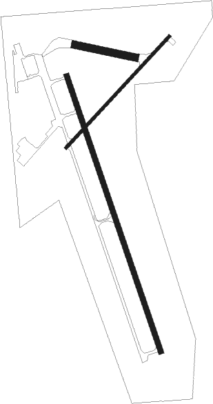
Runway info
Runway 16 / 34  | ||
| length | 1750m (5741ft) | |
| bearing | 159° / 339° | |
| width | 30m (100ft) | |
| surface | asphalt | |
| blast zone | 177m (581ft) / 60m (197ft) | |
| Runway 5 / 23 | ||
| length | 914m (2999ft) | |
| bearing | 58° / 238° | |
| width | 18m (60ft) | |
| surface | asphalt | |
| Runway 10 / 28 | ||
| length | 368m (1207ft) | |
| bearing | 101° / 281° | |
| width | 46m (150ft) | |
| surface | grass | |
Nearby beacons
| code | identifier | dist | bearing | frequency |
|---|---|---|---|---|
| GPZ | GRAND RAPIDS VOR/DME | 2.9 | 156° | 111.40 |
| HIB | HIBBING VOR/DME | 33.3 | 84° | 110.80 |
| FOZ | BIGFORK NDB | 34.9 | 346° | 345 |
| BR | LAREW (BRAINERD) NDB | 49.9 | 214° | 251 |
Instrument approach procedures
| runway | airway (heading) | route (dist, bearing) |
|---|---|---|
| RW16 | GPZ (336°) | GPZ EMIDY (14mi, 338°) 3000ft EMIDY (turn) 3000ft |
| RW16 | SQEAK (185°) | SQEAK EMIDY (29mi, 196°) 3000ft |
| RW16 | YOBRI (100°) | YOBRI ORTUC (10mi, 64°) 3000ft EMIDY (5mi, 80°) 3000ft |
| RNAV | EMIDY 3000ft APUNY (6mi, 159°) 2900ft KGPZ (5mi, 158°) 1345ft ADIER (11mi, 160°) 2900ft ADIER (turn) | |
| RW34 | GPZ (336°) | GPZ ADIER (8mi, 161°) 2900ft ADIER (turn) 2900ft |
| RW34 | NEBBS (353°) | NEBBS ADIER (8mi, 13°) 2900ft |
| RNAV | ADIER 2900ft DIKKA (6mi, 339°) 2900ft KGPZ (5mi, 340°) 1409ft (5548mi, 117°) 1556ft EMIDY (5551mi, 297°) 3000ft EMIDY (turn) |
Disclaimer
The information on this website is not for real aviation. Use this data with the X-Plane flight simulator only! Data taken with kind consent from X-Plane 12 source code and data files. Content is subject to change without notice.