Gladwin - Gladwin Zettel Mem
Airport details
| Country | United States of America |
| State | Michigan |
| Region | K5 |
| Airspace | Minneapolis Ctr |
| Municipality | Buckeye Township |
| Elevation | 774ft (236m) |
| Timezone | GMT -5 |
| Coordinates | 43.97059, -84.47502 |
| Magnetic var | |
| Type | land |
| Available since | X-Plane v10.40 |
| ICAO code | KGDW |
| IATA code | GDW |
| FAA code | GDW |
Communication
| Gladwin Zettel Mem CTAF/UNICOM | 122.800 |
| Gladwin Zettel Mem SAGINAW Approach/Departure | 126.450 |
Nearby Points of Interest:
Eggleston School
-George and Martha Hitchcock House
-Robert E. and Barbara Schwartz House
-Michigan Central Railroad Standish Depot
-Charles MacCallum House
-George Greene House
-Charles and Mary Kempf Penhaligen House
-Mr. and Mrs. Robert C. Reinke House
-Alden Hanson House
-Sheldon Heath House
-Howard Ball House
-Calvin A. and Alta Koch Campbell House
-Parents' and Children's Schoolhouse
-Mr. and Mrs. Louis P. Butenschoen House
-F.W. Lewis House
-Mr. and Mrs Frank Boonstra House
-Donald L. Conner House
-Oscar C. Diehl House
-James T. Pardee House
-John S. Whitman House
-Earl Stein House
-Herbert H. Dow House
-Joseph A. Cavanagh House
-Midland County Courthouse
-Mount Pleasant Indian Industrial Boarding School
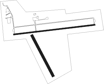
Runway info
Runway 9 / 27  | ||
| length | 1431m (4695ft) | |
| bearing | 88° / 268° | |
| width | 23m (75ft) | |
| surface | asphalt | |
| Runway 15 / 33 | ||
| length | 787m (2582ft) | |
| bearing | 149° / 329° | |
| width | 46m (150ft) | |
| surface | grass | |
Nearby beacons
| code | identifier | dist | bearing | frequency |
|---|---|---|---|---|
| MOP | MOUNT PLEASANT VOR/DME | 23.7 | 217° | 110.60 |
| MBS | SAGINAW VOR/DME | 31.5 | 138° | 112.90 |
| MB | OLSTE (SAGINAW) NDB | 33.1 | 150° | 257 |
| CGG | GRAYLING VOR | 44 | 340° | 109.80 |
| GYG | GRAYLING NDB | 49.2 | 336° | 359 |
| TV | GWENN (TRAVERSE CITY) NDB | 61.5 | 309° | 365 |
| AP | FELPS (ALPENA) NDB | 71.2 | 43° | 206 |
Instrument approach procedures
| runway | airway (heading) | route (dist, bearing) |
|---|---|---|
| RW09 | ICADA (78°) | ICADA JOMID (7mi, 52°) 5000ft |
| RW09 | JOMID (88°) | JOMID 5000ft |
| RW09 | ZOLOX (109°) | ZOLOX JOMID (22mi, 123°) 5000ft |
| RNAV | JOMID 5000ft YOKLU (8mi, 88°) 2700ft KGDW (6mi, 89°) 811ft (5167mi, 117°) 1174ft WELVI (5153mi, 298°) 3000ft WELVI (turn) | |
| RW27 | BANJO (245°) | BANJO WELVI (8mi, 170°) 3000ft WELVI (turn) 3000ft |
| RW27 | MBS (318°) | MBS WELVI (27mi, 350°) 3000ft |
| RW27 | MOP (37°) | MOP WELVI (33mi, 58°) 3000ft WELVI (turn) 3000ft |
| RNAV | WELVI 3000ft JIDUM (8mi, 268°) 2600ft KGDW (6mi, 268°) 813ft (5167mi, 117°) 1174ft WHIPP (5160mi, 297°) 2600ft WHIPP (turn) |
Disclaimer
The information on this website is not for real aviation. Use this data with the X-Plane flight simulator only! Data taken with kind consent from X-Plane 12 source code and data files. Content is subject to change without notice.