Bigfork - Bigfork Muni
Airport details
| Country | United States of America |
| State | Minnesota |
| Region | K3 |
| Airspace | Minneapolis Ctr |
| Municipality | Itasca County |
| Elevation | 1348ft (411m) |
| Timezone | GMT -6 |
| Coordinates | 47.78393, -93.65099 |
| Magnetic var | |
| Type | land |
| Available since | X-Plane v10.40 |
| ICAO code | KFOZ |
| IATA code | n/a |
| FAA code | FOZ |
Communication
| Bigfork Muni CTAF | 122.900 |
Nearby Points of Interest:
Bigfork Village Hall
-Scenic State Park CCC/WPA/Rustic Style Historic Resources
-Marcell Ranger Station
-Sts. Peter and Paul Russian Orthodox Church
-Winnibigoshish Lake Dam
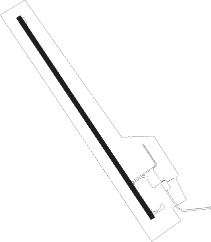
Runway info
| Runway 15 / 33 | ||
| length | 1218m (3996ft) | |
| bearing | 140° / 320° | |
| width | 23m (75ft) | |
| surface | asphalt | |
Nearby beacons
| code | identifier | dist | bearing | frequency |
|---|---|---|---|---|
| FOZ | BIGFORK NDB | 0 | 258° | 345 |
| GPZ | GRAND RAPIDS VOR/DME | 37.8 | 165° | 111.40 |
| INL | INTERNATIONAL FALLS VOR/DME | 47.9 | 17° | 111 |
| HIB | HIBBING VOR/DME | 48 | 117° | 110.80 |
| YAG | FORT FRANCES NDB | 54.5 | 7° | 376 |
| BDE | DME | 68.1 | 314° | 111.60 |
Instrument approach procedures
| runway | airway (heading) | route (dist, bearing) |
|---|---|---|
| RW15 | BOYKI (140°) | BOYKI 6000ft BOYKI (turn) 4000ft |
| RW15 | ENEPY (190°) | ENEPY BOYKI (7mi, 249°) 4000ft |
| RW15 | YOBRI (26°) | YOBRI DUCDO (36mi, 358°) 4000ft BOYKI (7mi, 69°) 4000ft |
| RNAV | BOYKI 4000ft AWUNA (5mi, 140°) 3000ft HOXAS (3mi, 140°) 1920ft KFOZ (2mi, 140°) 1391ft (5552mi, 117°) 1720ft FOLIM (5548mi, 297°) 4000ft FOLIM (turn) 4000ft | |
| RW33 | DUNEC (278°) | DUNEC FOLIM (12mi, 249°) 4000ft |
| RW33 | FOLIM (320°) | FOLIM 4000ft |
| RW33 | WIMJY (336°) | WIMJY FOLIM (15mi, 348°) 4000ft |
| RW33 | YOBRI (26°) | YOBRI FOLIM (26mi, 46°) 4000ft |
| RNAV | FOLIM 4000ft WONOD (5mi, 320°) 3000ft KFOZ (5mi, 320°) 1386ft (5552mi, 117°) 1751ft BOYKI (5557mi, 297°) 4000ft BOYKI (turn) 4000ft |
Disclaimer
The information on this website is not for real aviation. Use this data with the X-Plane flight simulator only! Data taken with kind consent from X-Plane 12 source code and data files. Content is subject to change without notice.