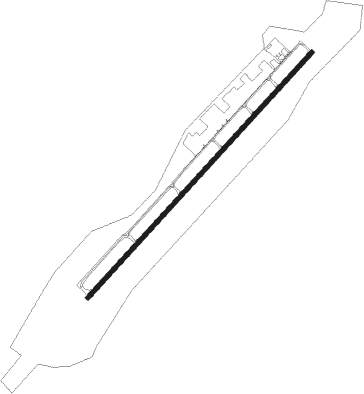
Monroe - Charlotte-monroe Executive
Airport details
| Country | United States of America |
| State | North Carolina |
| Region | K7 |
| Airspace | Atlanta Ctr |
| Municipality | Monroe |
| Elevation | 682ft (208m) |
| Timezone | GMT -5 |
| Coordinates | 35.01742, -80.62205 |
| Magnetic var | |
| Type | land |
| Available since | X-Plane v10.40 |
| ICAO code | KEQY |
| IATA code | n/a |
| FAA code | EQY |
Communication
| Charlotte-Monroe Executive ASOS | 135.775 |
| Charlotte-Monroe Executive CTAF/UNICOM | 122.700 |
| Charlotte-Monroe Executive CHARLOTTE Approach | 120.050 |
| Charlotte-Monroe Executive CHARLOTTE Departure | 120.050 |
Approach frequencies
| ILS-cat-I | RW05 | 109.75 | 18.00mi |
| 3° GS | RW05 | 109.75 | 18.00mi |
Nearby Points of Interest:
Waxhaw-Weddington Roads Historic District
-Monroe City Hall
-Union County Courthouse
-Piedmont Buggy Factory
-Monroe Downtown Historic District
-Monroe Residential Historic District
-Malcolm K. Lee House
-Matthews Commercial Historic District
-Providence Presbyterian Church and Cemetery
-Wingate Commercial Historic District
-Grier-Rea House
-Thomas Walker Huey House
-William Harrison Sapp House
-Pineville Commercial Historic District
-Neal Somers Alexander House
-Spears House
-Massey-Doby-Nisbet House
-Palmer Fire School
-North Carolina-South Carolina Cornerstone
-Hezekiah Alexander House
-Robert Harvey Morrison Farm and Pioneer Mills Gold Mine
-James Buchanan Duke House
-Springfield Plantation House
-Mayes House
-Mack-Belk House
Nearby beacons
| code | identifier | dist | bearing | frequency |
|---|---|---|---|---|
| CLT | CHARLOTTE VOR/DME | 19.2 | 298° | 115 |
| LKR | LANCASTER NDB | 21.2 | 219° | 400 |
| UZ | RALLY (ROCK HILL) NDB | 23.8 | 254° | 227 |
| CTF | CHESTERFIELD VOR/DME | 27.9 | 137° | 108.20 |
| GHJ | STONIA (GASTONIA) NDB | 28.3 | 288° | 260 |
| DCM | CHESTER NDB | 31.7 | 248° | 220 |
| VU | ALLER (ALBEMARLE) NDB | 38.7 | 49° | 346 |
| RU | ROVDY (SALISBURY) NDB | 43.4 | 10° | 275 |
| HVS | HARTSVILLE NDB | 44.2 | 141° | 341 |
| BES | BENNETTSVILLE NDB | 49.8 | 114° | 230 |
| SLP | FIRST RIVER (SHELBY) NDB | 50 | 284° | 417 |
| UDG | DARLINGTON NDB | 50 | 128° | 245 |
| HK | TAWBA (HICKORY) NDB | 57 | 318° | 332 |
| BZM | BARRETTS MOUNTAIN (HICKOR VOR/DME | 59.4 | 324° | 113.75 |
| FL | ALCOT (FLORENCE) NDB | 63.3 | 138° | 335 |
| FLO | FLORENCE VORTAC | 67 | 129° | 115.20 |
Departure and arrival routes
| Transition altitude | 18000ft |
| Transition level | 18000ft |
| SID end points | distance | outbound heading | |
|---|---|---|---|
| ALL | |||
| KILNS4 | 114mi | 57° | |
| BARMY4 | 154mi | 72° | |
| KNI2 | 39mi | 75° | |
| LILLS2 | 34mi | 97° | |
| KWEEN4 | 49mi | 193° | |
| ICONS4 | 65mi | 202° | |
| BEAVY5 | 78mi | 210° | |
| ESTRR4 | 117mi | 253° | |
| BOBZY4 | 68mi | 273° | |
| JOJJO4 | 227mi | 283° | |
| WEAZL4 | 88mi | 339° | |
| KRITR5 | 56mi | 347° | |
| RW05 | |||
| KER3 | 124mi | 203° | |
| RW23 | |||
| KER3 | 124mi | 203° | |
| STAR starting points | distance | inbound heading | |
|---|---|---|---|
| ALL | |||
| CHPTR3 | 52.8 | 61° | |
| UNARM6 | 54.8 | 70° | |
| LIINN3 | 70.0 | 113° | |
| MAJIC4 | 48.5 | 193° | |
| RASLN3 | 20.7 | 302° | |
Instrument approach procedures
| runway | airway (heading) | route (dist, bearing) |
|---|---|---|
| RW05 | CTF (317°) | CTF MOSEE (23mi, 284°) 2500ft FATED (8mi, 311°) 2500ft |
| RW05 | LOCKS (82°) | LOCKS BUTKE (17mi, 86°) 2500ft FATED (8mi, 131°) 2500ft |
| RNAV | FATED 2500ft JAMUN (8mi, 52°) 2500ft WUVUL (4mi, 52°) 1220ft KEQY (2mi, 52°) 729ft (4945mi, 113°) 1100ft MOSEE (4948mi, 293°) 2500ft MOSEE (turn) | |
| RW23 | HUSTN (339°) | HUSTN JOPKU (15mi, 50°) 3000ft JAMSR (7mi, 312°) 3000ft |
| RW23 | LOCAS (224°) | LOCAS JAMSR (3mi, 184°) 3000ft |
| RNAV | JAMSR 3000ft ELLYE (6mi, 233°) 2300ft XEWIR (3mi, 233°) 1480ft KEQY (3mi, 233°) 702ft (4945mi, 113°) 1200ft ZOPOC (4923mi, 294°) 3000ft ZOPOC (turn) |
Holding patterns
| STAR name | hold at | type | turn | heading* | altitude | leg | speed limit |
|---|---|---|---|---|---|---|---|
| CHPTR3 | EYPAD | VHF | right | 218 (38)° | DME 10.0mi | ICAO rules | |
| CHPTR3 | GRD | NDB | right | 227 (47)° | < 17999ft | 1.0min timed | ICAO rules |
| LIINN3 | LIINN | VHF | right | 302 (122)° | DME 10.0mi | ICAO rules | |
| MAJIC4 | KELLS | VHF | right | 39 (219)° | DME 15.0mi | ICAO rules | |
| MAJIC4 | MAJIC | VHF | left | 39 (219)° | DME 10.0mi | ICAO rules | |
| RASLN3 | DSTEE | VHF | left | 141 (321)° | DME 4.0mi | ICAO rules | |
| RASLN3 | FLO | NDB | left | 140 (320)° | 1.0min timed | ICAO rules | |
| RASLN3 | RODEZ | VHF | left | 141 (321)° | DME 5.0mi | ICAO rules | |
| UNARM6 | GRD | NDB | right | 227 (47)° | < 17999ft | 1.0min timed | ICAO rules |
| UNARM6 | LOCKS | VHF | right | 232 (52)° | < 17999ft | 1.0min timed | ICAO rules |
| UNARM6 | UNARM | VHF | right | 233 (53)° | DME 4.0mi | ICAO rules | |
| *) magnetic outbound (inbound) holding course | |||||||
Disclaimer
The information on this website is not for real aviation. Use this data with the X-Plane flight simulator only! Data taken with kind consent from X-Plane 12 source code and data files. Content is subject to change without notice.