Lambertville - Toledo Suburban
Airport details
| Country | United States of America |
| State | Michigan |
| Region | K5 |
| Airspace | Cleveland Ctr |
| Municipality | Whiteford Township |
| Elevation | 667ft (203m) |
| Timezone | GMT -5 |
| Coordinates | 41.73587, -83.65576 |
| Magnetic var | |
| Type | land |
| Available since | X-Plane v10.40 |
| ICAO code | KDUH |
| IATA code | n/a |
| FAA code | DUH |
Communication
| TOLEDO SUBURBAN AWOS 3 | 119.175 |
| TOLEDO SUBURBAN CTAF/UNICOM | 122.700 |
| TOLEDO SUBURBAN Approach/Departure | 126.100 |
Nearby Points of Interest:
Inverness Club
-Libbey High School
-Edward D. Libbey House
-James M. Ashley and Thomas W.L. Ashley United States Courthouse
-Lucas County Courthouse and Jail
-Tower on the Maumee
-Toledo Yacht Club
-North Maumee Bay Archeological District
-Hull-Wolcott House
-First Presbyterian Church of Blissfield
-Blissfield Downtown Historic District
-David Carpenter House
-Fallen Timbers Battlefield
-Dundee Historic District
-Rudolph Nims House
-Navarre-Anderson Trading Post
-Weis Manufacturing Company building
-Dodge Site
-Old Village Historic District
-Sawyer House
-St. Mary's Church Complex Historic District
-St. Mary Catholic Central High School
-Governor Robert McClelland House
-East Elm-North Macomb Street Historic District
-Edward Loranger House
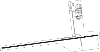
Runway info
| Runway 9 / 27 | ||
| length | 1525m (5003ft) | |
| bearing | 88° / 268° | |
| width | 15m (50ft) | |
| surface | asphalt | |
| displ threshold | 388m (1273ft) / 366m (1201ft) | |
Nearby beacons
| code | identifier | dist | bearing | frequency |
|---|---|---|---|---|
| TOL | TOLEDO TACAN | 10.6 | 225° | 112.50 |
| TO | TOPHR (TOLEDO) NDB | 16.1 | 235° | 219 |
| ADG | ADRIAN NDB | 20.5 | 288° | 278 |
| TCU | TECUMSEH NDB | 20.6 | 322° | 239 |
| CRL | CARLETON VOR/DME | 20.7 | 32° | 115.70 |
| DT | REVUP (DETROIT) NDB | 25.1 | 30° | 388 |
| DXO | DETROIT VOR/DME | 31.4 | 31° | 113.40 |
| RYS | GROSSE ILE (DETROIT) NDB | 31.4 | 54° | 419 |
| DM | SPENC (DETROIT) NDB | 35.4 | 43° | 223 |
| PCW | PORT CLINTON NDB | 37.6 | 105° | 423 |
| SVM | SALEM VORTAC | 40.4 | 5° | 114.30 |
| TII | TIFFIN NDB | 43.3 | 145° | 269 |
| FBC | FLAG CITY VORTAC | 47 | 187° | 108.20 |
| JXN | DME | 47.6 | 303° | 115.45 |
| QG | WINDSOR NDB | 49.3 | 54° | 353 |
| PSI | DME | 58.2 | 7° | 111 |
| MTC | SELFRIDGE (MOUNT CLEMENS) TACAN | 64.1 | 43° | 133.70 |
Instrument approach procedures
| runway | airway (heading) | route (dist, bearing) |
|---|---|---|
| RWNVA | WTRVL (357°) | WTRVL 6000ft WTRVL (turn) 2500ft |
| RNAV | WTRVL 2500ft TAINT (12mi, 357°) 2500ft MAKAF (5mi, 357°) 1180ft (5121mi, 117°) 1180ft WTRVL (5119mi, 296°) 2500ft WTRVL (turn) |
Disclaimer
The information on this website is not for real aviation. Use this data with the X-Plane flight simulator only! Data taken with kind consent from X-Plane 12 source code and data files. Content is subject to change without notice.