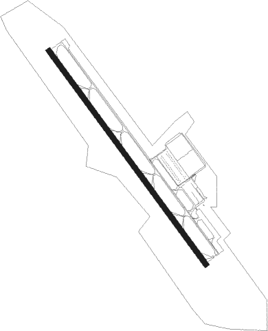
Westminster - Carroll County Rgnl
Airport details
| Country | United States of America |
| State | Maryland |
| Region | K6 |
| Airspace | New York Ctr |
| Municipality | Carroll County |
| Elevation | 789ft (240m) |
| Timezone | GMT -5 |
| Coordinates | 39.60828, -77.00767 |
| Magnetic var | |
| Type | land |
| Available since | X-Plane v10.40 |
| ICAO code | KDMW |
| IATA code | n/a |
| FAA code | DMW |
Communication
| Carroll County Rgnl AWOS 3 | 121.250 |
| Carroll County Rgnl CTAF/UNICOM | 122.700 |
| Carroll County Rgnl POTOMAC Approach | 125.525 |
| Carroll County Rgnl POTOMAC Departure | 125.525 |
Nearby beacons
| code | identifier | dist | bearing | frequency |
|---|---|---|---|---|
| EMI | WESTMINSTER VORTAC | 6.9 | 166° | 117.90 |
| FDK | FREDERICK VOR | 20.7 | 242° | 109 |
| FND | ELLICOTT (BALTIMORE) NDB | 22 | 144° | 371 |
| BAL | BALTIMORE VORTAC | 30.7 | 142° | 115.10 |
| MTN | MARTIN (BALTIMORE) TACAN | 32.2 | 115° | 134.10 |
| BUH | ANNE ARUNDEL (FT MEADE) NDB | 33.5 | 155° | 260 |
| CX | LATLE (HARRISBURG) NDB | 34.2 | 0° | 219 |
| MD | ENOLA (HARRISBURG) NDB | 38.6 | 10° | 204 |
| HGR | HAGERSTOWN VOR | 39.5 | 276° | 109.80 |
| GTN | GEORGETOWN (WASH., D.C.) NDB | 41.1 | 190° | 323 |
| MRB | MARTINSBURG VORTAC | 41.1 | 255° | 112.10 |
| HAR | HARRISBURG VORTAC | 41.7 | 355° | 112.50 |
| DCA | WASHINGTON, D.C. VOR/DME | 44.9 | 182° | 111 |
| LRP | LANCASTER VOR/DME | 45.1 | 54° | 117.30 |
| AML | ARMEL (WASH.,D.C.) VOR/DME | 45.7 | 214° | 113.50 |
| THS | SAINT THOMAS VORTAC | 47.7 | 289° | 115 |
| ADW | ANDREWS (CAMP SPRINGS) VORTAC | 48.5 | 170° | 113.10 |
| DCA | OXONN (WASHINGTON) NDB | 50.5 | 181° | 332 |
| BZJ | BELLGROVE (INDIANTOWN GAP) NDB | 53.9 | 29° | 328 |
| OTT | NOTTINGHAM VORTAC | 55.5 | 164° | 113.70 |
| DAA | DAVEE (FT BELVOIR) NDB | 57 | 186° | 223 |
| RAV | RAVINE VORTAC | 59.7 | 23° | 114.60 |
| CSN | CASANOVA VORTAC | 70.5 | 222° | 116.30 |
Departure and arrival routes
| Transition altitude | 18000ft |
| Transition level | 18000ft |
| SID end points | distance | outbound heading | |
|---|---|---|---|
| ALL | |||
| CONLE4 | 122mi | 169° | |
| TERPZ7 | 187mi | 218° | |
| STAR starting points | distance | inbound heading | |
|---|---|---|---|
| ALL | |||
| TRSTN3 | 98.1 | 27° | |
| RAVNN6, RIPKN2 | 55.5 | 344° | |
Instrument approach procedures
| runway | airway (heading) | route (dist, bearing) |
|---|---|---|
| RW16 | BINNS (179°) | BINNS UNYTS (6mi, 257°) 3000ft UNYTS (turn) 3000ft |
| RW16 | HYPER (109°) | HYPER UNYTS (6mi, 52°) 3000ft UNYTS (turn) 3000ft |
| RNAV | UNYTS 3000ft NISPL (7mi, 141°) 1900ft KDMW (4mi, 141°) 834ft (4806mi, 117°) 2200ft NABIC (4802mi, 297°) 2200ft FIGID (6mi, 65°) 3000ft FIGID (turn) | |
| RW34 | SLOAF (327°) | SLOAF FOUST (6mi, 339°) 2600ft |
| RW34 | TAFFI (280°) | TAFFI FOUST (13mi, 252°) 2600ft |
| RW34 | WOOLY (6°) | WOOLY FOUST (10mi, 51°) 2600ft |
| RNAV | FOUST 2600ft KATHH (6mi, 321°) 2100ft HEVIR (2mi, 321°) 1460ft KDMW (2mi, 321°) 819ft UNYTS (11mi, 321°) 3000ft UNYTS (turn) |
Holding patterns
| STAR name | hold at | type | turn | heading* | altitude | leg | speed limit |
|---|---|---|---|---|---|---|---|
| RAVNN6 | ACROW | VHF | left | 203 (23)° | DME 10.0mi | ICAO rules | |
| RAVNN6 | CAASH | VHF | left | 264 (84)° | DME 10.0mi | ICAO rules | |
| RAVNN6 | HBUDA | VHF | right | 210 (30)° | DME 10.0mi | ICAO rules | |
| RAVNN6 | JAYOH | VHF | left | 226 (46)° | 6001ft - 14000ft | DME 10.0mi | 210 |
| RAVNN6 | RAVNN | VHF | right | 252 (72)° | 6001ft - 14000ft | DME 5.0mi | 210 |
| RAVNN6 | TBART | VHF | left | 258 (78)° | DME 10.0mi | ICAO rules | |
| RAVNN6 | THHMP | VHF | left | 193 (13)° | DME 10.0mi | ICAO rules | |
| RIPKN2 | ACROW | VHF | left | 203 (23)° | DME 10.0mi | ICAO rules | |
| RIPKN2 | JAYOH | VHF | left | 226 (46)° | 6001ft - 14000ft | DME 10.0mi | 210 |
| RIPKN2 | RAVNN | VHF | right | 252 (72)° | 6001ft - 14000ft | DME 5.0mi | 210 |
| TRSTN3 | JOHOF | VHF | right | 214 (34)° | DME 10.0mi | ICAO rules | |
| *) magnetic outbound (inbound) holding course | |||||||
Disclaimer
The information on this website is not for real aviation. Use this data with the X-Plane flight simulator only! Data taken with kind consent from X-Plane 12 source code and data files. Content is subject to change without notice.
