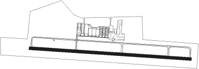
Delaware - Delaware Muni
Airport details
| Country | United States of America |
| State | Ohio |
| Region | K5 |
| Airspace | Indianapolis Ctr |
| Municipality | Delaware |
| Elevation | 942ft (287m) |
| Timezone | GMT -5 |
| Coordinates | 40.27969, -83.11481 |
| Magnetic var | |
| Type | land |
| Available since | X-Plane v10.40 |
| ICAO code | KDLZ |
| IATA code | n/a |
| FAA code | DLZ |
Communication
| Delaware Muni AWOS 3 | 119.025 |
| Delaware Muni CTAF/UNICOM | 122.700 |
| Delaware Muni COLUMBUS Approach/Departure | 120.200 |
Nearby beacons
| code | identifier | dist | bearing | frequency |
|---|---|---|---|---|
| OS | FULER (COLUMBUS) NDB | 12.9 | 202° | 515 |
| BUD | BUCKEYE (MARION) VOR | 20.3 | 9° | 109.80 |
| APE | APPLETON VORTAC | 25.3 | 104° | 116.70 |
| LC | PICKL (COLUMBUS) NDB | 27.1 | 145° | 376 |
| BU | BOUTN (COLUMBUS) NDB | 27.9 | 191° | 230 |
| LCK | RICKENBACKER (COLUMBUS) TACAN | 29.5 | 158° | 134.20 |
| DD | COBBS (COLUMBUS) NDB | 32.5 | 170° | 253 |
| MF | MANNS (MANSFIELD) NDB | 42.2 | 54° | 372 |
| ROD | ROSEWOOD VORTAC | 42.5 | 271° | 117.50 |
| MFD | MANSFIELD VORTAC | 42.6 | 42° | 108.80 |
| XSF | SPRINGFIELD TACAN | 42.6 | 239° | 133.80 |
| CSS | COURT HOUSE (WASHINGTON) NDB | 42.7 | 202° | 414 |
| SGH | DME | 42.8 | 239° | 113.20 |
| XUB | YELLOW BUD (CIRCLEVILLE) VOR | 45.6 | 170° | 112.50 |
| TII | TIFFIN NDB | 49.1 | 353° | 269 |
| FBC | FLAG CITY VORTAC | 50 | 316° | 108.20 |
| FFO | PATTERSON (DAYTON) TACAN | 51.3 | 244° | 115.20 |
| IL | AIRBO (WILMINGTON) NDB | 55.2 | 218° | 407 |
| MXQ | MIDWEST (WILMINGTON) VOR/DME | 60 | 219° | 112.90 |
| HW | CUBLA (WILMINGTON) NDB | 65.7 | 219° | 299 |
Instrument approach procedures
| runway | airway (heading) | route (dist, bearing) |
|---|---|---|
| RW10 | ESSIE (134°) | ESSIE KIRRA (8mi, 164°) 2600ft MOSQI (7mi, 191°) 2600ft |
| RW10 | PIZZA (50°) | PIZZA VIBCO (7mi, 326°) 2600ft MOSQI (7mi, 11°) 2600ft |
| RNAV | MOSQI 2600ft ITTOW (7mi, 96°) 2600ft CODOX (3mi, 96°) 1720ft KDLZ (3mi, 96°) 987ft (5090mi, 116°) 1195ft PICUM (5077mi, 296°) 3000ft PICUM (turn) | |
| RW28 | MEEKS (158°) | MEEKS ITENY (25mi, 121°) 3000ft PICUM (7mi, 191°) 3000ft |
| RW28 | PIZZA (50°) | PIZZA HABNI (22mi, 85°) 3100ft PICUM (7mi, 11°) 3000ft |
| RNAV | PICUM 3000ft WEBUT (7mi, 277°) 2600ft KDLZ (6mi, 276°) 986ft (5090mi, 116°) 1195ft MOSQI (5102mi, 296°) 2600ft MOSQI (turn) |
Disclaimer
The information on this website is not for real aviation. Use this data with the X-Plane flight simulator only! Data taken with kind consent from X-Plane 12 source code and data files. Content is subject to change without notice.
