Duluth - Duluth Intl
Airport details
| Country | United States of America |
| State | Minnesota |
| Region | K3 |
| Airspace | Minneapolis Ctr |
| Municipality | Duluth |
| Elevation | 1428ft (435m) |
| Timezone | GMT -6 |
| Coordinates | 46.84208, -92.19364 |
| Magnetic var | |
| Type | land |
| Available since | X-Plane v10.40 |
| ICAO code | KDLH |
| IATA code | DLH |
| FAA code | DLH |
Communication
| Duluth Intl ATIS | 124.100 |
| Duluth Intl UNICOM | 122.950 |
| Duluth Intl Ground Control | 121.900 |
| Duluth Intl Tower | 118.300 |
| Duluth Intl Approach | 125.450 |
| Duluth Intl Departure | 125.450 |
Approach frequencies
| ILS-cat-II | RW09 | 110.3 | 18.00mi |
| ILS-cat-I | RW27 | 108.7 | 18.00mi |
| 3° GS | RW09 | 110.3 | 18.00mi |
| 3° GS | RW27 | 108.7 | 18.00mi |
Nearby Points of Interest:
Munger Terrace
-St. Mark's African Methodist Episcopal Church
-Sacred Heart Cathedral, Sacred Heart School and Christian Brothers Home
-Fire Station No. 1
-Historic Central High School
-Duluth Public Library
-YWCA of Duluth
-Duluth Masonic Center
-Bridge L8515
-Wirth Building
-Duluth Depot
-Bergetta Moe Bakery
-Fitger Brewing Company
-Chester Terrace
-Lincoln Branch Library
-Duluth Missabe and Iron Range Depot
-Oliver G. Traphagen House
-DeWitt-Seitz Building
-Bridge L6113
-U.S. Army Corps of Engineers Vessel Yard
-Irving School
-Lester River Fish Hatchery
-Lester River Bridge
-Empire Block
-Douglas County Courthouse
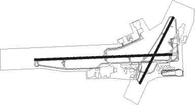
Runway info
Runway 9 / 27  | ||
| length | 3232m (10604ft) | |
| bearing | 92° / 272° | |
| width | 46m (150ft) | |
| surface | concrete | |
| displ threshold | 0m (0ft) / 142m (466ft) | |
| blast zone | 122m (400ft) / 0m (0ft) | |
| Runway 3 / 21 | ||
| length | 1737m (5699ft) | |
| bearing | 42° / 222° | |
| width | 46m (150ft) | |
| surface | asphalt | |
Nearby beacons
| code | identifier | dist | bearing | frequency |
|---|---|---|---|---|
| LKI | LAKESIDE (DULUTH) TACAN | 0.3 | 77° | 135.40 |
| DLH | DULUTH VORTAC | 2.4 | 193° | 112.60 |
| DL | PYKLA (DULUTH) NDB | 6.6 | 271° | 379 |
| HIB | HIBBING VOR/DME | 34.6 | 312° | 110.80 |
| HYR | DME | 58.3 | 138° | 113.40 |
| ELO | DME | 60.6 | 20° | 109.60 |
Instrument approach procedures
| runway | airway (heading) | route (dist, bearing) |
|---|---|---|
| RW03 | DEHBU (8°) | DEHBU OMARY (5mi, 293°) 3200ft |
| RW03 | OMARY (39°) | OMARY 3200ft |
| RW03 | PEGHI (63°) | PEGHI OMARY (5mi, 113°) 3200ft |
| RNAV | OMARY 3200ft AMLIY (6mi, 42°) 3000ft KDLH (5mi, 37°) 1453ft (5495mi, 117°) 1824ft CLIPH (5488mi, 297°) 3200ft CLIPH (turn) | |
| RW09 | UDTEG (91°) | UDTEG 3300ft |
| RW09 | VOZVE (109°) | VOZVE UDTEG (6mi, 183°) 3300ft |
| RW09 | WUFEF (74°) | WUFEF UDTEG (6mi, 3°) 3300ft |
| RNAV | UDTEG 3300ft OYEKU (6mi, 91°) 3300ft KDLH (7mi, 91°) 1487ft (5495mi, 117°) 1628ft HOMUV (5483mi, 297°) 4000ft HOMUV (turn) | |
| RW21 | CLIPH (224°) | CLIPH 3200ft |
| RW21 | JIMKI (245°) | JIMKI CLIPH (5mi, 293°) 3200ft |
| RW21 | JUDDD (196°) | JUDDD CLIPH (5mi, 113°) 3200ft |
| RNAV | CLIPH 3200ft JEFWY (6mi, 222°) 3200ft KDLH (6mi, 226°) 1456ft (5495mi, 117°) 1708ft OMARY (5501mi, 297°) 3200ft OMARY (turn) | |
| RW27 | HOMUV (272°) | HOMUV 4000ft |
| RW27 | PLANE (291°) | PLANE HOMUV (6mi, 4°) 4000ft |
| RW27 | SRTWO (253°) | SRTWO HOMUV (6mi, 184°) 4000ft |
| RNAV | HOMUV 4000ft CIRUS (6mi, 272°) 3200ft KDLH (6mi, 272°) 1469ft (5495mi, 117°) 1621ft UDTEG (5508mi, 297°) 3300ft UDTEG (turn) |
Disclaimer
The information on this website is not for real aviation. Use this data with the X-Plane flight simulator only! Data taken with kind consent from X-Plane 12 source code and data files. Content is subject to change without notice.