Clinton - Clinton Sherman
Airport details
| Country | United States of America |
| State | Oklahoma |
| Region | K4 |
| Airspace | Ft Worth Ctr |
| Municipality | Washita County |
| Elevation | 1919ft (585m) |
| Timezone | GMT -6 |
| Coordinates | 35.34830, -99.19695 |
| Magnetic var | |
| Type | land |
| Available since | X-Plane v10.40 |
| ICAO code | KCSM |
| IATA code | CSM |
| FAA code | CSM |
Communication
| CLINTON SHERMAN ASOS | 135.225 |
| CLINTON SHERMAN CTAF | 119.600 |
| CLINTON SHERMAN UNICOM | 122.950 |
| CLINTON SHERMAN Ground Control | 121.700 |
| CLINTON SHERMAN Tower | 119.600 |
| CLINTON SHERMAN FORT WORTH CNTR | 128.400 |
Approach frequencies
| ILS-cat-I | RW17R | 109.5 | 18.00mi |
| 3° GS | RW17R | 109.5 | 18.00mi |
Nearby Points of Interest:
Canute Service Station
-Cordell Carnegie Public Library
-Washita County Courthouse
-Hedlund Motor Company Building
-Storm House
-Hobart City Hall
-Downtown Hobart Historic District
-Beckham County Courthouse
-Sayre Rock Island Depot
-J. W. Danner House
-Sayre Champlin Service Station
-Sayre City Park
-Provine Service Station
-Greer County Courthouse
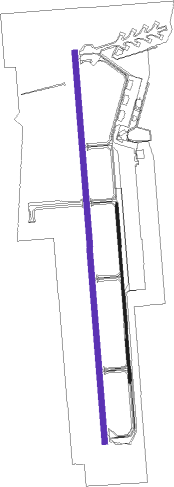
Runway info
Runway 17L / 35R  | ||
| length | 1896m (6220ft) | |
| bearing | 180° / 0° | |
| width | 23m (75ft) | |
| surface | concrete | |
| displ threshold | 155m (509ft) / 152m (499ft) | |
| Runway 17R / 35L | ||
| length | 4126m (13537ft) | |
| bearing | 180° / 0° | |
| width | 61m (200ft) | |
| surface | concrete | |
| blast zone | 255m (837ft) / 255m (837ft) | |
Nearby beacons
| code | identifier | dist | bearing | frequency |
|---|---|---|---|---|
| BZ | FOSSI (CLINTON) NDB | 6.1 | 357° | 393 |
| BFV | BURNS FLAT (CLINTON) VORTAC | 6.7 | 185° | 110 |
| HBR | HOBART VORTAC | 29.6 | 165° | 111.80 |
| LTS | ALTUS VORTAC | 41.3 | 186° | 109.80 |
| LAW | LAWTON VOR/DME | 64 | 137° | 109.40 |
| MMB | MITBEE (GAGE) VORTAC | 68.4 | 326° | 115.60 |
Instrument approach procedures
| runway | airway (heading) | route (dist, bearing) |
|---|---|---|
| RW17R | JETVE (179°) | JETVE 4100ft |
| RNAV | JETVE 4100ft REXFU (7mi, 180°) 3800ft KCSM (6mi, 178°) 1976ft (5855mi, 110°) 2500ft JETVE (5854mi, 290°) 4100ft JETVE (turn) | |
| RW35L | HUWHA (1°) | HUWHA 4000ft |
| RNAV | HUWHA 4000ft HIMRY (6mi, 0°) 3600ft SULSE (4mi, 0°) 2460ft KCSM (3mi, 5°) 1962ft (5855mi, 110°) 2113ft JETVE (5854mi, 290°) 4100ft JETVE (turn) |
Disclaimer
The information on this website is not for real aviation. Use this data with the X-Plane flight simulator only! Data taken with kind consent from X-Plane 12 source code and data files. Content is subject to change without notice.