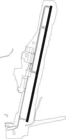
South Vinemont - Cullman Regional Airport-folsom Field
Airport details
| Country | United States of America |
| State | Alabama |
| Region | K7 |
| Airspace | Memphis Ctr |
| Municipality | Cullman County |
| Elevation | 969ft (295m) |
| Timezone | GMT -6 |
| Coordinates | 34.26995, -86.85996 |
| Magnetic var | |
| Type | land |
| Available since | X-Plane v11.05 |
| ICAO code | KCMD |
| IATA code | n/a |
| FAA code | n/a |
Communication
| CULLMAN REGIONAL AIRPORT-FOLSOM FIELD AWOS 3 | 124.175 |
| CULLMAN REGIONAL AIRPORT-FOLSOM FIELD CTAF/UNICOM | 122.800 |
| CULLMAN REGIONAL AIRPORT-FOLSOM FIELD HUNTSVILLE Approach/Departure | 118.050 |
Nearby Points of Interest:
Louisville and Nashville Railroad Depot
-Ernest Edward Greene House
-Stiefelmeyer's
-Ave Maria Grotto
-Hartselle Downtown Commercial Historic District
-Green Pryor Rice House
-Somerville Courthouse
-Crane Hill Masonic Lodge
-Newsome Sinks Karst Area
-Robert G. Griffith, Sr. House
-Wheeler National Wildlife Refuge Warden's Residence
-Cotaco Opera House
-New Decatur–Albany Historic District
-Rhea-McEntire House
-Belle Mina
-Pryor Field Regional Airport
-Propulsion and Structural Test Facility
-Saturn V Dynamic Test Stand
-Neutral Buoyancy Simulator
-Ice House
-James H. Bibb House
-Thomas Holland House
-Madison Station Historic District
-Saratoga Victory Mill
-William Lanford House
Nearby beacons
| code | identifier | dist | bearing | frequency |
|---|---|---|---|---|
| DCU | DME | 23 | 348° | 112.80 |
| RQZ | ROCKET (HUNTSVILLE) VORTAC | 33.5 | 23° | 112.20 |
| VUZ | VULCAN (BIRMINGHAM) VORTAC | 36 | 184° | 114.40 |
| MSL | MUSCLE SHOALS VORTAC | 40.8 | 305° | 116.50 |
| GAD | GADSDEN VOR/DME | 42.4 | 111° | 112.30 |
| BH | MCDEN (BIRMINGHAM) NDB | 45.5 | 179° | 224 |
| TDG | DME | 58.3 | 130° | 108.80 |
| AN | BOGGA (ANNISTON) NDB | 63.9 | 128° | 211 |
Instrument approach procedures
| runway | airway (heading) | route (dist, bearing) |
|---|---|---|
| RW02 | MELYE (19°) | MELYE 3200ft |
| RNAV | MELYE 3200ft DOWDU (6mi, 20°) 2700ft CUSAG (3mi, 20°) 1780ft KCMD (3mi, 17°) 984ft (5249mi, 112°) 1369ft AMUXY (5246mi, 292°) 3700ft AMUXY (turn) | |
| RW20 | AMUXY (200°) | AMUXY 3700ft |
| RNAV | AMUXY 3700ft FISRO (6mi, 200°) 2700ft ZEDNU (3mi, 200°) 1740ft KCMD (3mi, 202°) 1009ft (5249mi, 112°) 1219ft MELYE (5252mi, 291°) 3200ft MELYE (turn) |
Disclaimer
The information on this website is not for real aviation. Use this data with the X-Plane flight simulator only! Data taken with kind consent from X-Plane 12 source code and data files. Content is subject to change without notice.