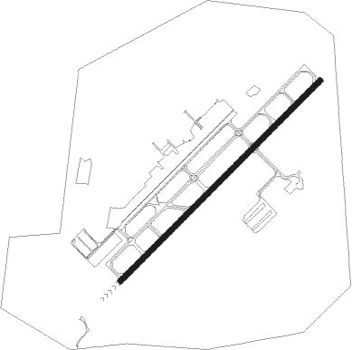
Cleveland - Cuyahoga Co
Airport details
| Country | United States of America |
| State | Ohio |
| Region | K5 |
| Airspace | Cleveland Ctr |
| Municipality | Highland Heights |
| Elevation | 876ft (267m) |
| Timezone | GMT -5 |
| Coordinates | 41.56511, -81.48636 |
| Magnetic var | |
| Type | land |
| Available since | X-Plane v10.40 |
| ICAO code | KCGF |
| IATA code | CGF |
| FAA code | CGF |
Communication
| CUYAHOGA CO UNICOM | 122.950 |
| CUYAHOGA CO CTAF | 118.500 |
| CUYAHOGA CO Ground Control/Clearance DEL | 121.850 |
| CUYAHOGA CO COUNTY Tower | 118.500 |
| CUYAHOGA CO CLEVELAND Approach/Departure | 125.350 |
Approach frequencies
| ILS-cat-I | RW24 | 111.1 | 18.00mi |
| 3° GS | RW24 | 111.1 | 18.00mi |
Nearby Points of Interest:
Nela Park
-First Church of Christ in Euclid
-Forest Hill, Ohio
-Louis Penfield House
-Alta Public Library
-Cozad-Bates House
-First Church of Christ, Scientist
-Flora Stone Mather College Historic District
-Tower East
-Allen Memorial Medical Library
-Adelbert Hall
-Cedar Glen Apartments
-Woodland-Larchmere Commercial Historic District
-Ansel Road Apartment Buildings Historic District
-Halle Brothers Shaker Square department store
-Dr. James Bell House
-Weizer Building
-St. Luke's Hospital
-Karamu House
-Baker Motor Vehicle Company Building
-Body Block
-Wade Park District
-Andrew and James Dall Houses
-St. Paul's Episcopal Church
Nearby beacons
| code | identifier | dist | bearing | frequency |
|---|---|---|---|---|
| BF | TABEY (CLEVELAND) NDB | 3.9 | 273° | 248 |
| LQL | LAKELAND (WILLOUGHBY) NDB | 8.5 | 42° | 263 |
| CXR | CHARDON VOR/DME | 14.8 | 98° | 112.70 |
| AK | AKRON NDB | 30 | 169° | 362 |
| ACO | AKRON VOR/DME | 30.3 | 148° | 114.40 |
| DJB | DRYER VOR/DME | 32.8 | 253° | 113.60 |
| JFN | JEFFERSON VOR/DME | 35.1 | 75° | 115.20 |
| YNG | YOUNGSTOWN VORTAC | 39.1 | 106° | 109 |
| YN | FETCH (YOUNGSTOWN/WARREN) NDB | 45.7 | 112° | 338 |
| BSV | BRIGGS VOR/DME | 49.5 | 176° | 112.40 |
| MF | MANNS (MANSFIELD) NDB | 64.6 | 230° | 372 |
Departure and arrival routes
| Transition altitude | 18000ft |
| Transition level | 18000ft |
| SID end points | distance | outbound heading | |
|---|---|---|---|
| RW06 | |||
| MYCAR4 | 38mi | 62° | |
| AHMET4 | 97mi | 156° | |
| CAVVS4 | 99mi | 218° | |
| ZAAPA5 | 231mi | 250° | |
| GTLKE4 | 190mi | 268° | |
| RW24 | |||
| MYCAR4 | 38mi | 62° | |
| AHMET4 | 97mi | 156° | |
| CAVVS4 | 99mi | 218° | |
| ZAAPA5 | 231mi | 250° | |
| GTLKE4 | 190mi | 268° | |
| STAR starting points | distance | inbound heading | |
|---|---|---|---|
| ALL | |||
| ROLLN2 | 42.6 | 21° | |
| ROKNN3 | 59.6 | 58° | |
| BRWNZ4 | 36.8 | 112° | |
| TRYBE4 | 19.4 | 277° | |
Instrument approach procedures
| runway | airway (heading) | route (dist, bearing) |
|---|---|---|
| RW24 | WEIDS (247°) | WEIDS EBLIS (7mi, 264°) 3000ft |
| RNAV | EBLIS 3000ft IMUSY (4mi, 237°) 3000ft KROOK (4mi, 237°) 2300ft KCGF (5mi, 237°) 917ft (5023mi, 117°) 2500ft ZUPKO (5020mi, 297°) 3000ft ZUPKO (turn) |
Holding patterns
| STAR name | hold at | type | turn | heading* | altitude | leg | speed limit |
|---|---|---|---|---|---|---|---|
| BRWNZ4 | BRWNZ | VHF | left | 293 (113)° | DME 10.0mi | ICAO rules | |
| BRWNZ4 | DETMR | VHF | left | 282 (102)° | DME 10.0mi | ICAO rules | |
| BRWNZ4 | FRYYE | VHF | left | 284 (104)° | DME 10.0mi | ICAO rules | |
| ROKNN3 | ROKNN | VHF | right | 232 (52)° | DME 10.0mi | ICAO rules | |
| ROLLN2 | ROLLN | VHF | right | 198 (18)° | DME 10.0mi | ICAO rules | |
| TRYBE4 | DECRR | VHF | left | 120 (300)° | DME 10.0mi | ICAO rules | |
| TRYBE4 | HFNER | VHF | right | 78 (258)° | DME 10.0mi | ICAO rules | |
| TRYBE4 | TRYBE | VHF | left | 95 (275)° | DME 10.0mi | ICAO rules | |
| *) magnetic outbound (inbound) holding course | |||||||
Disclaimer
The information on this website is not for real aviation. Use this data with the X-Plane flight simulator only! Data taken with kind consent from X-Plane 12 source code and data files. Content is subject to change without notice.