Brainerd - Brainerd Lakes Regl
Airport details
| Country | United States of America |
| State | Minnesota |
| Region | K3 |
| Airspace | Minneapolis Ctr |
| Municipality | Crow Wing County |
| Elevation | 1226ft (374m) |
| Timezone | GMT -6 |
| Coordinates | 46.39887, -94.13117 |
| Magnetic var | |
| Type | land |
| Available since | X-Plane v10.32 |
| ICAO code | KBRD |
| IATA code | BRD |
| FAA code | BRD |
Communication
| Brainerd Lakes Regl ASOS | 126.775 |
| Brainerd Lakes Regl CTAF/UNICOM | 122.700 |
Approach frequencies
| ILS-cat-I | RW23 | 109.9 | 18.00mi |
| ILS-cat-I | RW34 | 109.7 | 18.00mi |
| 3° GS | RW23 | 109.9 | 18.00mi |
| 3° GS | RW34 | 109.7 | 18.00mi |
Nearby Points of Interest:
Northern Pacific Railroad Shops Historic District
-Brainerd Public Library
-Parker Building
-Crow Wing County Courthouse and Jail
-Ironton City Hall
-Ironton Sintering Plant Complex
-Cuyuna Iron Range Municipally-Owned Elevated Metal Water Tanks
-Crosby station
-Milford Mine
-Deerwood Auditorium
-Wilford H. Fawcett House
-Kenney Lake Overlook
-Pequot Fire Lookout Tower
-Cole Memorial Building
-St. Alban's Bay Culvert
-Fort Ripley
-Bridge No. 3355-Kathio Township
-Aitkin County Courthouse and Jail
-Aitkin Carnegie Library
-Northern Pacific Depot
-Patrick Casey House
-Potter/Casey Company Building
-Camp Ripley Bridge
-St. Joseph's Church-Catholic
-Pine Tree Lumber Company Office Building
Runway info
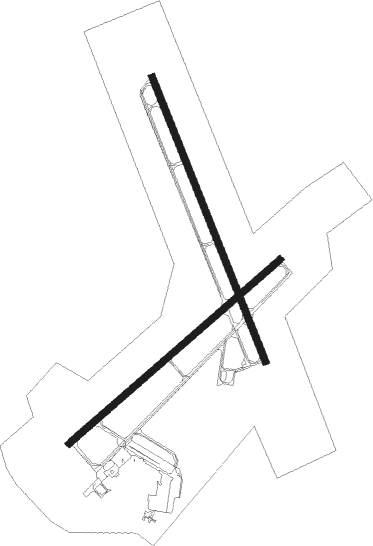
Runway 5 / 23  | ||
| length | 1982m (6503ft) | |
| bearing | 63° / 243° | |
| width | 46m (151ft) | |
| surface | concrete | |
| blast zone | 61m (200ft) / 61m (200ft) | |
| Runway 16 / 34 | ||
| length | 2165m (7103ft) | |
| bearing | 156° / 336° | |
| width | 46m (151ft) | |
| surface | concrete | |
| blast zone | 61m (200ft) / 61m (200ft) | |
Nearby beacons
| code | identifier | dist | bearing | frequency |
|---|---|---|---|---|
| BR | LAREW (BRAINERD) NDB | 5.6 | 62° | 251 |
| XCR | RIPLEY NDB | 21.1 | 214° | 404 |
| PK | SPIDA (PARK RAPIDS) NDB | 43.5 | 297° | 269 |
| PKD | RAPIDS DME | 48.9 | 298° | 110.60 |
| STC | SAINT CLOUD VOR/DME | 51.1 | 175° | 112.10 |
| GPZ | GRAND RAPIDS VOR/DME | 52.9 | 40° | 111.40 |
| PNM | PRINCETON NDB | 54.6 | 148° | 368 |
| ST | HUSSK (ST CLOUD) NDB | 55.6 | 170° | 342 |
Instrument approach procedures
| runway | airway (heading) | route (dist, bearing) |
|---|---|---|
| RW05 | BRNRD (296°) | BRNRD ONUNY (12mi, 244°) 3000ft UHAVE (5mi, 313°) 3000ft |
| RW05 | WATAM (92°) | WATAM PIVME (30mi, 93°) 3100ft UHAVE (7mi, 133°) 3000ft |
| RNAV | UHAVE 3000ft JIBYA (6mi, 63°) 2300ft KBRD (4mi, 65°) 1266ft (5576mi, 116°) 1424ft EYUPO (5566mi, 296°) 3000ft EYUPO (turn) | |
| RW23 | BRNRD (296°) | BRNRD JIKRO (10mi, 62°) 3000ft EYUPO (5mi, 313°) 3000ft |
| RW23 | EYUPO (242°) | EYUPO 3000ft |
| RW23 | HUUTA (149°) | HUUTA GUPKE (16mi, 110°) 3000ft EYUPO (5mi, 133°) 3000ft |
| RNAV | EYUPO 3000ft CUXUR (6mi, 243°) 3000ft KBRD (6mi, 242°) 1273ft (5576mi, 116°) 1501ft TEYYU (5580mi, 296°) CUCAC (15mi, 313°) 3300ft CUCAC (turn) | |
| RW34 | AFUNI (335°) | AFUNI 3000ft |
| RW34 | COMIN (8°) | COMIN AFUNI (5mi, 78°) 3000ft |
| RW34 | DRAWG (308°) | DRAWG AFUNI (5mi, 258°) 3000ft |
| RNAV | AFUNI 3000ft NUYBI (6mi, 336°) 3000ft KBRD (5mi, 334°) 1278ft (5576mi, 116°) 1432ft KRINK (5577mi, 296°) CUCAC (12mi, 289°) 3300ft CUCAC (turn) |
Disclaimer
The information on this website is not for real aviation. Use this data with the X-Plane flight simulator only! Data taken with kind consent from X-Plane 12 source code and data files. Content is subject to change without notice.