Bloomington - Monroe Co
Airport details
| Country | United States of America |
| State | Indiana |
| Region | K5 |
| Airspace | Indianapolis Ctr |
| Municipality | Monroe County |
| Elevation | 846ft (258m) |
| Timezone | GMT -5 |
| Coordinates | 39.14602, -86.61668 |
| Magnetic var | |
| Type | land |
| Available since | X-Plane v10.40 |
| ICAO code | KBMG |
| IATA code | BMG |
| FAA code | BMG |
Communication
| Monroe Co AWOS | 119.125 |
| Monroe Co CTAF | 120.775 |
| Monroe Co UNICOM | 122.950 |
| Monroe Co Ground Control | 121.900 |
| Monroe Co BLOOMINGTON Tower | 120.775 |
| Monroe Co HULMAN Approach/Departure | 128.025 |
Approach frequencies
| ILS-cat-I | RW35 | 108.3 | 18.00mi |
| 3° GS | RW35 | 108.3 | 18.00mi |
Nearby Points of Interest:
Leroy Mayfield House
-Woolery Stone Company
-Blair-Dunning House
-Steele Dunning Historic District
-Elias Abel House
-Prospect Hill Historic District
-Bloomington West Side Historic District
-Second Baptist Church
-Cochran–Helton–Lindley House
-Johnson's Creamery
-Princess Theatre
-Illinois Central Railroad Freight Depot
-Courthouse Square Historic District
-Bloomington City Hall
-Monroe County Courthouse
-Coca-Cola Bottling Plant
-Wicks Building
-Millen-Chase-McCalla House
-Morgan House
-Monroe Carnegie Library
-North Washington Street Historic District
-John L. Nichols House
-Daniel Stout House
-University Courts Historic District
-Vinegar Hill Historic District
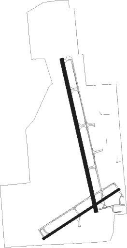
Runway info
Runway 17 / 35  | ||
| length | 1984m (6509ft) | |
| bearing | 169° / 349° | |
| width | 46m (151ft) | |
| surface | asphalt | |
| Runway 6 / 24 | ||
| length | 1158m (3799ft) | |
| bearing | 67° / 247° | |
| width | 30m (98ft) | |
| surface | asphalt | |
| displ threshold | 93m (305ft) / 68m (223ft) | |
Nearby beacons
| code | identifier | dist | bearing | frequency |
|---|---|---|---|---|
| OOM | HOOSIER (BLOOMINGTON) VORTAC | 0.2 | 121° | 110.20 |
| TTH | TERRE HAUTE VORTAC | 35.8 | 298° | 115.30 |
| CO | COLFA (INDIANAPOLIS) NDB | 36.6 | 40° | 232 |
| BA | CLIFS (COLUMBUS) NDB | 38.6 | 78° | 410 |
| HU | YINNO (TERRE HAUTE) NDB | 39.1 | 287° | 245 |
| VHP | BRICKYARD VORTAC | 41.7 | 20° | 116.30 |
| FV | LAREZ (INDIANAPOLIS) NDB | 43.1 | 33° | 349 |
| SHB | SHELBYVILLE VOR/DME | 46.9 | 58° | 112 |
| LWV | DME | 51.3 | 249° | 108.80 |
| CFJ | CRAWFORDSVILLE NDB | 52 | 340° | 388 |
| UMP | METROPOLITAN (INDIANAPOLIS) NDB | 54.3 | 36° | 338 |
| JV | CATCH (JEFFERSONVILLE) NDB | 57.6 | 127° | 331 |
| BQM | (LOUISVILLE) DME | 70.8 | 134° | 112.20 |
Instrument approach procedures
| runway | airway (heading) | route (dist, bearing) |
|---|---|---|
| RW06 | EYTEJ (30°) | EYTEJ OXDOH (8mi, 325°) 3000ft |
| RW06 | OOM (301°) | OOM OXDOH (11mi, 247°) 3000ft OXDOH (turn) 3000ft |
| RW06 | TUZYE (83°) | TUZYE OXDOH (5mi, 122°) 3000ft |
| RNAV | OXDOH 3000ft MIYOS (5mi, 67°) 2500ft KBMG (5mi, 64°) 881ft (5248mi, 114°) 1246ft IJPOV (5239mi, 294°) 3000ft IJPOV (turn) | |
| RW17 | BUNKA (83°) | BUNKA ZESXY (24mi, 57°) 3000ft ITYEF (5mi, 83°) 3000ft |
| RW17 | MOUTH (239°) | MOUTH EDISY (13mi, 270°) 3000ft ITYEF (5mi, 264°) 3000ft |
| RW17 | OOM (301°) | OOM ITYEF (12mi, 349°) 3000ft ITYEF (turn) 3000ft |
| RNAV | ITYEF 3000ft OGUSY (7mi, 169°) 2500ft KBMG (6mi, 170°) 886ft ALFRD (12mi, 169°) 3000ft ALFRD (turn) | |
| RW24 | HOUSE (283°) | HOUSE ROZUV (10mi, 300°) 3000ft IJPOV (5mi, 326°) 3000ft |
| RW24 | OOM (301°) | OOM IJPOV (10mi, 68°) 3000ft IJPOV (turn) 3000ft |
| RNAV | IJPOV 3000ft URCUR (5mi, 247°) 2500ft 30THR (2mi, 247°) 1840ft KBMG (3mi, 252°) 872ft OXDOH (10mi, 246°) 3000ft OXDOH (turn) | |
| RW35 | BUNKA (83°) | BUNKA BEWHY (23mi, 107°) 3000ft ALFRD (5mi, 83°) 3000ft |
| RW35 | HOUSE (283°) | HOUSE FODCU (14mi, 254°) 3100ft ALFRD (5mi, 264°) 3000ft |
| RW35 | OOM (301°) | OOM ALFRD (12mi, 170°) 3000ft ALFRD (turn) 3000ft |
| RNAV | ALFRD 3000ft NITTE (7mi, 349°) 2500ft KBMG (5mi, 349°) 887ft ITYEF (12mi, 350°) 3000ft ITYEF (turn) |
Disclaimer
The information on this website is not for real aviation. Use this data with the X-Plane flight simulator only! Data taken with kind consent from X-Plane 12 source code and data files. Content is subject to change without notice.