Cleveland - Burke Lakefront
Airport details
| Country | United States of America |
| State | Ohio |
| Region | K5 |
| Airspace | Cleveland Ctr |
| Municipality | Cleveland |
| Elevation | 583ft (178m) |
| Timezone | GMT -5 |
| Coordinates | 41.51786, -81.68264 |
| Magnetic var | |
| Type | land |
| Available since | X-Plane v10.40 |
| ICAO code | KBKL |
| IATA code | BKL |
| FAA code | BKL |
Communication
| Burke Lakefront ATIS | 125.250 |
| Burke Lakefront UNICOM | 122.950 |
| Burke Lakefront CTAF | 124.300 |
| Burke Lakefront LAKEFRONT Ground Control | 121.900 |
| Burke Lakefront LAKEFRONT Tower | 124.300 |
| Burke Lakefront CLEVELAND ApproachR | 125.350 |
| Burke Lakefront CLEVELAND Departure | 125.350 |
Approach frequencies
| ILS-cat-I | RW24R | 109.75 | 18.00mi |
| 3° GS | RW24R | 109.75 | 18.00mi |
Nearby Points of Interest:
Tower Press Building
-Bryant Building
-1717 East Ninth Building
-Superior Building
-Playhouse Square
-Federal Reserve Bank of Cleveland
-Fenn Tower
-Halle Building
-Euclid Avenue Historic District
-Cleveland Stadium
-Cleveland Athletic Club
-Cleveland Trust Company Building
-Cuyahoga County Courthouse
-Guardian Bank Building
-Howard M. Metzenbaum United States Courthouse
-Grays Armory
-Society for Savings Building
-First Methodist Church
-Caxton Building
-Public Square
-Brownell School and Annex
-Park Building
-May Company Ohio
-Dr. William Gifford House
-Cleveland Masonic Temple
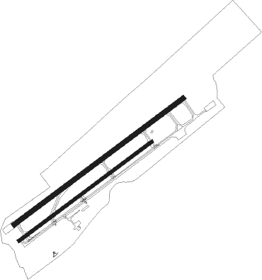
Runway info
Runway 6L / 24R  | ||
| length | 2015m (6611ft) | |
| bearing | 65° / 245° | |
| width | 46m (150ft) | |
| surface | concrete | |
| displ threshold | 60m (197ft) / 183m (600ft) | |
| blast zone | 125m (410ft) / 0m (0ft) | |
| Runway 6R / 24L | ||
| length | 1582m (5190ft) | |
| bearing | 65° / 245° | |
| width | 30m (100ft) | |
| surface | concrete | |
| displ threshold | 87m (285ft) / 0m (0ft) | |
Nearby beacons
| code | identifier | dist | bearing | frequency |
|---|---|---|---|---|
| BF | TABEY (CLEVELAND) NDB | 5.7 | 65° | 248 |
| LQL | LAKELAND (WILLOUGHBY) NDB | 16.8 | 62° | 263 |
| CXR | CHARDON VOR/DME | 23.3 | 90° | 112.70 |
| DJB | DRYER VOR/DME | 23.6 | 252° | 113.60 |
| AK | AKRON NDB | 30 | 147° | 362 |
| ACO | AKRON VOR/DME | 32.8 | 130° | 114.40 |
| JFN | JEFFERSON VOR/DME | 44.3 | 75° | 115.20 |
| BSV | BRIGGS VOR/DME | 48 | 162° | 112.40 |
| MFD | MANSFIELD VORTAC | 56.6 | 234° | 108.80 |
| MF | MANNS (MANSFIELD) NDB | 56.8 | 225° | 372 |
Departure and arrival routes
| Transition altitude | 18000ft |
| Transition level | 18000ft |
| SID end points | distance | outbound heading | |
|---|---|---|---|
| RW06 (ALL) | |||
| MYCAR4 | 47mi | 65° | |
| AHMET4 | 97mi | 150° | |
| CAVVS4 | 92mi | 214° | |
| ZAAPA5 | 222mi | 249° | |
| GTLKE4 | 181mi | 268° | |
| RW24 (ALL) | |||
| MYCAR4 | 47mi | 65° | |
| AHMET4 | 97mi | 150° | |
| CAVVS4 | 92mi | 214° | |
| ZAAPA5 | 222mi | 249° | |
| GTLKE4 | 181mi | 268° | |
| STAR starting points | distance | inbound heading | |
|---|---|---|---|
| ALL | |||
| ROLLN2 | 38.3 | 6° | |
| ROKNN3 | 51.1 | 54° | |
| BRWNZ4 | 31.1 | 122° | |
| TRYBE4 | 28.0 | 270° | |
Instrument approach procedures
| runway | airway (heading) | route (dist, bearing) |
|---|---|---|
| RW24R | CXR (270°) | CXR SOOTO (13mi, 279°) 3000ft |
| RW24R | SOOTO (259°) | SOOTO 3000ft |
| RNAV | SOOTO 3000ft NAATE (5mi, 261°) 2400ft JAYTO (3mi, 261°) 1420ft LOLCY (2mi, 261°) 886ft (5031mi, 117°) 984ft TOMMK (5036mi, 297°) 2000ft ZAMDO (5mi, 326°) 3000ft ZAMDO (turn) |
Holding patterns
| STAR name | hold at | type | turn | heading* | altitude | leg | speed limit |
|---|---|---|---|---|---|---|---|
| BRWNZ4 | BRWNZ | VHF | left | 293 (113)° | DME 10.0mi | ICAO rules | |
| BRWNZ4 | DETMR | VHF | left | 282 (102)° | DME 10.0mi | ICAO rules | |
| BRWNZ4 | FRYYE | VHF | left | 284 (104)° | DME 10.0mi | ICAO rules | |
| ROKNN3 | ROKNN | VHF | right | 232 (52)° | DME 10.0mi | ICAO rules | |
| ROLLN2 | ROLLN | VHF | right | 198 (18)° | DME 10.0mi | ICAO rules | |
| TRYBE4 | DECRR | VHF | left | 120 (300)° | DME 10.0mi | ICAO rules | |
| TRYBE4 | HFNER | VHF | right | 78 (258)° | DME 10.0mi | ICAO rules | |
| TRYBE4 | TRYBE | VHF | left | 95 (275)° | DME 10.0mi | ICAO rules | |
| *) magnetic outbound (inbound) holding course | |||||||
Disclaimer
The information on this website is not for real aviation. Use this data with the X-Plane flight simulator only! Data taken with kind consent from X-Plane 12 source code and data files. Content is subject to change without notice.