Bemidji - Bemidji Regl
Airport details
| Country | United States of America |
| State | Minnesota |
| Region | K3 |
| Airspace | Minneapolis Ctr |
| Municipality | Bemidji |
| Elevation | 1391ft (424m) |
| Timezone | GMT -6 |
| Coordinates | 47.51072, -94.93472 |
| Magnetic var | |
| Type | land |
| Available since | X-Plane v10.40 |
| ICAO code | KBJI |
| IATA code | BJI |
| FAA code | BJI |
Communication
| Bemidji Regl CTAF/UNICOM | 122.800 |
| Bemidji Regl MINNEAPOLIS ApproachROACH | 134.750 |
| Bemidji Regl MINNEAPOLIS DepartureARTURE | 134.750 |
Approach frequencies
| ILS-cat-I | RW25 | 109.35 | 18.00mi |
| ILS-cat-I | RW31 | 111.9 | 18.00mi |
| 3° GS | RW25 | 109.35 | 18.00mi |
| 3° GS | RW31 | 111.9 | 18.00mi |
Nearby Points of Interest:
David Park House
-Beltrami County Courthouse
-Great Northern Depot
-Nymore Bridge
-Lake Bemidji State Park CCC/NYA/Rustic Style Historic Resources
-Rabideau CCC Camp
-Itasca State Park
-Gran Evangelical Lutheran Church
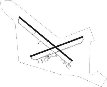
Runway info
Runway 13 / 31  | ||
| length | 2132m (6995ft) | |
| bearing | 123° / 303° | |
| width | 46m (150ft) | |
| surface | asphalt | |
| blast zone | 61m (200ft) / 61m (200ft) | |
| Runway 7 / 25 | ||
| length | 1733m (5686ft) | |
| bearing | 79° / 259° | |
| width | 46m (150ft) | |
| surface | asphalt | |
| blast zone | 61m (200ft) / 61m (200ft) | |
Nearby beacons
| code | identifier | dist | bearing | frequency |
|---|---|---|---|---|
| IDJ | LAKE BEMIDJI VOR/DME | 0.4 | 105° | 110 |
| PKD | RAPIDS DME | 37.2 | 193° | 110.60 |
| PK | SPIDA (PARK RAPIDS) NDB | 40.6 | 183° | 269 |
| DTL | DETROIT LAKES VOR/DME | 56.6 | 234° | 111.20 |
Instrument approach procedures
| runway | airway (heading) | route (dist, bearing) |
|---|---|---|
| RW13 | BLUOX (126°) | BLUOX TEGAE (7mi, 301°) 3200ft TEGAE (turn) 3200ft |
| RW13 | JUNSU (116°) | JUNSU TEGAE (8mi, 107°) 3200ft |
| RW13 | ORESE (144°) | ORESE TEGAE (8mi, 188°) 3200ft |
| RNAV | TEGAE 3200ft JOKOS (6mi, 123°) 3200ft HIROR (3mi, 123°) 2280ft KBJI (3mi, 123°) 1436ft (5605mi, 117°) 1648ft OMIGY (5597mi, 297°) 3200ft OMIGY (turn) | |
| RW25 | CADAR (259°) | CADAR 3100ft |
| RW25 | NECIG (244°) | NECIG CADAR (5mi, 157°) 3100ft |
| RW25 | SOCOD (273°) | SOCOD CADAR (5mi, 337°) 3100ft |
| RNAV | CADAR 3100ft BODAC (8mi, 259°) 3100ft LINRE (3mi, 259°) 2080ft KBJI (3mi, 261°) 1426ft (5605mi, 117°) 1589ft TUCTU (5610mi, 297°) CELIS (5mi, 178°) 3400ft CELIS (turn) | |
| RW31 | OMIGY (303°) | OMIGY 3200ft |
| RW31 | UDAYU (285°) | UDAYU OMIGY (5mi, 235°) 3200ft |
| RW31 | WOFPE (327°) | WOFPE OMIGY (5mi, 55°) 3200ft |
| RNAV | OMIGY 3200ft IPEMY (6mi, 303°) 3200ft HIPAV (3mi, 303°) 2240ft KBJI (3mi, 303°) 1429ft (5605mi, 117°) 1589ft TEGAE (5613mi, 297°) 3200ft TEGAE (turn) |
Disclaimer
The information on this website is not for real aviation. Use this data with the X-Plane flight simulator only! Data taken with kind consent from X-Plane 12 source code and data files. Content is subject to change without notice.