Columbus - Columbus Muni
Airport details
| Country | United States of America |
| State | Indiana |
| Region | K5 |
| Airspace | Indianapolis Ctr |
| Municipality | Columbus |
| Elevation | 653ft (199m) |
| Timezone | GMT -5 |
| Coordinates | 39.26192, -85.89633 |
| Magnetic var | |
| Type | land |
| Available since | X-Plane v10.40 |
| ICAO code | KBAK |
| IATA code | CLU |
| FAA code | BAK |
Communication
| Columbus Muni AWOS 3 | 119.750 |
| Columbus Muni UNICOM | 122.950 |
| Columbus Muni CTAF | 118.600 |
| Columbus Muni Clearance DEL | 134.850 |
| Columbus Muni Ground Control | 121.600 |
| Columbus Muni Tower | 118.600 |
| Columbus Muni INDIANAPOLIS Approach/Departure | 134.850 |
Approach frequencies
| ILS-cat-I | RW23 | 110.7 | 18.00mi |
| 3° GS | RW23 | 110.7 | 18.00mi |
Nearby Points of Interest:
James Marr Farm
-Miller House and Garden
-McKinley School
-Columbus Historic District
-Mabel McDowell Adult Education Center
-First Christian Church
-Irwin Conference Center
-Columbus City Hall
-McEwen-Samuels-Marr House
-Crump Theatre
-Bartholomew County Courthouse
-Haw Creek Leather Company
-David Aikens House
-D.W. Heagy Farm
-South Walnut Street Historic District
-Toner Historic District
-Hope Historic District
-Edinburgh Commercial Historic District
-Newsom-Marr Farm
-William R. Gant Farm
-Elnora Daugherty Farm
-George Rudicel Polygonal Barn
-Cooper-Alley House
-Thomas A. Hendricks House
-Franklin College Library
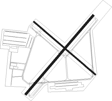
Runway info
Runway 5 / 23  | ||
| length | 1951m (6401ft) | |
| bearing | 52° / 232° | |
| width | 46m (150ft) | |
| surface | concrete | |
| blast zone | 0m (0ft) / 255m (837ft) | |
| Runway 14 / 32 | ||
| length | 1524m (5000ft) | |
| bearing | 128° / 308° | |
| width | 30m (100ft) | |
| surface | concrete | |
Nearby beacons
| code | identifier | dist | bearing | frequency |
|---|---|---|---|---|
| BA | CLIFS (COLUMBUS) NDB | 5.1 | 52° | 410 |
| SHB | SHELBYVILLE VOR/DME | 22.5 | 11° | 112 |
| CO | COLFA (INDIANAPOLIS) NDB | 27.2 | 324° | 232 |
| HLB | BATESVILLE NDB | 30 | 82° | 254 |
| OOM | HOOSIER (BLOOMINGTON) VORTAC | 34 | 261° | 110.20 |
| FV | LAREZ (INDIANAPOLIS) NDB | 34.4 | 330° | 349 |
| GVR | (MADISON) DME | 36.1 | 140° | 114.65 |
| VHP | BRICKYARD VORTAC | 39.7 | 320° | 116.30 |
| UMP | METROPOLITAN (INDIANAPOLIS) NDB | 41.2 | 347° | 338 |
| UWL | NEW CASTLE NDB | 45.7 | 43° | 385 |
| SQ | PNTHR (CONNERSVILLE) NDB | 47 | 56° | 227 |
| JV | CATCH (JEFFERSONVILLE) NDB | 47.9 | 169° | 331 |
| AI | VIDEO (ANDERSON) NDB | 51.6 | 26° | 394 |
| JN | BALLL (MUNCIE) NDB | 61.2 | 32° | 365 |
| MI | BALLL (MUNCIE) NDB | 61.2 | 32° | 365 |
| MIE | MUNCIE VOR/DME | 63 | 27° | 114.40 |
| AWW | WINCHESTER NDB | 70.6 | 47° | 212 |
Instrument approach procedures
| runway | airway (heading) | route (dist, bearing) |
|---|---|---|
| RW05 | HOUSE (54°) | HOUSE NASYI (8mi, 75°) 2500ft |
| RW05 | NASYI (38°) | NASYI 2500ft |
| RW05 | SCARF (316°) | SCARF LONIY (10mi, 259°) 2500ft NASYI (5mi, 294°) 2500ft |
| RNAV | NASYI 2500ft PEKYI (6mi, 37°) 2500ft YUPUR (3mi, 37°) 1680ft WIGUR (3mi, 37°) 865ft (5215mi, 115°) 1056ft ODACI (5214mi, 295°) SEVVO (10mi, 56°) 2500ft SEVVO (turn) | |
| RW14 | SHB (191°) | SHB EYUGI (11mi, 223°) 2500ft |
| RNAV | EYUGI 2500ft ILOYU (9mi, 180°) 2300ft WORIM (1mi, 143°) 1840ft YAYUY (3mi, 143°) 853ft (5215mi, 115°) 1040ft KUDNE (5213mi, 295°) HUMOX (10mi, 124°) 2500ft HUMOX (turn) | |
| RW23 | DECEE (249°) | DECEE SEVVO (6mi, 28°) 2500ft SEVVO (turn) 2500ft |
| RW23 | SHB (191°) | SHB SEVVO (15mi, 156°) 2500ft |
| RNAV | SEVVO 2500ft JOMOT (6mi, 232°) 2300ft KBAK (5mi, 232°) 707ft (5214mi, 115°) 906ft JUNON (5215mi, 295°) NASYI (11mi, 216°) 2500ft NASYI (turn) | |
| RW32 | DECEE (249°) | DECEE TIYCO (9mi, 136°) 2500ft HUMOX (5mi, 232°) 2500ft |
| RW32 | HUMOX (308°) | HUMOX 2500ft |
| RW32 | KAPRE (327°) | KAPRE HUMOX (10mi, 353°) 2500ft |
| RNAV | HUMOX 2500ft LUPIC (6mi, 308°) 2300ft KBAK (5mi, 307°) 696ft (5214mi, 115°) 1016ft ZURGA (5216mi, 295°) EYUGI (12mi, 352°) 2500ft EYUGI (turn) |
Disclaimer
The information on this website is not for real aviation. Use this data with the X-Plane flight simulator only! Data taken with kind consent from X-Plane 12 source code and data files. Content is subject to change without notice.