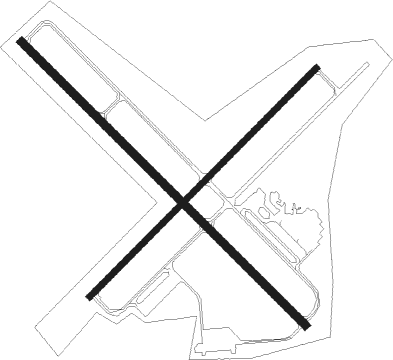
Alexandria - Chandler Fld
Airport details
| Country | United States of America |
| State | Minnesota |
| Region | K3 |
| Airspace | Minneapolis Ctr |
| Municipality | Alexandria |
| Elevation | 1424ft (434m) |
| Timezone | GMT -6 |
| Coordinates | 45.86631, -95.39467 |
| Magnetic var | |
| Type | land |
| Available since | X-Plane v10.40 |
| ICAO code | KAXN |
| IATA code | AXN |
| FAA code | AXN |
Communication
| CHANDLER FLD ASOS | 118.375 |
| CHANDLER FLD CTAF | 123.000 |
| CHANDLER FLD MINNEAPOLIS CENTER | 126.100 |
Approach frequencies
| ILS-cat-I | RW31 | 110.5 | 18.00mi |
| 3° GS | RW31 | 110.5 | 18.00mi |
Nearby Points of Interest:
Great Northern Passenger Depot
-Daniel Pennie House
-Northern Pacific Depot
-Pope County Courthouse
-Fremad Association Building
-Glenwood Public Library
-Little Falls and Dakota Depot
-Saint Cloud and Red River Valley Stage Road–Kandota Section
-Minnesota Home School for Girls Historic District
-Original Main Street Historic District
-Todd County Courthouse, Sheriff's House, and Jail
-Batcher Opera House Block
-Bank of Long Prairie
-Hotel Reichert
-Urjans Iverson House
-Grant County Courthouse
-Morris Industrial School for Indians
-Church of St. Boniface
-Trinity Lutheran Church
-Germania Hall

Nearby beacons
| code | identifier | dist | bearing | frequency |
|---|---|---|---|---|
| AXN | ALEXANDRIA VOR/DME | 8.7 | 60° | 112.80 |
| MOX | MORRIS VOR/DME | 30.1 | 242° | 109.60 |
| FF | HAMRE (FERGUS FALLS) NDB | 34.8 | 298° | 337 |
| FFM | FERGUS FALLS VOR/DME | 40.6 | 299° | 110.40 |
| BDH | WILLMAR VOR/DME | 46.3 | 160° | 113.70 |
| MVE | MONTEVIDEO VOR/DME | 55.3 | 200° | 111.60 |
| PK | SPIDA (PARK RAPIDS) NDB | 60.6 | 23° | 269 |
| DTL | DETROIT LAKES VOR/DME | 61.1 | 333° | 111.20 |
| DWN | DARWIN VORTAC | 61.2 | 130° | 109 |
Instrument approach procedures
| runway | airway (heading) | route (dist, bearing) |
|---|---|---|
| RW22 | HUDRO (214°) | HUDRO 3500ft KILVE (5mi, 129°) 3500ft |
| RW22 | KILVE (239°) | KILVE 3500ft |
| RW22 | VEMVY (258°) | VEMVY 3600ft KILVE (5mi, 309°) 3500ft |
| RNAV | KILVE 3500ft COXET (6mi, 239°) 3000ft WANBI (3mi, 239°) 1980ft KAXN (2mi, 240°) 1468ft MOVSE (5mi, 239°) EVDEQ (8mi, 309°) TILER (11mi, 38°) 3500ft TILER (turn) | |
| RW31 | WUNYE (309°) | WUNYE 3600ft |
| RW31 | YIMCU (335°) | YIMCU 3600ft WUNYE (5mi, 59°) 3600ft |
| RW31 | ZECWO (290°) | ZECWO 3600ft WUNYE (5mi, 239°) 3600ft |
| RNAV | WUNYE 3600ft UNRUY (6mi, 309°) 3300ft KAXN (6mi, 309°) 1471ft OCIWE (5mi, 309°) TILER (10mi, 355°) 3500ft TILER (turn) |
Disclaimer
The information on this website is not for real aviation. Use this data with the X-Plane flight simulator only! Data taken with kind consent from X-Plane 12 source code and data files. Content is subject to change without notice.