Washington - Washington Muni
Airport details
| Country | United States of America |
| State | Iowa |
| Region | K3 |
| Airspace | Chicago Ctr |
| Municipality | Washington County |
| Elevation | 753ft (230m) |
| Timezone | GMT -6 |
| Coordinates | 41.27503, -91.67516 |
| Magnetic var | |
| Type | land |
| Available since | X-Plane v10.40 |
| ICAO code | KAWG |
| IATA code | n/a |
| FAA code | AWG |
Communication
| Washington Muni AWOS 3 | 127.825 |
| Washington Muni CTAF/UNICOM | 122.700 |
Nearby Points of Interest:
Jonathan Clark Conger House
-Smith Wildman and Jennie (Hearne) Brookhart House
-Blair House
-Kurtz House
-H.A. Baxter Coal Company Historic District
-McCleery Calendar Factory
-Washington Downtown Historic District
-Washington County Courthouse
-Gracehill Moravian Church and Cemetery
-County Line Bridge
-Pilotburg Church
-Red Ball Garage
-John Hultquist House
-Gipple's Quarry Bridge
-St. Mary's Catholic Church
-Community Building
-Benjamin Chapel and Richwoods Cemetery
-C.F. and Mary Singmaster House
-New Sweden Chapel
-Saints Peter and Paul Roman Catholic Church
-Miller Round Barn
-Camp Harlan-Camp McKean Historic District
-Old Main
-Henry Ambler House
-Dr. J.O. and Catherine Ball House
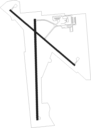
Runway info
Runway 18 / 36  | ||
| length | 1221m (4006ft) | |
| bearing | 184° / 4° | |
| width | 23m (75ft) | |
| surface | concrete | |
| Runway 13 / 31 | ||
| length | 1035m (3396ft) | |
| bearing | 127° / 307° | |
| width | 18m (60ft) | |
| surface | concrete | |
Nearby beacons
| code | identifier | dist | bearing | frequency |
|---|---|---|---|---|
| IOW | IOWA CITY VOR/DME | 14.9 | 14° | 116.20 |
| DDD | CITY DME | 24.3 | 80° | 116.50 |
| OTM | OTTUMWA VOR/DME | 32.9 | 249° | 111.60 |
| CID | CEDAR RAPIDS VOR/DME | 37.1 | 350° | 114.10 |
| BR | BURNS (BURLINGTON) NDB | 44.8 | 138° | 390 |
| BEX | BLOOMFIELD NDB | 46.7 | 235° | 269 |
| BRL | BURLINGTON VOR/DME | 47.4 | 126° | 111.40 |
| EOK | KEOKUK NDB | 49.8 | 163° | 366 |
Instrument approach procedures
| runway | airway (heading) | route (dist, bearing) |
|---|---|---|
| RW13 | GLOMS (127°) | GLOMS 3000ft |
| RNAV | GLOMS 3000ft WIROT (6mi, 127°) 2400ft KAWG (5mi, 128°) 790ft (5481mi, 114°) 1003ft KILKE (5473mi, 294°) 3000ft KILKE (turn) | |
| RW18 | GANAD (184°) | GANAD 3000ft |
| RNAV | GANAD 3000ft DORPE (6mi, 184°) 2400ft AMONE (3mi, 184°) 1300ft KAWG (2mi, 181°) 796ft (5481mi, 114°) 1002ft BEHTY (5482mi, 294°) 3000ft BEHTY (turn) | |
| RW31 | KILKE (306°) | KILKE 3000ft |
| RNAV | KILKE 3000ft JAVMO (6mi, 307°) 2400ft HUDUM (3mi, 307°) 1280ft KAWG (2mi, 304°) 788ft (5481mi, 114°) 1004ft GLOMS (5489mi, 294°) 3000ft GLOMS (turn) | |
| RW36 | BEHTY (4°) | BEHTY 3000ft |
| RNAV | BEHTY 3000ft SENOC (6mi, 4°) 2400ft JELEL (3mi, 4°) 1300ft KAWG (2mi, 7°) 796ft (5481mi, 114°) 1002ft GANAD (5480mi, 294°) 3000ft GANAD (turn) |
Disclaimer
The information on this website is not for real aviation. Use this data with the X-Plane flight simulator only! Data taken with kind consent from X-Plane 12 source code and data files. Content is subject to change without notice.