Austin - Austin Muni
Airport details
| Country | United States of America |
| State | Minnesota |
| Region | K3 |
| Airspace | Minneapolis Ctr |
| Municipality | Austin |
| Elevation | 1230ft (375m) |
| Timezone | GMT -6 |
| Coordinates | 43.66264, -92.93291 |
| Magnetic var | |
| Type | land |
| Available since | X-Plane v10.32 |
| ICAO code | KAUM |
| IATA code | AUM |
| FAA code | AUM |
Communication
| Austin Muni AWOS 3 | 119.025 |
| Austin Muni CTAF/UNICOM | 122.700 |
| Austin Muni ROCHESTER Approach/Departure | 119.800 |
Approach frequencies
| ILS-cat-I | RW35 | 110.55 | 18.00mi |
| 3° GS | RW35 | 110.55 | 18.00mi |
Nearby Points of Interest:
Hormel Historic Home
-First National Bank of Adams
-Otranto Bridge
-Grand Army of the Republic Hall
-Exchange State Bank
-Worth County Courthouse
-Old Worth County Courthouse
-Clarks Grove Cooperative Creamery
-Ole Carlson House
-Mitchell Powerhouse and Dam
-LeRoy Public Library
-First State Bank of Le Roy
-First Methodist Episcopal Church
-Mitchell County Courthouse
-Cedar Valley Seminary
-Kasson Municipal Building
-Nathaniel Cobb and Lucetia Baily Deering House
-Kasson Public School
-Spring Valley Methodist Episcopal Church
-James C. Fellows House
-Mantorville
-Walnut Grove School
-Pleasant Grove Masonic Lodge
-George Stoppel Farmstead
-Strangers Refuge Lodge Number 74, IOOF
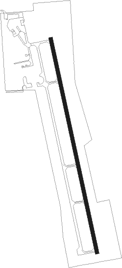
Runway info
| Runway 17 / 35 | ||
| length | 1769m (5804ft) | |
| bearing | 169° / 349° | |
| width | 30m (100ft) | |
| surface | concrete | |
| blast zone | 60m (197ft) / 59m (194ft) | |
Nearby beacons
| code | identifier | dist | bearing | frequency |
|---|---|---|---|---|
| JAY | AUSTIN VOR/DME | 5.2 | 171° | 108.20 |
| RST | ROCHESTER VOR/DME | 16.2 | 70° | 112 |
| AEL | ALBERT LEA VOR/DME | 19 | 272° | 109.80 |
| OW | TONNA (OWATONNA) NDB | 26.5 | 332° | 379 |
| IY | CHUKK (CHARLES CITY) NDB | 32.9 | 159° | 417 |
| FOW | HALFWAY (MORRISTOWN) VOR/DME | 37.6 | 321° | 111.20 |
| MCW | MASON CITY VOR/DME | 38.2 | 215° | 114.90 |
| MC | SURFF (MASON CITY) NDB | 40.4 | 213° | 348 |
| MKT | MANKATO VOR/DME | 53.9 | 300° | 110.80 |
| RG | REGUE (RED WING) NDB | 57.4 | 17° | 274 |
| FGT | FARMINGTON VORTAC | 59.1 | 346° | 115.70 |
Instrument approach procedures
| runway | airway (heading) | route (dist, bearing) |
|---|---|---|
| RW17 | KASPR (134°) | KASPR PICIB (9mi, 143°) 3000ft MAROE (8mi, 84°) 2900ft |
| RW17 | MAROE (169°) | MAROE 2900ft |
| RW17 | MCW (35°) | MCW PICIB (45mi, 13°) 3400ft MAROE (8mi, 84°) 2900ft |
| RW17 | RST (250°) | RST NABGE (10mi, 296°) 3000ft MAROE (8mi, 264°) 2900ft |
| RNAV | MAROE 2900ft IGAME (6mi, 169°) 2900ft JELOG (3mi, 169°) 1840ft KAUM (2mi, 169°) 1272ft (5533mi, 115°) 1484ft FARUN (5531mi, 295°) 3800ft FARUN (turn) | |
| RW35 | FARUN (349°) | FARUN 3800ft |
| RW35 | MCW (35°) | MCW ICUNE (24mi, 44°) 3800ft FARUN (6mi, 69°) 3800ft |
| RW35 | RST (250°) | RST ZONVO (21mi, 197°) 3900ft FARUN (9mi, 279°) 3800ft |
| RNAV | FARUN 3800ft DACAB (6mi, 349°) 2900ft ZEBOG (3mi, 349°) 1780ft KAUM (2mi, 349°) 1278ft (5533mi, 115°) 1431ft MAROE (5534mi, 295°) 2900ft MAROE (turn) |
Disclaimer
The information on this website is not for real aviation. Use this data with the X-Plane flight simulator only! Data taken with kind consent from X-Plane 12 source code and data files. Content is subject to change without notice.