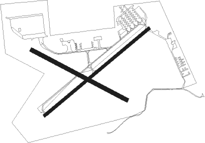
Ann Arbor - Ann Arbor Muni
Airport details
| Country | United States of America |
| State | Michigan |
| Region | K5 |
| Airspace | Cleveland Ctr |
| Municipality | Pittsfield Township |
| Elevation | 836ft (255m) |
| Timezone | GMT -5 |
| Coordinates | 42.22298, -83.74561 |
| Magnetic var | |
| Type | land |
| Available since | X-Plane v10.32 |
| ICAO code | KARB |
| IATA code | ARB |
| FAA code | ARB |
Communication
| Ann Arbor Muni ASOS | 134.550 |
| Ann Arbor Muni CTAF | 120.300 |
| Ann Arbor Muni UNICOM | 123.000 |
| Ann Arbor Muni Ground Control/Clearance DEL | 121.600 |
| Ann Arbor Muni Tower | 120.300 |
| Ann Arbor Muni DETROIT Approach/Departure | 118.950 |
Nearby Points of Interest:
Stone School
-William Anderson House
-Tuomy Hills Service Station
-Bell-Spalding House
-Rentschler Farm Museum
-Floyd R. Mechem House
-Delta Upsilon Fraternity House
-William and Elizabeth (Bodanzky) Muschenheim House
-Henry S. Frieze House
-Henry R. Watson House
-President's House, University of Michigan
-Robert C. and Bettie J. (Sponseller) Metcalf House
-University Of Michigan Central Campus Historic District
-Nickels Arcade
-Jacob Hoffstetter House
-Methodist Episcopal Church Parsonage
-First National Bank Building
-Weinmann Block
-William H. Davenport House
-East Michigan Avenue Historic District
-Detroit, Hillsdale and Indiana Railroad-Saline Depot
-Harris Hall
-Unitarian Universalist Church
-Judge Robert S. Wilson House
-Charles Guthard House

Nearby beacons
| code | identifier | dist | bearing | frequency |
|---|---|---|---|---|
| TCU | TECUMSEH NDB | 12.9 | 217° | 239 |
| SVM | SALEM VORTAC | 13 | 39° | 114.30 |
| DT | REVUP (DETROIT) NDB | 15.2 | 108° | 388 |
| CRL | CARLETON VOR/DME | 16.5 | 121° | 115.70 |
| DXO | DETROIT VOR/DME | 16.8 | 91° | 113.40 |
| DM | SPENC (DETROIT) NDB | 24.1 | 90° | 223 |
| ADG | ADRIAN NDB | 25.8 | 223° | 278 |
| RYS | GROSSE ILE (DETROIT) NDB | 27.3 | 102° | 419 |
| PSI | DME | 30.2 | 24° | 111 |
| JXN | DME | 31.7 | 273° | 115.45 |
| TOL | TOLEDO TACAN | 37.8 | 185° | 112.50 |
| QG | WINDSOR NDB | 39.3 | 84° | 353 |
| TO | TOPHR (TOLEDO) NDB | 40.9 | 195° | 219 |
| FNT | FLINT VORTAC | 44.6 | 360° | 116.90 |
| MTC | SELFRIDGE (MOUNT CLEMENS) TACAN | 46.7 | 67° | 133.70 |
| PCW | PORT CLINTON NDB | 57.6 | 129° | 423 |
Departure and arrival routes
| Transition altitude | 18000ft |
| Transition level | 18000ft |
| SID end points | distance | outbound heading | |
|---|---|---|---|
| RW06 | |||
| TRMML3 | 90mi | 3° | |
| METRO3 | 48mi | 42° | |
| ZETTR3 | 77mi | 59° | |
| HHOWE3 | 99mi | 89° | |
| PAVYL2 | 96mi | 93° | |
| LIDDS2 | 133mi | 114° | |
| CLVIN2 | 198mi | 187° | |
| BARII2 | 110mi | 200° | |
| SNDRS2 | 94mi | 204° | |
| CCOBB2 | 59mi | 271° | |
| KAYLN2 | 107mi | 276° | |
| MIGGY2 | 91mi | 316° | |
| RW24 | |||
| TRMML3 | 90mi | 3° | |
| METRO3 | 48mi | 42° | |
| ZETTR3 | 77mi | 59° | |
| HHOWE3 | 99mi | 89° | |
| PAVYL2 | 96mi | 93° | |
| LIDDS2 | 133mi | 114° | |
| CLVIN2 | 198mi | 187° | |
| BARII2 | 110mi | 200° | |
| SNDRS2 | 94mi | 204° | |
| CCOBB2 | 59mi | 271° | |
| KAYLN2 | 107mi | 276° | |
| MIGGY2 | 91mi | 316° | |
| STAR starting points | distance | inbound heading | |
|---|---|---|---|
| ALL | |||
| PETTE2 | 28.0 | 76° | |
| RRALF3 | 24.7 | 130° | |
| OKLND1 | 86.1 | 251° | |
| FOREY2 | 53.2 | 290° | |
Instrument approach procedures
| runway | airway (heading) | route (dist, bearing) |
|---|---|---|
| RW06 | YACNU (62°) | YACNU 3000ft |
| RNAV | YACNU 3000ft VUZJU (7mi, 62°) 2500ft KARB (5mi, 62°) 871ft (5127mi, 117°) 1081ft VAQOL (5118mi, 297°) 3000ft VAQOL (turn) | |
| RW24 | VAQOL (242°) | VAQOL 3000ft |
| RNAV | VAQOL 3000ft WUVRU (7mi, 242°) 2500ft ISPIW (3mi, 242°) 1660ft KARB (3mi, 242°) 866ft (5127mi, 117°) 1076ft YACNU (5137mi, 297°) 3000ft YACNU (turn) |
Holding patterns
| STAR name | hold at | type | turn | heading* | altitude | leg | speed limit |
|---|---|---|---|---|---|---|---|
| FOREY2 | FOREY | VHF | right | 144 (324)° | DME 10.0mi | ICAO rules | |
| PETTE2 | PETTE | VHF | left | 241 (61)° | DME 10.0mi | ICAO rules | |
| RRALF3 | KILTT | VHF | right | 313 (133)° | DME 10.0mi | ICAO rules | |
| *) magnetic outbound (inbound) holding course | |||||||
Disclaimer
The information on this website is not for real aviation. Use this data with the X-Plane flight simulator only! Data taken with kind consent from X-Plane 12 source code and data files. Content is subject to change without notice.