Ames - Ames Muni
Airport details
| Country | United States of America |
| State | Iowa |
| Region | K3 |
| Airspace | Minneapolis Ctr |
| Municipality | Ames |
| Elevation | 955ft (291m) |
| Timezone | GMT -6 |
| Coordinates | 41.99205, -93.62183 |
| Magnetic var | |
| Type | land |
| Available since | X-Plane v10.30 |
| ICAO code | KAMW |
| IATA code | AMW |
| FAA code | AMW |
Communication
| Ames Muni ASOS | 132.025 |
| Ames Muni CTAF/UNICOM | 122.700 |
| Ames Muni DES MOINES Approach/Departure | 123.900 |
Approach frequencies
| ILS-cat-I | RW01 | 110.7 | 18.00mi |
| 3° GS | RW01 | 110.7 | 18.00mi |
Nearby Points of Interest:
Gilmour B. and Edith Craig MacDonald House
-Ames Main Street Historic District
-Municipal Building
-Masonic Temple
-Ames City Hall
-Delta Upsilon Chapter House
-Sigma Sigma–Delta Chi Fraternity House
-Old Town Historic District
-Food Sciences Building
-Roosevelt School
-Enrollment Services Center
-Laboratory of Mechanics
-Catt Hall
-Morrill Hall
-Big Creek Bridge
-Nevada Downtown Historic District
-Edwards-Swayze House
-Octagon Round Barn, Indian Creek Township
-Richard L. and Verda M. Alleman Farm Historic District
-Carl and Ulrika Dalander Cassel House
-Henry T. and Emilie (Wiese) Henryson House
-Herschel-Spillman Two-Row Portable Menagerie Carousel
-Champlin Memorial Masonic Temple
-Ericson Public Library
-Perrigo-Holmes House
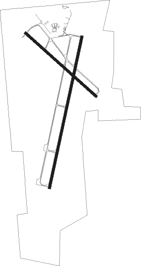
Runway info
Runway 1 / 19  | ||
| length | 1739m (5705ft) | |
| bearing | 22° / 202° | |
| width | 30m (100ft) | |
| surface | asphalt | |
| Runway 13 / 31 | ||
| length | 1063m (3488ft) | |
| bearing | 128° / 308° | |
| width | 30m (100ft) | |
| surface | asphalt | |
Nearby beacons
| code | identifier | dist | bearing | frequency |
|---|---|---|---|---|
| TNU | NEWTON VOR/DME | 26.1 | 112° | 112.50 |
| EFW | JEFFERSON NDB | 32.1 | 272° | 391 |
| JWJ | ELMWOOD (MARSHALTOWN) VOR/DME | 32.5 | 81° | 109.40 |
| DSM | DES MOINES VORTAC | 33.3 | 183° | 117.50 |
| FO | BARRO (FORT DODGE) NDB | 43.6 | 307° | 341 |
| PEA | PELLA NDB | 46.5 | 131° | 257 |
| FOD | FORT DODGE VORTAC | 47.7 | 313° | 113.50 |
Instrument approach procedures
| runway | airway (heading) | route (dist, bearing) |
|---|---|---|
| RW01 | OHFAH (22°) | OHFAH 4000ft |
| RW01 | SIFAY (356°) | SIFAY 4000ft OHFAH (5mi, 283°) 4000ft |
| RW01 | WOWLU (44°) | WOWLU 4000ft OHFAH (5mi, 103°) 4000ft |
| RNAV | OHFAH 4000ft NIYKU (6mi, 22°) 3400ft CEXOG (5mi, 22°) 1640ft KAMW (3mi, 21°) 1006ft FULLE (11mi, 22°) 3000ft FULLE (turn) | |
| RW13 | BIGEN (128°) | BIGEN 3000ft |
| RW13 | OYJUQ (108°) | OYJUQ 4000ft BIGEN (5mi, 54°) 3000ft |
| RW13 | SIQGE (154°) | SIQGE 3000ft BIGEN (5mi, 234°) 3000ft |
| RNAV | BIGEN 3000ft AFFIC (6mi, 128°) 2600ft GIJLE (2mi, 128°) 1780ft KAMW (3mi, 130°) 968ft MOXIW (13mi, 127°) 3000ft MOXIW (turn) | |
| RW19 | FULLE (202°) | FULLE 3000ft |
| RW19 | IWIQA (171°) | IWIQA 4000ft FULLE (5mi, 103°) 3000ft |
| RW19 | MUQXU (229°) | MUQXU 4000ft FULLE (5mi, 283°) 3000ft |
| RNAV | FULLE 3000ft AILEN (6mi, 202°) 2600ft FEKHO (2mi, 202°) 1920ft KAMW (3mi, 203°) 967ft OHFAH (14mi, 202°) 4000ft OHFAH (turn) | |
| RW31 | IWELA (330°) | IWELA 4000ft MOXIW (5mi, 54°) 3000ft |
| RW31 | MOXIW (307°) | MOXIW 3000ft |
| RW31 | OYTOV (289°) | OYTOV 3000ft MOXIW (5mi, 235°) 3000ft |
| RNAV | MOXIW 3000ft OSEWE (8mi, 308°) 2600ft HEGBO (3mi, 308°) 1560ft KAMW (2mi, 305°) 956ft BIGEN (11mi, 308°) 3000ft BIGEN (turn) |
Disclaimer
The information on this website is not for real aviation. Use this data with the X-Plane flight simulator only! Data taken with kind consent from X-Plane 12 source code and data files. Content is subject to change without notice.