Wadesboro - Anson Co
Airport details
| Country | United States of America |
| State | North Carolina |
| Region | K7 |
| Airspace | Atlanta Ctr |
| Municipality | Anson County |
| Elevation | 296ft (90m) |
| Timezone | GMT -5 |
| Coordinates | 35.02064, -80.07712 |
| Magnetic var | |
| Type | land |
| Available since | X-Plane v10.32 |
| ICAO code | KAFP |
| IATA code | n/a |
| FAA code | AFP |
Communication
| Anson CO AWOS 3 | 119.325 |
| Anson CO CTAF/UNICOM | 122.800 |
| Anson CO CHARLOTTE Approach/Departure | 120.050 |
Approach frequencies
| ILS-cat-I | RW34 | 108.55 | 18.00mi |
| 3° GS | RW34 | 108.55 | 18.00mi |
Nearby Points of Interest:
United States Post Office
-Wadesboro Downtown Historic District
-Boggan-Hammond House and Alexander Little Wing
-Naval Health Clinic Charleston
-Alfred Dockery House
-Barrett-Faulkner House
-Randle House
-Covington Plantation House
-Pegues Place
-Bank of Pee Dee Building
-Rockingham County Courthouse
-Richmond County Courthouse
-Manufacturers Building
-U. S. Post Office and Federal Building
-Rockingham Historic District
-Bostick School
-Roberdel Mill No. 1 Company Store
-Dr. Thomas E. Lucas House
-East Main Street Historic District (Chesterfield, South Carolina)
-West Main Street Historic District (Chesterfield, South Carolina)
-Wingate Commercial Historic District
-Main Street Commercial Historic District
-Five Points Historic District
-Isaiah Wilson Snugs House
-Downtown Albemarle Historic District
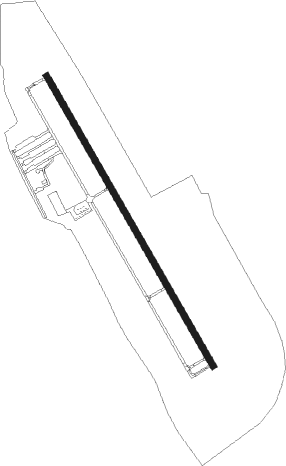
Runway info
| Runway 16 / 34 | ||
| length | 1681m (5515ft) | |
| bearing | 150° / 330° | |
| width | 30m (100ft) | |
| surface | asphalt | |
Nearby beacons
| code | identifier | dist | bearing | frequency |
|---|---|---|---|---|
| CTF | CHESTERFIELD VOR/DME | 24.2 | 208° | 108.20 |
| SDZ | SANDHILLS (SOUTHERN PINES VORTAC | 26.7 | 68° | 111.80 |
| VU | ALLER (ALBEMARLE) NDB | 28.1 | 359° | 346 |
| BES | BENNETTSVILLE NDB | 29.4 | 139° | 230 |
| ME | MAXTN (MAXTON) NDB | 35.6 | 114° | 257 |
| UDG | DARLINGTON NDB | 35.9 | 162° | 245 |
| HVS | HARTSVILLE NDB | 36.9 | 184° | 341 |
| LKR | LANCASTER NDB | 42.4 | 249° | 400 |
| CLT | CHARLOTTE VOR/DME | 44.1 | 281° | 115 |
| RU | ROVDY (SALISBURY) NDB | 47.3 | 330° | 275 |
| DLC | DILLON NDB | 48.9 | 129° | 274 |
| FLO | FLORENCE VORTAC | 51.6 | 152° | 115.20 |
| FL | ALCOT (FLORENCE) NDB | 52 | 165° | 335 |
| LIB | LIBERTY VORTAC | 52.6 | 30° | 113 |
| JB | JIGEL (LUMBERTON) NDB | 54.3 | 117° | 384 |
| HB | ALAMM NDB | 62.3 | 27° | 361 |
Departure and arrival routes
| Transition altitude | 18000ft |
| Transition level | 18000ft |
| STAR starting points | distance | inbound heading | |
|---|---|---|---|
| ALL | |||
| RASLN3 | 16.5 | 44° | |
| CHPTR3 | 76.6 | 71° | |
| UNARM6 | 80.2 | 77° | |
| LIINN3 | 94.4 | 107° | |
| MAJIC4 | 50.6 | 156° | |
Instrument approach procedures
| runway | airway (heading) | route (dist, bearing) |
|---|---|---|
| RW16 | JORGA (150°) | JORGA 3000ft |
| RNAV | JORGA 3000ft OFOLY (6mi, 150°) 2100ft CIPOV (3mi, 150°) 1040ft KAFP (3mi, 150°) 339ft (4918mi, 114°) 584ft OPICU (4911mi, 294°) 3000ft OPICU (turn) | |
| RW34 | OPICU (330°) | OPICU 3000ft |
| RNAV | OPICU 3000ft RUZLY (7mi, 330°) 2000ft CILRU (3mi, 330°) 1000ft KAFP (3mi, 330°) 339ft (4918mi, 114°) 547ft JORGA (4924mi, 294°) 3000ft JORGA (turn) |
Holding patterns
| STAR name | hold at | type | turn | heading* | altitude | leg | speed limit |
|---|---|---|---|---|---|---|---|
| CHPTR3 | EYPAD | VHF | right | 218 (38)° | DME 10.0mi | ICAO rules | |
| CHPTR3 | GRD | NDB | right | 227 (47)° | < 17999ft | 1.0min timed | ICAO rules |
| LIINN3 | LIINN | VHF | right | 302 (122)° | DME 10.0mi | ICAO rules | |
| MAJIC4 | KELLS | VHF | right | 39 (219)° | DME 15.0mi | ICAO rules | |
| MAJIC4 | MAJIC | VHF | left | 39 (219)° | DME 10.0mi | ICAO rules | |
| RASLN3 | DSTEE | VHF | left | 141 (321)° | DME 4.0mi | ICAO rules | |
| RASLN3 | FLO | NDB | left | 140 (320)° | 1.0min timed | ICAO rules | |
| RASLN3 | RODEZ | VHF | left | 141 (321)° | DME 5.0mi | ICAO rules | |
| UNARM6 | GRD | NDB | right | 227 (47)° | < 17999ft | 1.0min timed | ICAO rules |
| UNARM6 | LOCKS | VHF | right | 232 (52)° | < 17999ft | 1.0min timed | ICAO rules |
| UNARM6 | UNARM | VHF | right | 233 (53)° | DME 4.0mi | ICAO rules | |
| *) magnetic outbound (inbound) holding course | |||||||
Disclaimer
The information on this website is not for real aviation. Use this data with the X-Plane flight simulator only! Data taken with kind consent from X-Plane 12 source code and data files. Content is subject to change without notice.