Camp Springs - Joint Base Andrews
Airport details
| Country | United States of America |
| State | Maryland |
| Region | K6 |
| Airspace | Washington Ctr |
| Municipality | Prince George's County |
| Elevation | 275ft (84m) |
| Timezone | GMT -5 |
| Coordinates | 38.81079, -76.86738 |
| Magnetic var | |
| Type | land |
| Available since | X-Plane v10.40 |
| ICAO code | KADW |
| IATA code | ADW |
| FAA code | ADW |
Communication
| Joint Base Andrews ATIS | 133.675 |
| Joint Base Andrews Clearance DEL | 127.550 |
| Joint Base Andrews Ground Control | 121.800 |
| Joint Base Andrews Tower | 118.400 |
| Joint Base Andrews POTOMAC Approach | 128.000 |
| Joint Base Andrews POTOMAC EAST Departure | 125.650 |
| Joint Base Andrews POTOMAC WEST Departure | 118.950 |
Approach frequencies
| ILS-cat-III | RW19R | 111.5 | 18.00mi |
| ILS-cat-III | RW01L | 111.5 | 18.00mi |
| ILS-cat-I | RW19L | 110.5 | 18.00mi |
| ILS-cat-I | RW01R | 110.5 | 18.00mi |
| 3° GS | RW19L | 110.5 | 18.00mi |
| 3° GS | RW19R | 111.5 | 18.00mi |
| 3° GS | RW01L | 111.5 | 18.00mi |
| 3° GS | RW01R | 110.5 | 18.00mi |
Nearby Points of Interest:
His Lordship's Kindness
-Melwood Park
-The Cottage
-Woodstock
-Concord
-Mount Lubentia
-Pleasant Hills (Upper Marlboro, Maryland)
-John H. Traband House
-Kingston
-Content
-Wyoming
-Bellefields
-St. Matthew's Church
-Fairmount Heights Historic District
-John Philip Sousa Junior High School
-Strand Theater
-Engine Company No. 19
-John W. Coffren House and Store
-St. Elizabeths Hospital
-Frederick Douglass National Historic Site
-St. Thomas' Episcopal Parish Historic District
-Anacostia Historic District
-Butler House
-Engine Company 27
-Ashland
Runway info
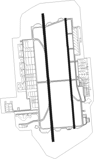
Runway 1R / 19L  | ||
| length | 2979m (9774ft) | |
| bearing | 360° / 180° | |
| width | 46m (150ft) | |
| surface | asphalt | |
| blast zone | 255m (837ft) / 255m (837ft) | |
| Runway 1L / 19R | ||
| length | 3450m (11319ft) | |
| bearing | 360° / 180° | |
| width | 61m (200ft) | |
| surface | concrete | |
| displ threshold | 304m (997ft) / 304m (997ft) | |
| blast zone | 122m (400ft) / 122m (400ft) | |
Nearby beacons
| code | identifier | dist | bearing | frequency |
|---|---|---|---|---|
| ADW | ANDREWS (CAMP SPRINGS) VORTAC | 0.2 | 163° | 113.10 |
| DCA | OXONN (WASHINGTON) NDB | 7.9 | 254° | 332 |
| DCA | WASHINGTON, D.C. VOR/DME | 8.4 | 286° | 111 |
| OTT | NOTTINGHAM VORTAC | 8.5 | 131° | 113.70 |
| GTN | GEORGETOWN (WASH., D.C.) NDB | 13.9 | 295° | 323 |
| DAA | DAVEE (FT BELVOIR) NDB | 14.4 | 238° | 223 |
| BUH | ANNE ARUNDEL (FT MEADE) NDB | 17.1 | 21° | 260 |
| BAL | BALTIMORE VORTAC | 23.6 | 30° | 115.10 |
| AML | ARMEL (WASH.,D.C.) VOR/DME | 28.9 | 282° | 113.50 |
| FND | ELLICOTT (BALTIMORE) NDB | 28.9 | 11° | 371 |
| BRV | BROOKE VORTAC | 36.4 | 226° | 114.50 |
| MTN | MARTIN (BALTIMORE) TACAN | 37.7 | 41° | 134.10 |
| NHK | PATUXENT NDB | 38.3 | 139° | 400 |
| PXT | PATUXENT (PATUXENT RIVER) VORTAC | 38.3 | 138° | 117.60 |
| EMI | WESTMINSTER VORTAC | 41.4 | 351° | 117.90 |
| EZF | SHANNON (FREDERICKSBURG) NDB | 42.6 | 227° | 237 |
| FDK | FREDERICK VOR | 43.1 | 320° | 109 |
| CSN | CASANOVA VORTAC | 47.8 | 260° | 116.30 |
| MRB | MARTINSBURG VORTAC | 57.2 | 300° | 112.10 |
| HGR | HAGERSTOWN VOR | 70.3 | 312° | 109.80 |
Departure and arrival routes
| Transition altitude | 18000ft |
| Transition level | 18000ft |
| SID end points | distance | outbound heading | |
|---|---|---|---|
| RW01 (ALL) | |||
| JEFSN1 | 152mi | 230° | |
| LINCN1 | 64mi | 276° | |
| RW19L | |||
| JEFSN1 | 152mi | 230° | |
| LINCN1 | 64mi | 276° | |
| RW19R | |||
| JEFSN1 | 152mi | 230° | |
| LINCN1 | 64mi | 276° | |
| STAR starting points | distance | inbound heading | |
|---|---|---|---|
| ALL | |||
| TIKEE3 | 65.7 | 82° | |
| RW01 (ALL) | |||
| TRUPS4 | 38.9 | 91° | |
| FRDMM5 | 31.3 | 101° | |
| NUMMY3 | 28.9 | 102° | |
| SPISY2 | 16.6 | 285° | |
| VUDOO2 | 36.2 | 342° | |
| RW19 (ALL) | |||
| TRUPS4 | 38.9 | 91° | |
| FRDMM5 | 31.3 | 101° | |
| NUMMY3 | 28.9 | 102° | |
| SPISY2 | 16.6 | 285° | |
| VUDOO2 | 36.2 | 342° | |
Instrument approach procedures
| runway | airway (heading) | route (dist, bearing) |
|---|---|---|
| RW01LY | EDDGY (273°) | EDDGY 4000ft OVAAL (13mi, 171°) 2500ft PREZZ (6mi, 267°) 2500ft |
| RW01LY | FUNNY (346°) | FUNNY 8000ft PREZZ (15mi, 333°) 2500ft |
| RW01LY | SPISY (285°) | SPISY OFICE (14mi, 228°) 2500ft PREZZ (7mi, 286°) 2500ft |
| RW01LY | VEEPP (37°) | VEEPP 2500ft PREZZ (8mi, 89°) 2500ft |
| RNAV | PREZZ 2500ft FAWKS (7mi, 360°) 2000ft KADW (6mi, 2°) 310ft EGUDE (13mi, 359°) 2500ft EGUDE (turn) 4000ft | |
| RW01LZ | IRONS (40°) | IRONS 2500ft PREZZ (12mi, 76°) 2500ft |
| RW01LZ | JUDED (333°) | JUDED 2500ft PREZZ (8mi, 295°) 2500ft |
| RW01LZ | PREZZ (1°) | PREZZ 4000ft PREZZ (turn) 2500ft |
| RW01LZ | SABBI (32°) | SABBI 2500ft PREZZ (18mi, 52°) 2500ft |
| RW01LZ | WHINO (338°) | WHINO 2500ft PREZZ (13mi, 318°) 2500ft |
| RNAV | PREZZ 2500ft FAWKS (7mi, 360°) 2000ft KADW (6mi, 2°) 311ft (4793mi, 117°) 680ft EGUDE (4795mi, 297°) 2500ft EGUDE (turn) 4000ft | |
| RW01R | BRINE (359°) | BRINE 2500ft |
| RW01R | HUBAS (326°) | HUBAS 2500ft BRINE (8mi, 287°) 2500ft |
| RW01R | IRONS (40°) | IRONS 2500ft BRINE (12mi, 73°) 2500ft |
| RW01R | SABBI (32°) | SABBI 2500ft BRINE (19mi, 51°) 2500ft |
| RW01R | WHINO (338°) | WHINO 2500ft BRINE (14mi, 321°) 2500ft |
| RNAV | BRINE 2500ft GREEF (7mi, 360°) 1800ft WIPAG (3mi, 360°) 960ft KADW (3mi, 355°) 299ft (4793mi, 117°) 660ft HULVI (4794mi, 297°) 2500ft HULVI (turn) 4000ft | |
| RW19L | GEEMO (236°) | GEEMO 2500ft HULVI (17mi, 266°) 2500ft |
| RW19L | HULVI (181°) | HULVI 4000ft HULVI (turn) 2500ft |
| RW19L | OASES (158°) | OASES 2500ft HULVI (8mi, 124°) 2500ft |
| RW19L | YOKUM (199°) | YOKUM 2500ft HULVI (9mi, 223°) 2500ft |
| RNAV | HULVI 2500ft BEEMR (7mi, 180°) 2000ft KADW (6mi, 182°) 333ft (4793mi, 117°) 680ft BRINE (4791mi, 297°) 2500ft BRINE (turn) 4000ft | |
| RW19R | EGUDE (179°) | EGUDE 4000ft EGUDE (turn) 2500ft |
| RW19R | GEEMO (236°) | GEEMO 2500ft EGUDE (17mi, 266°) 2500ft |
| RW19R | OASES (158°) | OASES 2500ft EGUDE (7mi, 126°) 2500ft |
| RW19R | YOKUM (199°) | YOKUM 2500ft EGUDE (9mi, 225°) 2500ft |
| RNAV | EGUDE 2500ft PUFFE (7mi, 180°) 2000ft KADW (6mi, 178°) 329ft (4793mi, 117°) 680ft PREZZ (4791mi, 297°) 2500ft PREZZ (turn) 4000ft | |
| RWNVA | GRAVZ (309°) | GRAVZ 2500ft |
| RNAV | GRAVZ 2500ft JIMES (6mi, 308°) 1500ft JOLOS (4mi, 308°) 840ft (4791mi, 117°) 840ft JUVUT (4793mi, 297°) 2500ft JUVUT (turn) 5000ft |
Holding patterns
| STAR name | hold at | type | turn | heading* | altitude | leg | speed limit |
|---|---|---|---|---|---|---|---|
| FRDMM5 | ALWYZ | VHF | left | 299 (119)° | 6001ft - 14000ft | DME 6.0mi | 210 |
| FRDMM5 | FORGT | VHF | left | 297 (117)° | DME 10.0mi | 250 | |
| FRDMM5 | PLDGE | VHF | left | 288 (108)° | DME 10.0mi | 250 | |
| NUMMY3 | ALWYZ | VHF | left | 299 (119)° | 6001ft - 14000ft | DME 6.0mi | 210 |
| NUMMY3 | DRUZZ | VHF | left | 283 (103)° | < 60000ft | DME 10.0mi | ICAO rules |
| NUMMY3 | FORGT | VHF | left | 297 (117)° | DME 10.0mi | 250 | |
| SPISY2 | BILIT | VHF | left | 95 (275)° | 1.0min timed | ICAO rules | |
| SPISY2 | DECON | VHF | right | 190 (10)° | 6001ft - 14000ft | DME 4.0mi | 210 |
| TRUPS4 | OOURR | VHF | right | 259 (79)° | 6001ft - 14000ft | DME 6.0mi | 210 |
| TRUPS4 | SEALZ | VHF | right | 257 (77)° | DME 10.0mi | 250 | |
| TRUPS4 | WEEDU | VHF | left | 268 (88)° | DME 10.0mi | 250 | |
| VUDOO2 | BEEVR | VHF | left | 218 (38)° | 6001ft - 14000ft | DME 6.0mi | 210 |
| VUDOO2 | GOLOE | VHF | left | 211 (31)° | DME 10.0mi | ICAO rules | |
| VUDOO2 | HOLIO | VHF | right | 186 (6)° | 6001ft - 14000ft | DME 5.0mi | 210 |
| VUDOO2 | VIIPR | VHF | left | 190 (10)° | DME 10.0mi | 230 | |
| *) magnetic outbound (inbound) holding course | |||||||
Disclaimer
The information on this website is not for real aviation. Use this data with the X-Plane flight simulator only! Data taken with kind consent from X-Plane 12 source code and data files. Content is subject to change without notice.