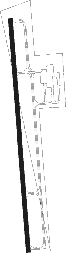
Abilene - Abilene Muni
Airport details
| Country | United States of America |
| State | Kansas |
| Region | K3 |
| Airspace | Kansas City Ctr |
| Municipality | Abilene |
| Elevation | 1149ft (350m) |
| Timezone | GMT -6 |
| Coordinates | 38.90406, -97.23586 |
| Magnetic var | |
| Type | land |
| Available since | X-Plane v10.30 |
| ICAO code | K78 |
| IATA code | n/a |
| FAA code | K78 |
Communication
| Abilene Muni CTAF/UNICOM | 122.800 |
Nearby Points of Interest:
Atchison, Topeka and Santa Fe Railway 3415
-Lebold Mansion
-Masonic Temple
-Grand Army of the Republic memorial
-First Territorial Capitol of Kansas
-Rock City, Kansas
-Farmers State Bank
-Clay County Courthouse
Nearby beacons
| code | identifier | dist | bearing | frequency |
|---|---|---|---|---|
| FRI | FORT RILEY (JUNCTION CITY VOR | 17.9 | 80° | 109.40 |
| SLN | SALINA VORTAC | 18 | 273° | 117.10 |
| SL | FLORY (SALINA) NDB | 23.3 | 241° | 344 |
| HRU | HERINGTON NDB | 23.5 | 116° | 407 |
| MHK | MANHATTAN VOR/DME | 30.1 | 67° | 110.20 |
| CA | HARVS (NEWTON) NDB | 45.6 | 183° | 395 |
| HU | SALTT (HUTCHINSON) NDB | 57 | 222° | 404 |
| HUT | HUTCHINSON VOR/DME | 63.6 | 218° | 116.80 |
Instrument approach procedures
| runway | airway (heading) | route (dist, bearing) |
|---|---|---|
| RW17 | FINEB (180°) | FINEB 3400ft |
| RW17 | HOSKU (158°) | HOSKU FINEB (5mi, 114°) 3400ft |
| RW17 | PIGYI (202°) | PIGYI FINEB (5mi, 246°) 3400ft |
| RNAV | FINEB 3400ft OKADY (6mi, 180°) 2900ft WOBLO (2mi, 180°) 2180ft K78 (3mi, 180°) 1197ft (5743mi, 112°) 1553ft ADELA (5744mi, 292°) 3400ft ADELA (turn) | |
| RW35 | ADELA (0°) | ADELA 3400ft |
| RW35 | ECHEL (22°) | ECHEL ADELA (5mi, 66°) 3400ft |
| RW35 | EZTIX (338°) | EZTIX ADELA (5mi, 294°) 3400ft |
| RNAV | ADELA 3400ft IKEHU (6mi, 0°) 2900ft ZEDUD (3mi, 0°) 1820ft K78 (2mi, 0°) 1195ft (5743mi, 112°) 1468ft FINEB (5742mi, 292°) 3400ft FINEB (turn) |
Disclaimer
The information on this website is not for real aviation. Use this data with the X-Plane flight simulator only! Data taken with kind consent from X-Plane 12 source code and data files. Content is subject to change without notice.