Beloit - Moritz Mem
Airport details
| Country | United States of America |
| State | Kansas |
| Region | K3 |
| Airspace | Kansas City Ctr |
| Municipality | Beloit |
| Elevation | 1416ft (432m) |
| Timezone | GMT -6 |
| Coordinates | 39.47115, -98.12878 |
| Magnetic var | |
| Type | land |
| Available since | X-Plane v10.40 |
| ICAO code | K61 |
| IATA code | n/a |
| FAA code | n/a |
Communication
| Moritz Mem AWOS | 118.225 |
| Moritz Mem CTAF/UNICOM | 122.800 |
Nearby Points of Interest:
Mitchell County Courthouse
-St. John the Baptist Catholic Church
-E. W. Norris Service Station
-Old Cawker City Library
-Pott's Ford Bridge
-Jewell County Courthouse
-Bankers Loan and Trust Company Building
-Danske Evangelist Lutheran Kirke
-Meades Ranch Triangulation Station
-Burr Oak United Methodist Church
-Lincoln County Courthouse
-County Line Bowstring
-Pawnee Indian Museum State Historic Site
-Rock City, Kansas
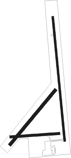
Runway info
Runway 17 / 35  | ||
| length | 1282m (4206ft) | |
| bearing | 179° / 359° | |
| width | 23m (75ft) | |
| surface | concrete | |
| displ threshold | 56m (184ft) / 0m (0ft) | |
| Runway 04 / 22 | ||
| length | 727m (2385ft) | |
| bearing | 52° / 232° | |
| width | 34m (110ft) | |
| surface | grass | |
| Runway 08 / 26 | ||
| length | 504m (1654ft) | |
| bearing | 90° / 270° | |
| width | 27m (90ft) | |
| surface | grass | |
Nearby beacons
| code | identifier | dist | bearing | frequency |
|---|---|---|---|---|
| TKO | MANKATO VORTAC | 21 | 339° | 109.80 |
| SLN | SALINA VORTAC | 40.4 | 137° | 117.10 |
| SL | FLORY (SALINA) NDB | 52.5 | 149° | 344 |
| FBY | FAIRBURY NDB | 61.3 | 54° | 293 |
Instrument approach procedures
| runway | airway (heading) | route (dist, bearing) |
|---|---|---|
| RW17 | CADAD (179°) | CADAD 6000ft CADAD (turn) 4000ft |
| RW17 | DENTE (213°) | DENTE CADAD (6mi, 269°) 4000ft |
| RW17 | HILVA (145°) | HILVA CADAD (6mi, 89°) 4000ft |
| RNAV | CADAD 4000ft YULUD (6mi, 179°) 3100ft DAVKE (3mi, 179°) 2240ft K61 (3mi, 181°) 1456ft (5782mi, 112°) 1816ft ADICA (5782mi, 292°) 4000ft ADICA (turn) | |
| RW35 | ADICA (358°) | ADICA 6000ft ADICA (turn) 4000ft |
| RW35 | BEDBE (329°) | BEDBE ADICA (5mi, 269°) 4000ft |
| RW35 | FRAPS (28°) | FRAPS ADICA (5mi, 89°) 4000ft |
| RNAV | ADICA 4000ft UTEYI (6mi, 359°) 3100ft K61 (5mi, 357°) 1455ft (5782mi, 112°) 1818ft CADAD (5781mi, 292°) 4000ft CADAD (turn) |
Disclaimer
The information on this website is not for real aviation. Use this data with the X-Plane flight simulator only! Data taken with kind consent from X-Plane 12 source code and data files. Content is subject to change without notice.