Wilmington - Clinton Field
Airport details
| Country | United States of America |
| State | Ohio |
| Region | K5 |
| Airspace | Indianapolis Ctr |
| Municipality | Clinton County |
| Elevation | 1033ft (315m) |
| Timezone | GMT -5 |
| Coordinates | 39.50247, -83.86330 |
| Magnetic var | |
| Type | land |
| Available since | X-Plane v10.40 |
| ICAO code | I66 |
| IATA code | n/a |
| FAA code | n/a |
Communication
| Clinton Field AWOS 3 | 124.175 |
| Clinton Field CTAF/UNICOM | 123.000 |
| Clinton Field DAYTON Approach/Departure | 118.850 |
Nearby Points of Interest:
Keiter Mound
-Clinton County Courthouse
-Rombach Place
-Doan House
-Hillside Haven Mound
-Beam Farm Woodland Archaeological District
-Cowan Creek Circular Enclosure
-McDonald Farm
-Waynesville Main Street Historic District
-Jamestown Opera House
-Hollencamp House
-Alexander Conner House
-Bank of Xenia
-Millen-Schmidt House
-Samuel N. Patterson House
-Berryhill-Morris House
-Bone Stone Graves
-Bone Mound II
-Crossed Keys Tavern
-Whitelaw Reid House
-Harper Mausoleum and George W. Harper Memorial Entrance
-Mohrman-Jack-Evans House
-Springboro Historic District
-Moar Mound and Village Site
-Dr. Aaron Wright House
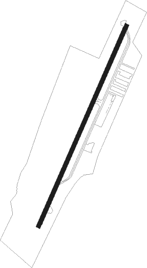
Runway info
| Runway 3 / 21 | ||
| length | 1092m (3583ft) | |
| bearing | 35° / 215° | |
| width | 20m (66ft) | |
| surface | asphalt | |
| blast zone | 0m (0ft) / 37m (121ft) | |
Nearby beacons
| code | identifier | dist | bearing | frequency |
|---|---|---|---|---|
| MXQ | MIDWEST (WILMINGTON) VOR/DME | 5.2 | 140° | 112.90 |
| IL | AIRBO (WILMINGTON) NDB | 5.8 | 94° | 407 |
| HW | CUBLA (WILMINGTON) NDB | 8.9 | 185° | 299 |
| SGH | DME | 20 | 3° | 113.20 |
| XSF | SPRINGFIELD TACAN | 20.1 | 4° | 133.80 |
| FFO | PATTERSON (DAYTON) TACAN | 20.9 | 329° | 115.20 |
| MW | ONIDA (MIDDLETOWN) NDB | 21.7 | 279° | 223 |
| CSS | COURT HOUSE (WASHINGTON) NDB | 22.6 | 78° | 414 |
| HKF | HOOK FIELD (MIDDLETOWN) NDB | 27 | 270° | 239 |
| AT | BRUNY (DAYTON) NDB | 30 | 306° | 315 |
| PWF | SPORTYS (BATAVIA) NDB | 30.3 | 220° | 245 |
| BU | BOUTN (COLUMBUS) NDB | 35.9 | 64° | 230 |
| DQN | DAYTON VOR/DME | 39.4 | 314° | 114.50 |
| XUB | YELLOW BUD (CIRCLEVILLE) VOR | 41 | 88° | 112.50 |
| DD | COBBS (COLUMBUS) NDB | 41.5 | 74° | 253 |
| OS | FULER (COLUMBUS) NDB | 46 | 49° | 515 |
| LCK | RICKENBACKER (COLUMBUS) TACAN | 46.9 | 72° | 134.20 |
| RID | RICHMOND VOR/DME | 47.6 | 285° | 110.60 |
| EOP | WAVERLY NDB | 47.7 | 110° | 385 |
| ROD | ROSEWOOD VORTAC | 47.8 | 347° | 117.50 |
| CVG | CINCINNATI VORTAC | 48.7 | 240° | 117.30 |
| FLM | FALMOUTH VOR/DME | 55.3 | 208° | 117 |
| YRK | YORK VORTAC | 66 | 134° | 112.80 |
Instrument approach procedures
| runway | airway (heading) | route (dist, bearing) |
|---|---|---|
| RW03 | CUSTA (6°) | CUSTA 3000ft NEKOE (5mi, 293°) 3000ft |
| RW03 | NEKOE (35°) | NEKOE 3000ft |
| RW03 | SINRE (58°) | SINRE 3000ft NEKOE (5mi, 113°) 3000ft |
| RNAV | NEKOE 3000ft DINNE (7mi, 35°) 2600ft I66 (5mi, 35°) 1066ft (5121mi, 115°) 1433ft HITON (5116mi, 295°) 3000ft HITON (turn) | |
| RW21 | COMAS (186°) | COMAS 3100ft HITON (5mi, 113°) 3000ft |
| RW21 | HITON (215°) | HITON 3000ft |
| RW21 | YOSUN (239°) | YOSUN 3000ft HITON (5mi, 293°) 3000ft |
| RNAV | HITON 3000ft IKEYU (6mi, 215°) 2600ft I66 (5mi, 215°) 1071ft NEKOE (12mi, 215°) 3000ft NEKOE (turn) |
Disclaimer
The information on this website is not for real aviation. Use this data with the X-Plane flight simulator only! Data taken with kind consent from X-Plane 12 source code and data files. Content is subject to change without notice.