Coshocton - Richard Downing
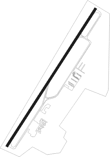
Airport details
| Country | United States of America |
| State | Ohio |
| Region | K5 |
| Airspace | Indianapolis Ctr |
| Municipality | Keene Township |
| Elevation | 979ft (298m) |
| Timezone | GMT -5 |
| Coordinates | 40.31017, -81.85242 |
| Magnetic var | |
| Type | land |
| Available since | X-Plane v10.40 |
| ICAO code | I40 |
| IATA code | n/a |
| FAA code | n/a |
Communication
| Richard Downing AWOS 3 | 118.875 |
| Richard Downing CTAF/UNICOM | 123.000 |
Nearby Points of Interest:
Muskingum River Navigation Historic District
-Coshocton County Courthouse
-Adams-Gray House
-Prospect Place
-Booth Homestead
-Holmes County Courthouse
-Millersburg Christian Church
-Brightman House
-Boyd School
-Samuel Harper Stone House
-Kennedy Stone House
-Ralph Hardesty Stone House
-William Rainey Harper Log House
-Broom-Braden Stone House
-Guernsey County Courthouse
-Croco House
-Barnett-Criss House
-Colonel Joseph Taylor House
-McCracken-McFarland House
-Broom Building
-Joseph Armstrong Farm
-Tuscarawas County Courthouse
-James Boggs Tannehill House
-Jeremiah Reeves House and Carriage House
-West Union School
Nearby beacons
| code | identifier | dist | bearing | frequency |
|---|---|---|---|---|
| CTW | DME | 17.9 | 102° | 111.80 |
| ZZV | ZANESVILLE VOR/DME | 22.2 | 186° | 114.95 |
| BSV | BRIGGS VOR/DME | 32.1 | 44° | 112.40 |
| APE | APPLETON VORTAC | 35 | 258° | 116.70 |
| MF | MANNS (MANSFIELD) NDB | 38.4 | 308° | 372 |
| CFX | CADIZ NDB | 38.7 | 95° | 239 |
| MFD | MANSFIELD VORTAC | 47.5 | 307° | 108.80 |
| AK | AKRON NDB | 50.2 | 31° | 362 |
| LC | PICKL (COLUMBUS) NDB | 52 | 246° | 376 |
| ACO | AKRON VOR/DME | 56.3 | 39° | 114.40 |
| JPU | PARKERSBURG VOR/DME | 56.6 | 151° | 108.60 |
Instrument approach procedures
| runway | airway (heading) | route (dist, bearing) |
|---|---|---|
| RW04 | WUMDO (45°) | WUMDO 3400ft |
| RNAV | WUMDO 3400ft UREYO (7mi, 45°) 2400ft ZIRUV (2mi, 45°) 1560ft I40 (2mi, 45°) 1018ft (5033mi, 116°) 1480ft WUMDO (5038mi, 296°) 3400ft | |
| RW22 | BEDDE (225°) | BEDDE 3400ft |
| RNAV | BEDDE 3400ft IRACU (6mi, 225°) 2400ft BPANE (2mi, 225°) 1840ft I40 (3mi, 225°) 1024ft (5033mi, 116°) 1400ft BEDDE (5027mi, 296°) 3400ft BEDDE (turn) |
Disclaimer
The information on this website is not for real aviation. Use this data with the X-Plane flight simulator only! Data taken with kind consent from X-Plane 12 source code and data files. Content is subject to change without notice.