Winchester - Randolph Co
Airport details
| Country | United States of America |
| State | Indiana |
| Region | K5 |
| Airspace | Indianapolis Ctr |
| Municipality | Randolph County |
| Elevation | 1119ft (341m) |
| Timezone | GMT -5 |
| Coordinates | 40.16769, -84.92939 |
| Magnetic var | |
| Type | land |
| Available since | X-Plane v10.40 |
| ICAO code | I22 |
| IATA code | n/a |
| FAA code | I22 |
Communication
| Randolph Co CTAF/UNICOM | 123.000 |
| Randolph Co Columbus Approach/Departure | 118.425 |
Nearby Points of Interest:
Winchester Courthouse Square Historic District
-Winchester Residential Historic District
-Gen. Asahel Stone Mansion
-Union City Passenger Depot
-Raphael Kirshbaum Building
-Union City Commercial Historic District
-William Kerr House
-Union City Public Library
-Lambert-Parent House
-James and Sophia Clemens Farmstead
-Farmland Downtown Historic District
-Levi Coffin House
-Brown Township Building
-James Haines Farm
-Greenville Mausoleum
-Broadway Bridge
-Waring House
-Donovan Robeson House
-Greenville Carnegie Library
-Darke County Courthouse, Sheriff's House and Jail
-Anna Beir House
-Lansdowne House
-Benjamin Franklin Coppess House
-Leftwich House
-Studabaker-Scott House and Beehive School
Nearby beacons
| code | identifier | dist | bearing | frequency |
|---|---|---|---|---|
| AWW | WINCHESTER NDB | 0.3 | 87° | 212 |
| JN | BALLL (MUNCIE) NDB | 17.9 | 272° | 365 |
| MI | BALLL (MUNCIE) NDB | 17.9 | 272° | 365 |
| MIE | MUNCIE VOR/DME | 21.7 | 279° | 114.40 |
| UWL | NEW CASTLE NDB | 24.8 | 234° | 385 |
| RID | RICHMOND VOR/DME | 25.1 | 168° | 110.60 |
| SQ | PNTHR (CONNERSVILLE) NDB | 25.2 | 207° | 227 |
| DQN | DAYTON VOR/DME | 26 | 106° | 114.50 |
| AI | VIDEO (ANDERSON) NDB | 27.3 | 260° | 394 |
| AT | BRUNY (DAYTON) NDB | 33.4 | 118° | 315 |
| MZZ | MARION VOR/DME | 39.5 | 293° | 108.60 |
| ROD | ROSEWOOD VORTAC | 41.2 | 82° | 117.50 |
| MW | ONIDA (MIDDLETOWN) NDB | 45 | 134° | 223 |
| FFO | PATTERSON (DAYTON) TACAN | 45.3 | 112° | 115.20 |
| HKF | HOOK FIELD (MIDDLETOWN) NDB | 45.9 | 144° | 239 |
| FWA | FORT WAYNE VORTAC | 50.1 | 342° | 117.80 |
| HLB | BATESVILLE NDB | 51.6 | 202° | 254 |
| SHB | SHELBYVILLE VOR/DME | 52.2 | 239° | 112 |
| BA | CLIFS (COLUMBUS) NDB | 65.3 | 226° | 410 |
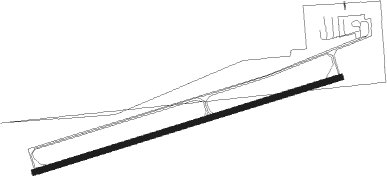
Instrument approach procedures
| runway | airway (heading) | route (dist, bearing) |
|---|---|---|
| RW08 | OYCEG (80°) | OYCEG 6000ft OYCEG (turn) 3000ft |
| RNAV | OYCEG 3000ft WUBEK (8mi, 80°) 2800ft HURIB (3mi, 80°) 1820ft I22 (2mi, 80°) 1161ft (5173mi, 115°) 1430ft MOSEW (5160mi, 295°) 3000ft MOSEW (turn) | |
| RW26 | BOOKS (202°) | BOOKS NOPCU (11mi, 147°) 3000ft MOSEW (8mi, 164°) 3000ft |
| RW26 | DQN (286°) | DQN SOWDO (10mi, 286°) 3000ft MOSEW (9mi, 344°) 3000ft |
| RW26 | MIE (99°) | MIE MOSEW (34mi, 92°) 3000ft MOSEW (turn) 3000ft |
| RNAV | MOSEW 3000ft AGUBE (8mi, 260°) 2800ft ZOKUV (3mi, 260°) 1860ft I22 (3mi, 260°) 1163ft (5173mi, 115°) 2500ft MOSEW (5160mi, 295°) 3000ft MOSEW (turn) |
Disclaimer
The information on this website is not for real aviation. Use this data with the X-Plane flight simulator only! Data taken with kind consent from X-Plane 12 source code and data files. Content is subject to change without notice.