Faranah
Airport details
| Country | Guinea |
| State | Faranah Region |
| Region | GU |
| Airspace | Roberts Ctr |
| Municipality | Faranah |
| Elevation | 1476ft (450m) |
| Timezone | GMT +0 |
| Coordinates | 10.03850, -10.76036 |
| Magnetic var | |
| Type | land |
| Available since | X-Plane v10.40 |
| ICAO code | GUFH |
| IATA code | FAA |
| FAA code | n/a |
Communication
| Faranah Tower | 118.500 |
Runway info
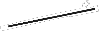
| Runway 09 / 27 | ||
| length | 2356m (7730ft) | |
| bearing | 83° / 263° | |
| width | 45m (148ft) | |
| surface | asphalt | |
| blast zone | 145m (476ft) / 0m (0ft) | |
Nearby beacons
| code | identifier | dist | bearing | frequency |
|---|---|---|---|---|
| FH | FARANAH NDB | 0.7 | 1° | 350 |
| FRH | FARANAH VOR | 0.7 | 1° | 112.10 |
| KU | KISSIDOUGOU NDB | 64.4 | 144° | 387 |
Disclaimer
The information on this website is not for real aviation. Use this data with the X-Plane flight simulator only! Data taken with kind consent from X-Plane 12 source code and data files. Content is subject to change without notice.