Kwekwe - Kwekwe East
Airport details
| Country | Zimbabwe |
| State | Midlands Province |
| Region | |
| Airspace | Harare Ctr |
| Municipality | Kwekwe |
| Elevation | 4023ft (1226m) |
| Timezone | GMT +2 |
| Coordinates | -18.99623, 30.01873 |
| Magnetic var | |
| Type | land |
| Available since | X-Plane v10.40 |
| ICAO code | FV76 |
| IATA code | n/a |
| FAA code | n/a |
Communication
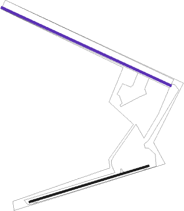
Runway info
| Runway 12 / 30 | ||
| length | 1689m (5541ft) | |
| bearing | 118° / 298° | |
| width | 20m (65ft) | |
| surface | dirt | |
Runway 09 / 27  | ||
| length | 1128m (3701ft) | |
| bearing | 78° / 258° | |
| width | 17m (56ft) | |
| surface | asphalt | |
Nearby beacons
| code | identifier | dist | bearing | frequency |
|---|---|---|---|---|
| RC | KWEKWE NDB | 12.6 | 286° | 385 |
| TO | THORNHILL (GWERU) NDB | 26.8 | 211° | 268 |
| TI | THORNHILL (GWERU) NDB | 27.7 | 202° | 278 |
| VTL | THORNHILL (GWERU) VOR/DME | 28.1 | 200° | 114.30 |
| TL | THORNHILL (GWERU) NDB | 28.5 | 200° | 213 |
| FI | FYLDE NDB | 50.9 | 355° | 310 |
| FY | FYLDE NDB | 53.2 | 351° | 290 |
Disclaimer
The information on this website is not for real aviation. Use this data with the X-Plane flight simulator only! Data taken with kind consent from X-Plane 12 source code and data files. Content is subject to change without notice.