Ndola - Simon Mwansa Kapwepwe International
Airport details
| Country | Zambia |
| State | Copperbelt Province |
| Region | |
| Airspace | Lusaka Ctr |
| Municipality | Ndola |
| Elevation | 4166ft (1270m) |
| Timezone | GMT +2 |
| Coordinates | -12.99759, 28.65412 |
| Magnetic var | |
| Type | land |
| Available since | X-Plane v10.40 |
| ICAO code | FLND |
| IATA code | NLA |
| FAA code | n/a |
Communication
| Simon Mwansa Kapwepwe International Tower | 118.300 |
| Simon Mwansa Kapwepwe International Approach | 119.700 |
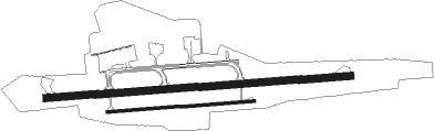
Runway info
Runway 10L / 28R  | ||
| length | 2512m (8241ft) | |
| bearing | 90° / 270° | |
| width | 59m (195ft) | |
| surface | concrete | |
| blast zone | 0m (0ft) / 175m (574ft) | |
| Runway 10R / 28L | ||
| length | 1207m (3960ft) | |
| bearing | 90° / 270° | |
| width | 22m (73ft) | |
| surface | concrete | |
Nearby beacons
| code | identifier | dist | bearing | frequency |
|---|---|---|---|---|
| VND | NDOLA VOR/DME | 0.7 | 93° | 112.10 |
| NW | NDOLA NDB | 3.9 | 272° | 240 |
| VCD | SMKIA VOR/DME | 9.8 | 282° | 114 |
| KT | SOUTHDOWNS (KITWE) NDB | 30 | 281° | 394 |
| KM | KAPIRI MPOSHI NDB | 58.2 | 178° | 312 |
Disclaimer
The information on this website is not for real aviation. Use this data with the X-Plane flight simulator only! Data taken with kind consent from X-Plane 12 source code and data files. Content is subject to change without notice.