Plettenberg Bay
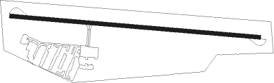
Airport details
| Country | South Africa |
| State | Western Cape |
| Region | FA |
| Airspace | Cape Town Ctr |
| Municipality | Bitou Local Municipality |
| Elevation | 463ft (141m) |
| Timezone | GMT +2 |
| Coordinates | -34.08816, 23.32862 |
| Magnetic var | |
| Type | land |
| Available since | X-Plane v10.40 |
| ICAO code | FAPG |
| IATA code | PBZ |
| FAA code | n/a |
Communication
| Plettenberg Bay TIBA | 124.800 |
Nearby Points of Interest:
van Plettenberg beacon
-All Saints Church, Uniondale
Nearby beacons
| code | identifier | dist | bearing | frequency |
|---|---|---|---|---|
| PY | PLETTENBERG BAY NDB | 0.1 | 229° | 277 |
| GRV | GEORGE VOR/DME | 47.6 | 275° | 116.60 |
Instrument approach procedures
| runway | airway (heading) | route (dist, bearing) |
|---|---|---|
| RW12 | EXITU (126°) | EXITU 4300ft PG1T1 (5mi, 191°) 2700ft |
| RW12 | UDNEG (98°) | UDNEG 4300ft PG1T1 (5mi, 98°) 2700ft |
| RW12 | XARSA (71°) | XARSA 3500ft PG1T1 (5mi, 11°) 2700ft |
| RNAV | PG1T1 2700ft PG1F1 (4mi, 98°) 1500ft FAPG (3mi, 98°) 512ft PG1M1 (4mi, 98°) PG1M2 (5mi, 192°) XARSA (12mi, 278°) 3500ft XARSA (turn) 3500ft | |
| RW30 | EGMAB (251°) | EGMAB 4200ft PG2T1 (5mi, 191°) 2800ft |
| RW30 | GENUV (278°) | GENUV 4200ft PG2T1 (5mi, 278°) 2800ft |
| RW30 | UNGOR (306°) | UNGOR 4200ft PG2T1 (5mi, 11°) 2800ft |
| RNAV | PG2T1 2800ft PG2F1 (4mi, 278°) 1500ft FAPG (3mi, 278°) 493ft PG2M1 (4mi, 278°) PG2M2 (5mi, 192°) UNGOR (12mi, 98°) 3500ft UNGOR (turn) 3500ft |
Disclaimer
The information on this website is not for real aviation. Use this data with the X-Plane flight simulator only! Data taken with kind consent from X-Plane 12 source code and data files. Content is subject to change without notice.