Gütersloh - Guetersloh Ab (clsd)
Airport details
| Country | Germany |
| State | North Rhine-Westphalia |
| Region | |
| Airspace | Langen Ctr |
| Municipality | Gütersloh |
| Elevation | 235ft (72m) |
| Timezone | GMT +1 |
| Coordinates | 51.92287, 8.28995 |
| Magnetic var | |
| Type | land |
| Available since | X-Plane v10.40 |
| ICAO code | ETUO |
| IATA code | GUT |
| FAA code | n/a |
Communication
Nearby Points of Interest:
Abtei (Marienfeld)
-Marienfeld Abbey
-Jüdischer Friedhof Harsewinkel
-Amtsgericht Gütersloh
-Wasserturm Carl-Miele-Straße
-Rötteken-Palais
-Brennerei Elmendorf
-Holtkämperei
-St. Vitus
-Künstlerhaus Wiedenbrück
-Museum für Westfälische Literatur
-Schloss Holtfeld
-Dorfmühle
-Amtsgericht Halle (Westf.)
-Haus Dieck
-Wellensiek
-Handwerker- und Kunstgewerbeschule Bielefeld
-Spiegelshof
-Landgericht Bielefeld
-Römische Kreisgrabenanlage auf der Sparrenberger Egge
-Crüwell-Haus (Bielefeld)
-Battig-Haus
-Haus der Technik
-Ostmannturm
-St. Joseph (Bielefeld)
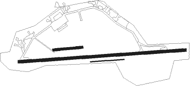
Runway info
Runway 09 / 27  | ||
| length | 2520m (8268ft) | |
| bearing | 90° / 270° | |
| width | 46m (151ft) | |
| surface | asphalt | |
| displ threshold | 178m (584ft) / 1742m (5715ft) | |
| blast zone | 244m (801ft) / 0m (0ft) | |
| Runway 09R / 27L | ||
| length | 507m (1663ft) | |
| bearing | 90° / 270° | |
| width | 10m (33ft) | |
| surface | asphalt | |
| Runway 08 / 26 | ||
| length | 425m (1394ft) | |
| bearing | 90° / 270° | |
| width | 38m (125ft) | |
| surface | grass | |
Nearby beacons
| code | identifier | dist | bearing | frequency |
|---|---|---|---|---|
| OSB | OSNABRUCK TACAN | 16.6 | 359° | 108.35 |
| OSN | OSNABRUECK VOR | 16.6 | 359° | 114.30 |
| HMM | HAMM VOR/DME | 21.9 | 264° | 115.65 |
| PAD | PADERBORN-LIPPSTADT NDB | 22.1 | 131° | 354 |
| PAD | DME-ILS | 22.4 | 134° | 108.50 |
| MYN | MUENSTER/OSNABRUECK NDB | 23 | 296° | 371 |
| MOD | DME | 25.7 | 290° | 114.05 |
| DWI | DORTMUND-WICKEDE NDB | 34 | 239° | 357 |
| DOR | WICKEDE (DORTMUND) VOR/DME | 34.2 | 239° | 108.65 |
| BYC | BUECKEBURG NDB | 36.9 | 65° | 368 |
| WRB | WARBURG VOR/DME | 39.5 | 117° | 113.70 |
| DP | DIEPHOLZ NDB | 40.6 | 14° | 325 |
| GMH | GERMINGHAUSEN VOR/DME | 47.5 | 208° | 115.40 |
Disclaimer
The information on this website is not for real aviation. Use this data with the X-Plane flight simulator only! Data taken with kind consent from X-Plane 12 source code and data files. Content is subject to change without notice.