Haderslev
Airport details
| Country | Denmark |
| State | Region of Southern Denmark |
| Region | EK |
| Airspace | Copenhagen Ctr |
| Municipality | Haderslev Municipality |
| Elevation | 81ft (25m) |
| Timezone | GMT +1 |
| Coordinates | 55.30222, 9.52250 |
| Magnetic var | |
| Type | land |
| Available since | X-Plane v10.40 |
| ICAO code | EKHV |
| IATA code | n/a |
| FAA code | n/a |
Communication
| Haderslev Haderslev Radio | 122.225 |
Nearby Points of Interest:
Christinero
-Helligkorsgade 18
-Assens station
-Little Belt
-Eltang stone
-Billeskov
-Hagenskov
-Flenstofte
-Krudttårnet
-Erholm
-Egtved Runestone
-Oregaard
-Hamborggård stone
-Nydam Boat
-Tirslund Rock
-Det Gule Palæ
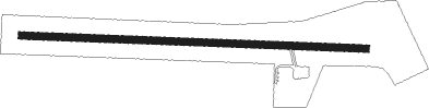
Runway info
| Runway 10 / 28 | ||
| length | 1108m (3635ft) | |
| bearing | 94° / 274° | |
| width | 23m (75ft) | |
| surface | asphalt | |
Nearby beacons
| code | identifier | dist | bearing | frequency |
|---|---|---|---|---|
| VO | VOJENS/SKRYDSTRUP NDB | 9.7 | 253° | 321 |
| VAM | DME | 10.3 | 306° | 110.05 |
| KD | KOLDING NDB | 10.6 | 307° | 357 |
| SKR | VOJENS/SKRYDSTRUP VORTAC | 11.4 | 257° | 110.40 |
| ALS | ALSIE VOR | 28.8 | 130° | 114.70 |
| EJ | ESBJERG NDB | 31.5 | 286° | 400 |
| FE | ODENSE NDB | 34.6 | 77° | 423 |
| ESE | DME | 35.4 | 283° | 116.60 |
| SWG | SCHLESWIG TACAN | 50.3 | 180° | 111.80 |
| HN | HOHN NDB | 58.8 | 171° | 344 |
| KIL | KIEL-HOLTENAU NDB | 59.2 | 147° | 353 |
| KHD | (HOLTENAU) DME-ILS | 59.4 | 146° | 109.50 |
| HNT | HOHN TACAN | 59.5 | 179° | 115.30 |
| KAR | KARUP TACAN | 62.1 | 333° | 110 |
Disclaimer
The information on this website is not for real aviation. Use this data with the X-Plane flight simulator only! Data taken with kind consent from X-Plane 12 source code and data files. Content is subject to change without notice.