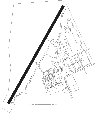
Den Helder - De Kooy
Airport details
| Country | Netherlands |
| State | North Holland |
| Region | EH |
| Airspace | Amsterdam Ctr |
| Municipality | Den Helder |
| Elevation | 0ft (0m) |
| Timezone | GMT +1 |
| Coordinates | 52.92361, 4.78056 |
| Magnetic var | |
| Type | land |
| Available since | X-Plane v10.40 |
| ICAO code | EHKD |
| IATA code | DHR |
| FAA code | n/a |
Communication
| De Kooy Ground Control | 121.725 |
| De Kooy Tower | 122.100 |
| De Kooy Tower | 120.125 |
| De Kooy Approach | 119.100 |
| De Kooy Approach | 122.100 |
Approach frequencies
| ILS-cat-I | RW21 | 108.9 | 18.00mi |
| 3° GS | RW21 | 108.9 | 18.00mi |
Nearby Points of Interest:
Fort Westoever
-Onze-Lieve-Vrouw-Onbevlekt-Ontvangenkerk
-Willemsoord, Den Helder
-Nieuwe Kerk
-Royal Netherlands Naval College
-Gerechtsgebouw
-Monument voor het Reddingswezen (Den Helder)
-Nicolaaskerk
-Hervormde kerk (Wieringerwaard)
-Railway station Wieringerwaard
-Hervormde Kerk, Callantsoog
-Gemeenschapsgebouw Slootdorp
-Hervormde kerk, Oudeschild
-Wezenputten
-Hervormde kerk, Den Burg
-T-vormige schuilkerk
-Nederlands Hervormde Kerk, Schagen
-Laan 23, Schagen
-Hervormde Kerk
-Nederlands Hervormde Kerk, Sint Maartensbrug
-Hervormde Kerk, Valkkoog
-Afsluitdijk and Stevinsluizen in Den Oever
-Hervormde Kerk, Oosterend
-Nederlands Hervormde Kerk, De Koog
-Ondermolen Schagerwaard of Witsmeer
Nearby beacons
| code | identifier | dist | bearing | frequency |
|---|---|---|---|---|
| HDR | HELDER DME | 1.1 | 222° | 115.55 |
| SPY | DME | 23.1 | 169° | 113.30 |
| AMS | DME | 35.5 | 187° | 113.95 |
| SPL | SCHIPHOL (AMSTERDAM) VOR/DME | 35.5 | 183° | 108.40 |
| PAM | PAMPUS VOR/DME | 37.1 | 152° | 117.80 |
| FRO | DME | 38.7 | 123° | 111.40 |
| LWD | LEEUWARDEN TACAN | 39.4 | 73° | 114.70 |
| FRT | DME | 55.2 | 181° | 117.15 |
| RTM | ROTTERDAM VOR/DME | 58 | 198° | 110.40 |
Instrument approach procedures
| runway | airway (heading) | route (dist, bearing) |
|---|---|---|
| RW03-Z | ASTUW (333°) | ASTUW 2000ft KD441 (3mi, 264°) 2000ft EDFOS (2mi, 276°) 2000ft |
| RW03-Z | HDR (42°) | HDR 2000ft KD440 (5mi, 117°) 2000ft ASTUW (5mi, 184°) 2000ft KD441 (3mi, 264°) 2000ft EDFOS (2mi, 276°) 2000ft |
| RW03-Z | NIXCO (39°) | NIXCO 2000ft EDFOS (3mi, 79°) 2000ft |
| RNAV | EDFOS 2000ft KD442 (3mi, 17°) 2000ft HDR (5mi, 17°) 322ft (3186mi, 185°) 1000ft KD444 (3189mi, 5°) HDR (3mi, 244°) 2000ft HDR (turn) 2000ft | |
| RW21-Z | FAFLO (228°) | FAFLO 2000ft ZOJIK (3mi, 228°) 1700ft |
| RW21-Z | HDR (42°) | HDR 2000ft YOJUP (7mi, 69°) 2000ft JOPFI (3mi, 48°) 2000ft ZOJIK (3mi, 292°) 1700ft |
| RW21-Z | JOPFI (246°) | JOPFI 2000ft ZOJIK (3mi, 292°) 1700ft |
| RW21-Z | PUFLA (167°) | PUFLA 2000ft KD451 (4mi, 112°) 2000ft ZOJIK (3mi, 112°) 1700ft |
| RNAV | ZOJIK 1700ft KD452 (3mi, 228°) 1700ft EHKD (5mi, 228°) 52ft (3187mi, 185°) 500ft KD453 (3183mi, 5°) HDR (3mi, 1°) 2000ft HDR (turn) 2000ft |
Disclaimer
The information on this website is not for real aviation. Use this data with the X-Plane flight simulator only! Data taken with kind consent from X-Plane 12 source code and data files. Content is subject to change without notice.