Burgh - Haamstede Gliders
Airport details
| Country | Netherlands |
| State | Zeeland |
| Region | |
| Airspace | Amsterdam Ctr |
| Municipality | Burgh-Haamstede |
| Elevation | 22ft (7m) |
| Timezone | GMT +1 |
| Coordinates | 51.70819, 3.70512 |
| Magnetic var | |
| Type | land |
| Available since | X-Plane v10.40 |
| ICAO code | EHHS |
| IATA code | n/a |
| FAA code | n/a |
Communication
Nearby Points of Interest:
Nederlands Hervormde Kerk, Burg
-Sint Alardskerk, Serooskerke (Schouwen-Duiveland)
-Nederlands Hervormde Kerk
-Nederlands Hervormde Kerk, Colijnsplaat
-Bouw- en Plantlust
-Nieuwe Bogerdstraat 1, Zierikzee
-Havenpark 14, Zierikzee
-Oude Haven 13, Zierikzee
-Veerdam
-Markt 7, Veere
-Veere City Hall
-Mijnenmagazijn, geheel uit monoliet gestort beton opgetrokken
-Nederlands Hervormde kerk
-Weststraat 3, Ouddorp
-Goemanszorg
-Hervormde Kerk
-Hoge Huis, Oud-Sabbinge
-Nederlands Hervormde Kerk, Sint Laurens
-De Griffioen (Wolphaartsdijk)
-Stadhuis Domburg
-Wilhelmina's Oord, Grijpskerke
-Stadhuis
-Nederlands Hervormde Kerk, Aagtekerke
-Oude Kraan
-Watertoren
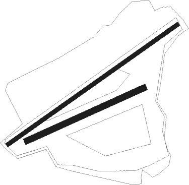
Runway info
Runway 05 / 23  | ||
| length | 1011m (3317ft) | |
| bearing | 70° / 250° | |
| width | 20m (66ft) | |
| surface | grass | |
| Runway 06 / 24 | ||
| length | 625m (2051ft) | |
| bearing | 77° / 257° | |
| width | 30m (98ft) | |
| surface | concrete | |
Nearby beacons
| code | identifier | dist | bearing | frequency |
|---|---|---|---|---|
| COA | COSTA VOR/DME | 25.2 | 224° | 110.05 |
| WDT | WOENSDRECHT TACAN | 28.5 | 112° | 115 |
| RTM | ROTTERDAM VOR/DME | 32.9 | 71° | 110.40 |
| NIK | NICKY VOR/DME | 37.2 | 139° | 117.40 |
| ONO | OOSTENDE NDB | 39.1 | 235° | 399 |
| ANT | ANTWERP (DEURNE) VOR/DME | 42.3 | 124° | 113.50 |
| OO | OOSTENDE (OOSTENDE-BRUGGE) NDB | 42.4 | 238° | 375 |
| DD | OOSTENDE (OOSTENDE-BRUGGE) NDB | 44.8 | 239° | 352 |
| MAK | MACKEL NDB | 45.3 | 196° | 360 |
| ONW | ANTWERP NDB | 45.7 | 122° | 355 |
| AFI | AFFLIGEM VOR/DME | 50.7 | 152° | 114.90 |
| OP | BRUSSELS NATIONAL NDB | 56.9 | 131° | 402 |
| BUB | BRUSSELS VOR/DME | 57.6 | 134° | 114.60 |
| OB | BRUSSELS NDB | 58.3 | 131° | 293 |
| OZ | BRUSSELS NATIONAL NDB | 60.1 | 139° | 314 |
| HUL | HULDENBERG VOR/DME | 67.4 | 136° | 117.55 |
Disclaimer
The information on this website is not for real aviation. Use this data with the X-Plane flight simulator only! Data taken with kind consent from X-Plane 12 source code and data files. Content is subject to change without notice.