Wheldrake - Elvington
Airport details
| Country | United Kingdom |
| State | England |
| Region | |
| Airspace | London Ctr |
| Municipality | Heslington |
| Elevation | 0ft (0m) |
| Timezone | GMT +0 |
| Coordinates | 53.92381, -0.99067 |
| Magnetic var | |
| Type | land |
| Available since | X-Plane v10.40 |
| ICAO code | EGYK |
| IATA code | n/a |
| FAA code | n/a |
Communication
| Elvington York Radio | 119.630 |
Nearby Points of Interest:
Derwent Ings
-Heslington Church
-More House
-Langwith College
-Middlethorpe Hall
-Female Prison, York
-St Anthony's Hall
-Peaseholme House
-Castlegate House And Attached Railings
-The Blue Bell
-The Herbert House
-golden fleece york
-Cumberland House
-Merchant Taylors' Hall, York
-Lady Row
-The Wealden Hall
-The Anglers Arms And Attached Buildings At Rear
-41, 43 And 45, Goodramgate
-the roman bath public house
-30 and 32 Goodramgate and 11 and 12 College Street
-73, 75 And 77, Low Petergate
-St John's Church, Micklegate, York
-Mulberry Hall
-Grays Court, York
-The Norman House
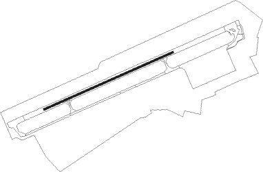
Runway info
| Runway 07 / 25 | ||
| length | 1711m (5614ft) | |
| bearing | 78° / 258° | |
| width | 23m (75ft) | |
| surface | asphalt | |
| displ threshold | 40m (131ft) / 52m (171ft) | |
Nearby beacons
| code | identifier | dist | bearing | frequency |
|---|---|---|---|---|
| SBL | SHERBURN-IN-ELMET NDB | 11.1 | 238° | 323 |
| LBA | LEEDS BRADFORD NDB | 23.7 | 265° | 402 |
| FNY | DONCASTER SHEFFIELD NDB | 26.9 | 181° | 338 |
| LEE | LEEMING TACAN | 29.5 | 304° | 112.60 |
| KIM | HUMBERSIDE NDB | 30.8 | 119° | 365 |
| OTR | OTTRINGHAM VOR/DME | 34.2 | 104° | 113.90 |
| GAM | GAMSTON VOR/DME | 38.6 | 176° | 112.80 |
| TD | TEESSIDE INTL NDB | 40 | 332° | 347 |
| WAD | WADDINGTON TACAN | 48.4 | 149° | 117.10 |
| CWZ | CRANWELL TACAN | 56.7 | 151° | 117.40 |
| CWL | CRANWELL NDB | 56.8 | 151° | 423 |
| TNT | TRENT VOR/DME | 57.6 | 218° | 115.70 |
| CGY | CONINGSBY TACAN | 57.9 | 135° | 111.10 |
Disclaimer
The information on this website is not for real aviation. Use this data with the X-Plane flight simulator only! Data taken with kind consent from X-Plane 12 source code and data files. Content is subject to change without notice.