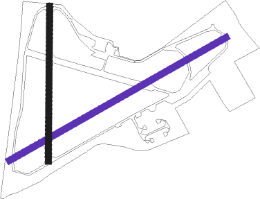
Colerne - Raf Colerne
Airport details
| Country | United Kingdom |
| State | England |
| Region | EG |
| Airspace | London Ctr |
| Municipality | Colerne |
| Elevation | 591ft (180m) |
| Timezone | GMT +0 |
| Coordinates | 51.44108, -2.27908 |
| Magnetic var | |
| Type | land |
| Available since | X-Plane v10.40 |
| ICAO code | EGUO |
| IATA code | n/a |
| FAA code | n/a |
Communication
Nearby Points of Interest:
Eagle House
-Hazelbury Manor
-Shockerwick House
-Hartham Park
-Browne's Folly
-Hampton Rocks Cutting
-Monkton Farleigh Manor
-South Wraxall Manor
-The Bath House
-Hungerford Almshouses
-Corsham Court
-Neston Park
-Claverton Pumping Station
-Cleveland Pools
-Long barrow 500m north of Lugbury Farm
-North Road Quarry, Bath
-Lansdown Crescent, Bath
-Sheldon Manor
-The Circus
-Guildhall, Bath
-Ralph Allen's Town House, Bath
-Bath
-Marshal Wade's House
-Queen Square
-Grand Pump Room, Bath

Nearby beacons
| code | identifier | dist | bearing | frequency |
|---|---|---|---|---|
| OF | FILTON NDB | 12.6 | 284° | 325 |
| BRI | BRISTOL NDB | 16.8 | 262° | 414 |
| FFA | FAIRFORD TACAN | 23 | 63° | 113.40 |
| BDN | BOSCOMBE DOWN TACAN | 26.4 | 119° | 108.20 |
| GST | GLOUCESTERSHIRE NDB | 27.3 | 14° | 331 |
| VLN | YEOVILTON TACAN | 29.4 | 220° | 111 |
| BZN | BRIZE NORTON TACAN | 31.2 | 66° | 111.90 |
| BZ | BRIZE NORTON NDB | 31.3 | 66° | 386 |
| YVL | DME | 33.1 | 217° | 109.05 |
| YVL | YEOVIL NDB | 33.3 | 218° | 343 |
| BCN | BRECON VOR/DME | 40.4 | 286° | 117.45 |
| OX | OXFORD NDB | 42.7 | 68° | 367 |
| BIA | BOURNEMOUTH NDB | 43.1 | 147° | 339 |
| EAS | SOUTHAMPTON (EASTLEIGH) NDB | 45.3 | 118° | 391 |
| SAM | SOUTHAMPTON VOR/DME | 45.6 | 117° | 113.35 |
| SH | SHOBDON NDB | 53 | 323° | 426 |
| HON | HONILEY VOR/DME | 59.5 | 34° | 113.65 |
Disclaimer
The information on this website is not for real aviation. Use this data with the X-Plane flight simulator only! Data taken with kind consent from X-Plane 12 source code and data files. Content is subject to change without notice.