Castletown - Isle Of Man Ronaldsway
Airport details
| Country | Isle of Man |
| State | [Other] |
| Region | EG |
| Airspace | London Ctr |
| Municipality | Malew |
| Elevation | 0ft (0m) |
| Timezone | GMT +0 |
| Coordinates | 54.08333, -4.62333 |
| Magnetic var | |
| Type | land |
| Available since | X-Plane v10.40 |
| ICAO code | EGNS |
| IATA code | IOM |
| FAA code | n/a |
Communication
| Isle Of Man Ronaldsway Ronaldsway Information | 123.875 |
| Isle Of Man Ronaldsway Ronaldsway Tower | 118.900 |
| Isle Of Man Ronaldsway Ronaldsway Approach | 120.850 |
Approach frequencies
| ILS-cat-I | RW08 | 111.15 | 18.00mi |
| ILS-cat-I | RW26 | 111.15 | 18.00mi |
| 3.5° GS | RW08 | 111.15 | 18.00mi |
| 3° GS | RW26 | 111.15 | 18.00mi |
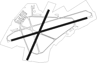
Runway info
Runway 08 / 26  | ||
| length | 1834m (6017ft) | |
| bearing | 83° / 263° | |
| width | 46m (151ft) | |
| surface | asphalt | |
| displ threshold | 166m (545ft) / 148m (486ft) | |
| Runway 03 / 21 | ||
| length | 1251m (4104ft) | |
| bearing | 42° / 222° | |
| width | 46m (151ft) | |
| surface | asphalt | |
| displ threshold | 147m (482ft) / 0m (0ft) | |
Nearby beacons
| code | identifier | dist | bearing | frequency |
|---|---|---|---|---|
| RWY | RONALDSWAY NDB | 0.1 | 169° | 359 |
| IOM | ISLE OF MAN VOR/DME | 5 | 263° | 112.20 |
| VYL | VALLEY TACAN | 50.1 | 175° | 108.40 |
Disclaimer
The information on this website is not for real aviation. Use this data with the X-Plane flight simulator only! Data taken with kind consent from X-Plane 12 source code and data files. Content is subject to change without notice.