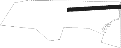
Tingewick - Finmere
Airport details
| Country | United Kingdom |
| State | England |
| Region | |
| Airspace | London Ctr |
| Municipality | Buckinghamshire |
| Elevation | 403ft (123m) |
| Timezone | GMT +0 |
| Coordinates | 51.98538, -1.06029 |
| Magnetic var | |
| Type | land |
| Available since | X-Plane v10.40 |
| ICAO code | EG40 |
| IATA code | n/a |
| FAA code | n/a |
Communication
Nearby Points of Interest:
Yeomanry Hall And Attached Building Bordering Yard To South Yeomanry House
-Old Town Hall
-St Michael and All Angels' Church, Thornton
-The Cottage
-Astwell Castle
-Winslow War Memorial
-Middleton Park, Oxfordshire
-Horwood House
-Weston Hall
-Thenford House
-Whaddon Hall
-Wotton House
-Town Hall
-Easton Neston
-Cosgrove aqueduct
-Rousham House
-Chacombe Priory
-Stoke Bruerne Canal Museum
-Eydon Hall
-Wardington Manor
-Town Hall Town Hall And Attached Walls
-Studley Priory, Oxfordshire
-Edgcote House
-Beckley Park
-Blisworth Rectory Farm Quarry
Nearby beacons
| code | identifier | dist | bearing | frequency |
|---|---|---|---|---|
| WCO | WESTCOTT NDB | 8.7 | 144° | 335 |
| DTY | DAVENTRY VOR/DME | 11.8 | 345° | 116.40 |
| OX | OXFORD NDB | 13.3 | 240° | 367 |
| HEN | HENTON NDB | 16.8 | 130° | 433 |
| CIT | CRANFIELD NDB | 20.5 | 74° | 850 |
| BSO | BENSON TACAN | 22.3 | 186° | 110 |
| BNN | BOVINGDON VOR/DME | 24.5 | 117° | 113.75 |
| BZ | BRIZE NORTON NDB | 24.5 | 246° | 386 |
| BZN | BRIZE NORTON TACAN | 24.6 | 246° | 111.90 |
| CHT | CHILTERN NDB | 29.6 | 124° | 277 |
| CPT | COMPTON VOR/DME | 30.2 | 198° | 114.35 |
| LUT | LUTON NDB | 30.4 | 96° | 345 |
| BUR | BURNHAM NDB | 31.4 | 141° | 421 |
| HON | HONILEY VOR/DME | 31.4 | 302° | 113.65 |
| WOD | WOODLEY NDB | 32.6 | 161° | 352 |
| FFA | FAIRFORD TACAN | 32.8 | 248° | 113.40 |
| LON | LONDON VOR/DME | 37.1 | 130° | 113.60 |
| LE | LEICESTER NDB | 37.3 | 2° | 383 |
| BHX | BIRMINGHAM NDB | 37.9 | 304° | 406 |
| BPK | BROOKMANS PARK VOR/DME | 38 | 104° | 117.50 |
| BLC | DME | 40.5 | 162° | 116.20 |
| BLK | BLACKBUSHE NDB | 40.5 | 162° | 328 |
| BKY | BARKWAY VOR/DME | 41.5 | 90° | 116.25 |
| WIT | WITTERING TACAN | 42.6 | 42° | 117.60 |
| ODH | ODIHAM TACAN | 45.3 | 172° | 109.60 |
| OCK | OCKHAM VOR/DME | 46.8 | 138° | 115.30 |
| EPM | EPSOM NDB | 47.5 | 134° | 316 |
| CAM | CAMBRIDGE NDB | 47.8 | 80° | 332 |
| LAM | LAMBOURNE VOR/DME | 49.3 | 106° | 115.60 |
| LCY | LONDON CITY NDB | 50.9 | 113° | 322 |
| EME | EAST MIDLANDS NDB | 51.1 | 351° | 353 |
| EMW | EAST MIDLANDS NDB | 52.6 | 335° | 393 |
| TNL | TATENHILL NDB | 56.1 | 320° | 327 |
| BDN | BOSCOMBE DOWN TACAN | 56.5 | 220° | 108.20 |
| MID | MIDHURST VOR/DME | 58.2 | 155° | 114 |
| MLD | MILDENHALL TACAN | 61.3 | 76° | 115.90 |
| LKH | LAKENHEATH TACAN | 64.3 | 75° | 110.20 |
| SND | SOUTHEND NDB | 69.8 | 103° | 362 |
| MAM | MARHAM TACAN | 71.5 | 68° | 108.70 |
| MAY | MAYFIELD VOR/DME | 72.9 | 129° | 117.90 |
| DET | DETLING VOR/DME | 74 | 112° | 117.30 |
| WTZ | WATTISHAM TACAN | 74.3 | 86° | 109.30 |
Disclaimer
The information on this website is not for real aviation. Use this data with the X-Plane flight simulator only! Data taken with kind consent from X-Plane 12 source code and data files. Content is subject to change without notice.