Jyväskylän Maalaiskunta - Jyväskylä
Airport details
| Country | Finland |
| State | Western Finland |
| Region | EF |
| Airspace | Helsinki Ctr |
| Municipality | Jyväskylä |
| Elevation | 458ft (140m) |
| Timezone | GMT +2 |
| Coordinates | 62.40083, 25.67278 |
| Magnetic var | |
| Type | land |
| Available since | X-Plane v10.40 |
| ICAO code | EFJY |
| IATA code | JYV |
| FAA code | n/a |
Communication
| Jyväskylä ATIS | 134.150 |
| Jyväskylä Tower | 119.700 |
| Jyväskylä Tower | 118.000 |
| Jyväskylä Approach | 119.700 |
| Jyväskylä Approach | 127.000 |
Approach frequencies
| ILS-cat-I | RW30 | 110.9 | 18.00mi |
| 3° GS | RW30 | 110.9 | 18.00mi |
Nearby Points of Interest:
Ison Kuhajärven kalliomaalaus
-Venäläiskivi
-Saraakallio rock paintings
-Jyväskylä Workers' Club
-Valtiontalo
-College of Education staff dormitory
-Ryhtilä
-Gardener's house
-Seminaarinmäki
-AaltoAlvari
-main building of the University of Jyväskylä
-Suolahden Wanha Asema
-Kinkomaa Hospital
-Lievestuore Railway Station
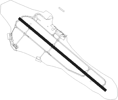
Runway info
| Runway 12 / 30 | ||
| length | 2674m (8773ft) | |
| bearing | 114° / 294° | |
| width | 60m (197ft) | |
| surface | asphalt | |
| displ threshold | 0m (0ft) / 95m (312ft) | |
| blast zone | 255m (837ft) / 190m (623ft) | |
Nearby beacons
| code | identifier | dist | bearing | frequency |
|---|---|---|---|---|
| LNE | LUONET (JYVASKYLA) VOR/DME | 1.8 | 292° | 112.30 |
| HAL | HALLI VOR/DME | 40.8 | 238° | 115.20 |
Departure and arrival routes
| Transition altitude | 5000ft |
| STAR starting points | distance | inbound heading | |
|---|---|---|---|
| RW12 | |||
| ERTO3K | 23.4 | 33° | |
| LUME2K | 27.4 | 106° | |
| ELSO2K | 25.7 | 141° | |
| RERG3K | 22.2 | 266° | |
| EROK2K | 28.2 | 302° | |
| RW30 | |||
| ERTO2L | 23.4 | 33° | |
| LUME2L | 27.4 | 106° | |
| ELSO2L | 25.7 | 141° | |
| RERG2L | 22.2 | 266° | |
| EROK2L | 28.2 | 302° | |
Instrument approach procedures
| runway | airway (heading) | route (dist, bearing) |
|---|---|---|
| RW12 | ETNUP (98°) | ETNUP 2900ft LUTOP (5mi, 64°) 2900ft |
| RW12 | SISBA (145°) | SISBA 2900ft LUTOP (5mi, 244°) 2900ft |
| RNAV | LUTOP 2900ft BIKBO (5mi, 114°) 2000ft EFJY (5mi, 114°) 503ft RUBAX (11mi, 114°) 2900ft | |
| RW30 | IPLUV (318°) | IPLUV 2900ft RUBAX (5mi, 64°) 2900ft |
| RW30 | MAVUP (280°) | MAVUP 2900ft RUBAX (5mi, 244°) 2900ft |
| RNAV | RUBAX 2900ft ATNEK (5mi, 294°) 2200ft EFJY (6mi, 294°) 463ft LUTOP (10mi, 294°) 2900ft |
Holding patterns
| STAR name | hold at | type | turn | heading* | altitude | leg | speed limit |
|---|---|---|---|---|---|---|---|
| ELSO2K | LUTOP | VHF | right | 304 (124)° | > 2900ft | 1.0min timed | 230 |
| ELSO2L | RUBAX | VHF | right | 124 (304)° | > 2900ft | 1.0min timed | 230 |
| EROK2K | LUTOP | VHF | right | 304 (124)° | > 2900ft | 1.0min timed | 230 |
| EROK2L | RUBAX | VHF | right | 124 (304)° | > 2900ft | 1.0min timed | 230 |
| ERTO2L | RUBAX | VHF | right | 124 (304)° | > 2900ft | 1.0min timed | 230 |
| ERTO3K | LUTOP | VHF | right | 304 (124)° | > 2900ft | 1.0min timed | 230 |
| LUME2K | LUTOP | VHF | right | 304 (124)° | > 2900ft | 1.0min timed | 230 |
| LUME2L | RUBAX | VHF | right | 124 (304)° | > 2900ft | 1.0min timed | 230 |
| RERG2L | RUBAX | VHF | right | 124 (304)° | > 2900ft | 1.0min timed | 230 |
| RERG3K | LUTOP | VHF | right | 304 (124)° | > 2900ft | 1.0min timed | 230 |
| *) magnetic outbound (inbound) holding course | |||||||
Disclaimer
The information on this website is not for real aviation. Use this data with the X-Plane flight simulator only! Data taken with kind consent from X-Plane 12 source code and data files. Content is subject to change without notice.