Bohmte - Bohmte-bad Essen
Airport details
| Country | Germany |
| State | Lower Saxony |
| Region | ED |
| Airspace | Bremen Ctr |
| Municipality | Bohmte |
| Elevation | 157ft (48m) |
| Timezone | GMT +1 |
| Coordinates | 52.35139, 8.32611 |
| Magnetic var | |
| Type | land |
| Available since | X-Plane v10.30 |
| ICAO code | EDXD |
| IATA code | n/a |
| FAA code | n/a |
Communication
| Bohmte-Bad Essen Bohmte INFO | 118.985 |
Nearby Points of Interest:
Sankt Johannes der Täufer, Bohmte
-Heilig-Kreuz-Kapelle
-Martin-Luther-Kirche
-Nonnenstein Observation Tower
-Gut Hudenbeck
-Schloss Bruche
-Holter Kirche
-Freibad Lübbecke
-Horse mill Oberbauerschaft
-Burg Rahden
-Stadthaus
-Liebfrauenkirche
-Burg Blankena
-Museum Bünde
-Kloster Ohrbeck
-St. Johannes Baptist
-Haus Hiddenhausen
-Jüdischer Friedhof
-Heeker Klause
-Church of the Nativity of the Virgin Mary
-Amtsgericht Halle (Westf.)
-Schloss Holtfeld
-Giersfeld
-Kloster Bersenbrück
-Großsteingrab von Werste
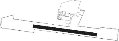
Runway info
| Runway 10 / 28 | ||
| length | 580m (1903ft) | |
| bearing | 97° / 277° | |
| width | 30m (98ft) | |
| surface | grass | |
Nearby beacons
| code | identifier | dist | bearing | frequency |
|---|---|---|---|---|
| OSB | OSNABRUCK TACAN | 9.2 | 195° | 108.35 |
| OSN | OSNABRUECK VOR | 9.2 | 195° | 114.30 |
| DP | DIEPHOLZ NDB | 15.1 | 28° | 325 |
| MYN | MUENSTER/OSNABRUECK NDB | 22.5 | 250° | 371 |
| MOD | DME | 26.7 | 252° | 114.05 |
| BYC | BUECKEBURG NDB | 28.3 | 95° | 368 |
| HMM | HAMM VOR/DME | 37.4 | 231° | 115.65 |
| BMN | BREMEN VOR/DME | 44.6 | 32° | 117.45 |
| BND | DME | 44.7 | 33° | 113.65 |
| PAD | PADERBORN-LIPPSTADT NDB | 45.2 | 157° | 354 |
| PAD | DME-ILS | 45.8 | 158° | 108.50 |
| HIG | BREMEN NDB | 46.9 | 40° | 318 |
| DWI | DORTMUND-WICKEDE NDB | 55.7 | 220° | 357 |
| DOR | WICKEDE (DORTMUND) VOR/DME | 55.8 | 220° | 108.65 |
| WRB | WARBURG VOR/DME | 58.5 | 137° | 113.70 |
| WSN | WESER NDB | 63 | 29° | 378 |
Disclaimer
The information on this website is not for real aviation. Use this data with the X-Plane flight simulator only! Data taken with kind consent from X-Plane 12 source code and data files. Content is subject to change without notice.