Krefeld - Krefeld- Egelsberg
Airport details
| Country | Germany |
| State | North Rhine-Westphalia |
| Region | ED |
| Airspace | Langen Ctr |
| Municipality | Krefeld |
| Elevation | 141ft (43m) |
| Timezone | GMT +1 |
| Coordinates | 51.38500, 6.58750 |
| Magnetic var | |
| Type | land |
| Available since | X-Plane v10.40 |
| ICAO code | EDLK |
| IATA code | n/a |
| FAA code | n/a |
Communication
| Krefeld- Egelsberg Krefeld Info | 120.680 |
Nearby Points of Interest:
Sanctuary of Elfrath
-Poelzig House
-Künstlerhaus Krefeld
-Haus Kaldenhausen
-Stadthaus
-Haus Floh
-Beech of Schwafheim
-Wasserturm an der Gutenbergstraße
-Alte Post (Krefeld)
-Bergwerk Niederberg
-Vogelsang House
-Amtsgericht Moers
-Altes Rathaus
-Hauptfriedhof Krefeld
-Haus Tervoort
-Kapelle St Pankratius
-Siedlung Repelen
-Kasteel Ruhrort
-St. Jakobus
-Sperrtor Marientor
-Tausendfensterhaus
-Werfthafen Ruhrort
-Postamt Ruhrort
-Kontorhaus Duisburg
-Amtsgericht Duisburg-Ruhrort
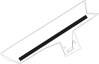
Runway info
| Runway 06 / 24 | ||
| length | 676m (2218ft) | |
| bearing | 71° / 251° | |
| width | 30m (98ft) | |
| surface | grass | |
Nearby beacons
| code | identifier | dist | bearing | frequency |
|---|---|---|---|---|
| LMA | LIMA NDB | 7.2 | 266° | 311 |
| DUS | DUESSELDORF VOR/DME | 8.7 | 121° | 115.15 |
| DY | DUESSELDORF NDB | 9.3 | 156° | 284 |
| MHV | MOENCHENGLADBACH VOR | 9.5 | 213° | 109.80 |
| MHD | DME | 9.7 | 212° | 112.50 |
| LI | DUESSELDORF NDB | 11.6 | 97° | 417 |
| BOT | BOTTROP NDB | 20.2 | 65° | 406 |
| LAA | NIEDERRHEIN NDB | 20.2 | 298° | 352 |
| NID | DME | 21 | 296° | 115.50 |
| BAM | BARMEN VOR/DME | 22.3 | 96° | 114 |
| GIX | GEILENKIRCHEN TACAN | 32.5 | 232° | 108.10 |
| LJ | COLOGNE-BONN NDB | 32.8 | 134° | 365 |
| WYP | WIPPER VOR | 32.9 | 116° | 109.60 |
| WNN | DME | 33.1 | 172° | 109.85 |
| NVO | NOERVENICH VORTAC | 33.8 | 175° | 116.20 |
| MAS | MAASTRICHT VOR/DME | 34.2 | 237° | 108.60 |
| NW | MAASTRICHT NDB | 34.5 | 243° | 373 |
| VKL | VOLKEL TACAN | 36.6 | 287° | 108.30 |
| KBO | COLOGNE-BONN VOR/DME | 37.8 | 133° | 112.15 |
| LW | COLOGNE-BONN NDB | 38.5 | 126° | 300 |
| LV | COLOGNE-BONN NDB | 42.6 | 132° | 327 |
| RKN | DME | 45.4 | 13° | 116.80 |
| DLN | DEELEN TACAN | 48.3 | 313° | 112.20 |
| LNO | OLNO VOR/DME | 58.3 | 228° | 112.80 |
| SLV | SPA NDB | 60.1 | 217° | 386 |
| SPI | SPRIMONT VOR/DME | 63.7 | 228° | 113.10 |
Disclaimer
The information on this website is not for real aviation. Use this data with the X-Plane flight simulator only! Data taken with kind consent from X-Plane 12 source code and data files. Content is subject to change without notice.