Freudenberg - Huensborn
Airport details
| Country | Germany |
| State | North Rhine-Westphalia |
| Region | ED |
| Airspace | Langen Ctr |
| Municipality | Wenden |
| Elevation | 1305ft (398m) |
| Timezone | GMT +1 |
| Coordinates | 50.92889, 7.89917 |
| Magnetic var | |
| Type | land |
| Available since | X-Plane v10.40 |
| ICAO code | EDKH |
| IATA code | n/a |
| FAA code | n/a |
Communication
| Huensborn Huensborn Info | 123.685 |
Nearby Points of Interest:
Krupp-Hochhaus Geisweid
-Laurentiuskirche (Ferndorf)
-Jüdischer Friedhof Hermelsbach
-St. Josef
-Saint George Church
-Reichsbank (Siegen)
-Amtsgericht Olpe
-Jüdischer Friedhof
-Jüdischer Friedhof Lindenberg
-Stadtbefestigung Olpe
-Freusburger Mühle
-Pallottihaus
-Kloster Drolshagen
-St. Clemens
-St.-Anna-Kirche (Belmicke)
-St. Aloisius (Herdorf)
-St. Mariä Heimsuchung
-St. Martinus
-Kloster Ewig
-St. Katharina
-Bone mill
-Derschlag railway station
-Protestant Church
-St. Peter und Paul
-Protestant Church Altenhundem
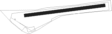
Runway info
| Runway 09 / 27 | ||
| length | 748m (2454ft) | |
| bearing | 88° / 268° | |
| width | 30m (98ft) | |
| surface | grass | |
Nearby beacons
| code | identifier | dist | bearing | frequency |
|---|---|---|---|---|
| COL | COLA VOR/DME | 14.4 | 245° | 108.80 |
| GMH | GERMINGHAUSEN VOR/DME | 14.5 | 358° | 115.40 |
| SLD | DME | 14.9 | 141° | 108.05 |
| SIL | SIEGERLAND NDB | 17.4 | 136° | 489 |
| WYP | WIPPER VOR | 24.4 | 281° | 109.60 |
| LW | COLOGNE-BONN NDB | 24.5 | 267° | 300 |
| LV | COLOGNE-BONN NDB | 26 | 259° | 327 |
| KBO | COLOGNE-BONN VOR/DME | 28.8 | 265° | 112.15 |
| LJ | COLOGNE-BONN NDB | 31.6 | 270° | 365 |
| BAM | BARMEN VOR/DME | 36.2 | 299° | 114 |
| DOR | WICKEDE (DORTMUND) VOR/DME | 37.2 | 336° | 108.65 |
| DWI | DORTMUND-WICKEDE NDB | 37.2 | 336° | 357 |
| TAU | TAUNUS VOR/DME | 41.9 | 159° | 113.35 |
| PAD | DME-ILS | 49 | 47° | 108.50 |
| PAD | PADERBORN-LIPPSTADT NDB | 50.1 | 47° | 354 |
| BOT | BOTTROP NDB | 51.3 | 307° | 406 |
| MTR | METRO VOR | 53.3 | 125° | 110 |
| BUE | BUECHEL TACAN | 55 | 228° | 117.10 |
| WIB | WIESBADEN TACAN | 55.3 | 155° | 114.10 |
| HMM | HAMM VOR/DME | 56.1 | 348° | 115.65 |
| FW | FRANKFURT NDB | 59 | 150° | 382 |
| FFM | FRANKFURT VORTAC | 59.6 | 140° | 114.20 |
| FRD | DME | 59.7 | 143° | 115.90 |
| FR | FRANKFURT NDB | 59.8 | 138° | 297 |
| VFM | NAUHEIM VOR | 62 | 149° | 113.75 |
| HAN | HAHN NDB | 62.5 | 213° | 376 |
| FHH | DME | 64.1 | 213° | 117.35 |
Disclaimer
The information on this website is not for real aviation. Use this data with the X-Plane flight simulator only! Data taken with kind consent from X-Plane 12 source code and data files. Content is subject to change without notice.