Fehrbellin - Ruppiner Land
Airport details
| Country | Germany |
| State | Brandenburg |
| Region | ED |
| Airspace | Bremen Ctr |
| Municipality | Fehrbellin |
| Elevation | 138ft (42m) |
| Timezone | GMT +1 |
| Coordinates | 52.79333, 12.76033 |
| Magnetic var | |
| Type | land |
| Available since | X-Plane v10.40 |
| ICAO code | EDBF |
| IATA code | n/a |
| FAA code | n/a |
Communication
| Ruppiner Land Ruppiner Land Info | 122.500 |
Nearby Points of Interest:
Village church Brunne
-Village church Dechtow
-Village church Langen (Fehrbellin)
-Gut Buskow
-Burgwall von Linum
-Wustrau church
-Village church Karwe
-Village church Dabergotz
-Burgwall Wildberg (Temnitztal)
-Ruppiner Kliniken
-Village church Lichtenberg (Neuruppin)
-Village church Kerzlin
-Burgwall Tietzow
-Village church Paulinenaue
-Dorfkirche Gottberg
-Dorfkirche Wagenitz
-Village church Kantow
-Gord of Ruppin
-Ruppin Castle
-Pfarrkirche St. Nikolai
-St. Nicholas church Kremmen
-Dorfkirche Ribbeck
-Herzberg church
-Hellmuth Ulrici Clinic
-Dorfkirche Kleßen
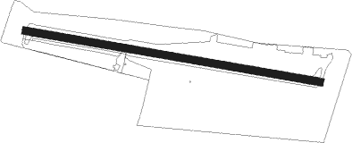
Runway info
| Runway 10 / 28 | ||
| length | 906m (2972ft) | |
| bearing | 99° / 279° | |
| width | 23m (75ft) | |
| surface | asphalt | |
| displ threshold | 125m (410ft) / 128m (420ft) | |
Nearby beacons
| code | identifier | dist | bearing | frequency |
|---|---|---|---|---|
| LWB | LOEWENBERG VOR/DME | 15.2 | 73° | 114.55 |
| SDD | DME | 36.9 | 119° | 114.40 |
| BBI | BERLIN BRANDENBURG VOR/DME | 37 | 123° | 114.10 |
| PI | SCHWERIN-PARCHIM NDB | 50.5 | 308° | 333 |
| PMD | DME | 51.7 | 303° | 117.50 |
| KLF | KLASDORF VOR/DME | 55 | 134° | 115.15 |
| MAG | MAGDEBURG VOR/DME | 59.5 | 230° | 110.45 |
| FLD | FRIEDLAND VOR/DME | 64.9 | 40° | 117.15 |
Disclaimer
The information on this website is not for real aviation. Use this data with the X-Plane flight simulator only! Data taken with kind consent from X-Plane 12 source code and data files. Content is subject to change without notice.